The posted coordinates will take you to a roadside plaque. From there, you need to collect the necessary information to locate the final. The final is a gold coloured bison tube hanging low.
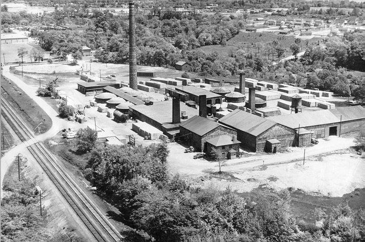
The Garden Trail Development you are about to enter was built on the former sight of “National Fireproofing Company”, later known as Natco. It was built on 160 acres of land purchased from the Hendrie Farm. The section of the RBG directly below this sight is referred to as Hendrie Valley, also part of the former Hendrie Farm. One of the landmark features of this location, was the large smokestack that was removed in the mid 1990’s.
To find the North Coordinates, take the first date from the plaque (when the plant was built), divide it by 1000, then add this number to the following meaningless coordinates: N 43 16.208
To find the West Coordinates, take the second date from the plaque (the year production stopped), divide it by 1000, then add this number to the following meaningless coordinates: W 079 50.349
Parking can be found nearby.