This is an addition to the Milestone series of caches, simply being a cache placed near a milestone.
However, we hope that it will get you thinking about these blocks of stone, which you may or may not notice as you drive along main roads in this country.
This particular milestone dates back to the 1700's, which explains why it is marked with the name of Frimley, even though it is now most certainly within the town of Camberley. In the 18th century the two large settlements in the area were Bagshot and Frimley, with Camberley itself only being developed following the building of the Royal Military College in Sandhurst.
It was in the 1700's that heathland tracks were created across the Borough of Surrey Heath. Those tracks have now become today's main routes, including the A30 (Great West Road) and the A325 (Portsmouth Road). The increase in stagecoach travel throughout this century badly affected the tracks, making many of them impassable. Turnpike trusts were therefore set up across the country to charge tolls for travelling on these rural roads, with the money raised being spent on the upkeep of the routes.
It was the Bedfont and Bagshot Turnpike Trust that had control of the London and Portsmouth roads through Surrey Heath, and who installed 10 milestones, of which 9 are still standing. They also now stand out extremely well, for in 2016 two volunteers at Surrey Heath Museum, Tim Dodds and Reg Davis, were inspired to clean, paint, and re-letter the milestones. On one occasion the police were called, as it was reported that two men were trying to steal a milestone!
This particular milestone is close to the site of a tollgate operated by the Turnpike Trust, which is still marked by a Tollgate Stone. It stands somewhat incongruously in front of the garden wall of a house on the American Golf roundabout, where the Great West Road and Portsmouth Road diverge; see waypoint 1.
Another interesting ancient stone stands beside the A30 just to the west, being the Darby Stone, marking the site of a gibbet; see waypoint 2. The gibbet (a gallows used for hanging criminals) might have been well used, as the area was notorious in the days of the stage coaches for the ruthless highwaymen who preyed on those who passed by. The road that leads from the A30 near the site of the gibbet, to the milestone on the A325 which is the subject of this cache, is still named "Gibbet Hill".
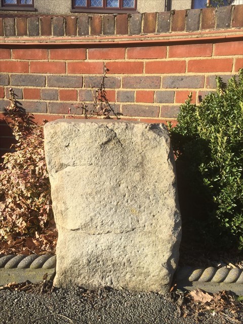
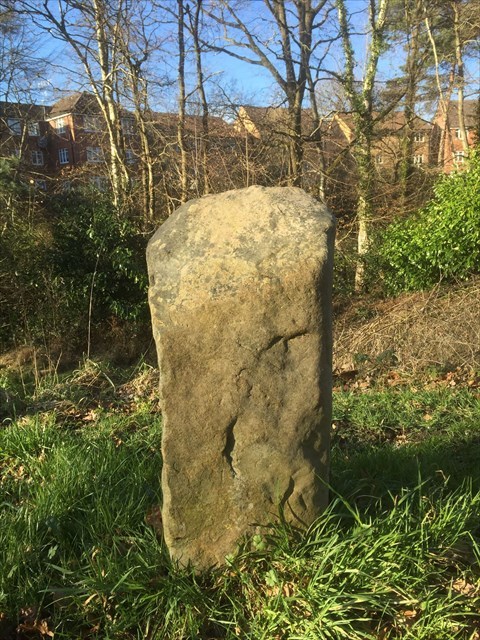 The Tollgate Stone The Darby Stone
Now to the cache itself. At the cache co-ordinates you will find the milestone
Two double digit numbers each appear twice, either on the milestone itself, or within 1 metre of it.
The lower double digit number is AB
The higher double digit number is CD
The number of miles to Winton* is EF
The total number of miles shown on the milepost is GHI
The top number on the adjoining SV sign is J
The cache may be found at 51 2(I-J).F(E-A)(C+E) 000 4(I-G).(B+H)(D-A)F
A checksum for all digits of the cache co-ordinates is 41
* Winton refers to Winchester, being an abbreviation of Wintoniensis, meaning "of Winchester"
If you wish to set a milestone cache (a cache near a milestone) then please contact Marcusmaximi who is keeping track of the numbers. You may have to check on the 'magic' map to make sure that a particular milestone is not a scheduled ancient monument or somesuch.
To see all Milestone Caches please click
HERE.