Letterboxing - a close relative to geocaching - has been around much longer than the GPS. The origin of letterboxing can be traced to Dartmoor, Devon, England in 1854. A well known Dartmoor guide, James Perrott, placed a bottle for visiting cards at Cranmere Pool on the northern moor in 1854. From this, hikers on the moors began to leave a letter or postcard inside a box along the trail (sometimes addressed to themselves, sometimes a friend or relative)—hence the name "letterboxing". The next person to discover the site would collect the postcards and post them.
The pic below shows how the original Cranmere Pool letterbox looked like up until 2014:
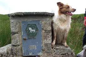
Inside the Letterbox was a container, stamp and instructions on what to do.

With current geocaching adopting the letterbox cache, there are now 2 methods to find this type of geocache, The “Letterboxer method and the Geocachers method. You choose which one (or both) will be your preferred method.
Method #1: The Letterboxer Method
From the posted coordinates for the start of the trail (you should be under the arch), walk 22 “hScouter” paces. Keeping in mind that hScouter is about 5’3”…a bit taller if stretched. Then turn left on the trail.
Walk another 59 paces. You’ll be at a fork in the trail. Take the trail to the right.
Walk another 35 paces. You’ll be at another fork in the trail. Take the trail to the right.
Walk another 153 paces. Take the trail to the right.
Walk another 44 paces. You'll be at another fork in the trail. Take the trail to the right.
Walk another 42 paces. Turn to the left to face the tree line. About 12 feet from the tree line, you’ll see a stump of a tree that’s about the height of hScouter (5’3”) Walk another 18 feet from the stump and you’ll find your prize hanging a little below waist high in an evergreen. There’s a bare, dead stick of a tree next to the evergreen.
Method #2: The Geocacher’s Method
If you chose this method, you will find the cache at:
N 47 34.ABC W 052 50.DEF
The city crest, or coat of arms, is the official crest of the City of St. John’s. It was officially presented to the City on March 1, 19A5.
The parking area listed under “Additional Waypoints” is on a road with X letters (excluding the word “Road”) Where B = X - 5
Thorburn Road is on Route X0. Where C = X + 2 (hint…it’s on a sign on the road that you used for B.)
For information on booking the Rotary Sunshine Park Chalet, call 576-8D99.
The Rotary Sunshine Park Chalet can sleep 2X people. Where E = 2X
Although the Rotary Sunshine Park is utilized and maintained by the City of St. John’s, it is located in Portugal Cove – St. Philips. Portugal Cove – St. Philips was created in 19X2 by amalgamating the towns of Portugal Cove and St. Philips. Where F = X – 2.
Have you got it figured out? Then go get it! Check your coordinates with the coordinate checker, or just risk it, and go for it!
Remember, geocachers, sign the logbook! (Do not take the stamp from the geocache; this is not a geocaching trade item.)
Check your answer here:
