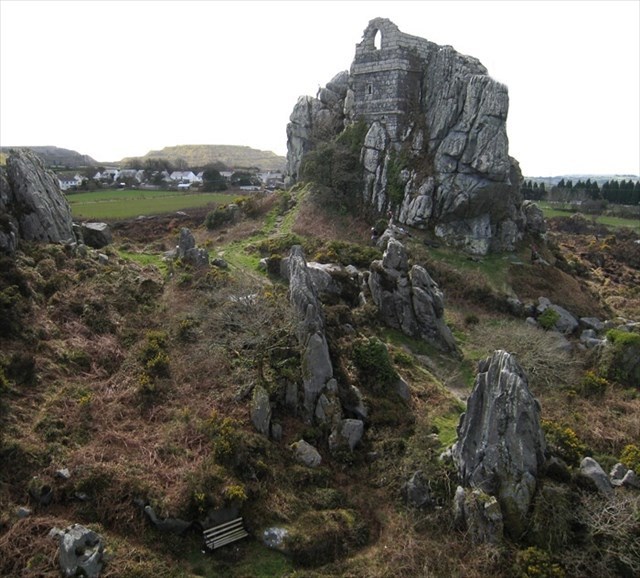
Roche Rock EarthCache
 Permission
Permission was kindly granted to site this EarthCache here by Natural England . Roche Rock and it’s surrounding location are of geological importance and an SSSI .
It is imperative that no flaura and fauna is touched or damaged . I will also reiterate what the information board says in that no rock samples are to be removed from the location either.
Thank you for your co-operation
Location
Roche Rock is situated close to the village of Roche and is a truly iconic landmark.There is access to the top via some metal ladders and a bit of scrambling . The Rock itself lies 500 metres north of the northern margin of the St Austell granite, the smallest of the five main outcrops of the Hercynian batholith of Southwest England. It stands on an approximate outcrop of some 600m x 300m. The stepped waste heaps from China Clay production (from the industrial extraction of the products of weathered granite) can be seen from here too
History
On top of Roche Rock, is a ruined chapel (dedicated to St Michael) perched dramatically at the top.This chapel dates back to 1409 .Roche Rock has many folkloric tales associated with it, the two most famous being the legend of Jan Tregeagle, a seventeenth century magistrate, who after death found refuge in the chapel and the other being part of the Tristan and Iseult tale - which is a tragic story of the adulterous love between the Cornish knight ‘Tristan’ and the Irish princess Iseult.
Formation
This is an internationally-famous tor composed of only two minerals. It is arguably the best exposure of this composition in the country. The mineralisation very probably occurred around 270 million years ago during the intrusive activity that was then taking place following the Variscan Orogeny. There has been some debate about its origin; it may have formed from a boron/fluorine fluid as a result of magmatic or hydrothermal processes.
It was formed close to the roof of the St Austell intrusion of the Cornubian batholith, which is the granite mass underlying large parts of Devon and Cornwall.
The most popular theory by geologists is that when the molten granite cooled a crystallised pocket of watery liquid separated out. This can be explained in the same way as in oil and water don’t mix. The liquid contained several chemicals including boron and this finally crystallised to what we see today .
The outcrop is considered to have been close to the roof of the intrusion as indicated by the presence of numerous pegmatites occurring as sheets and containing abundant miarolitic cavities carrying quartz, tourmaline, zinnwaldite, topaz and a wide range of other phases.
To claim this EarthCache please answer the following questions then email me your answers via my profile or use the message centre .
N.B.Please email/message me first before you log online. I will reply to you in due course.
The posted co ordinates will take you to the information board to help you with some of your answers , you will have to observe the base of the main rock (waypoint) to assist you with the rest .
Q1 The rock is made of only two minerals ,what are they ?
Q2 How would you describe the minerals ? What’s the size and shape of the crystals ?
Q3 Do you think any one mineral is predominant ?Roughly estimate the percentage of each
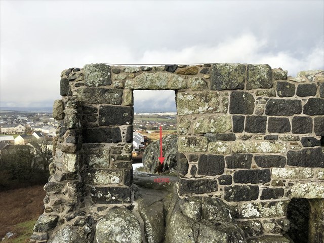
Q4 Climb right to the top and note the 6 letters of someone’s name, see picture below for exact location.
Q5 Photos are not necessary of your visit but speak a thousand words and are appreciated