The road over the saddle with the switchbacks wasn't the first from Glen Haven to Estes Park. The original track started behind the old firehouse (destroyed in the 2013 flood) next to the Inn and slanted up the ridge towards the H-G Ranch. It was rough, rocky, and very steep. You can just make out the old roadbed from the cache site. Speaking of which, watch out for some old barbed wire fencing and rehide it well; quite a few people use this old track as a shortcut down, which is why there's a path along it.
In the early 1900s, someone constructed a "corduroy road" straight down into Devil's Gulch. This was made of logs placed crossways. In wet weather, the logs rolled in their mud packing and their surface became treacherous, making it too slippery for horses pulling a load.
The switchbacks were built in 1910 when George Dennis was appointed County Roadman, and paved in the 1960s.
You can hike from Estes Park along the old road to Piper Meadows, but you have to park at the intersection of Devil's Gulch and Dry Gulch Roads, then walk along the gravel road to the H-G trailhead, or get someone to drop you off.
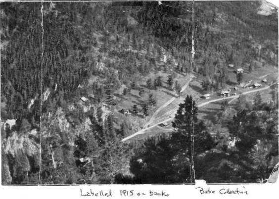
This picture from 1915 shows where the road angled off up the hill. The Inn will be built just to the right of the intersection. You can still see this part of the old road if you look at the slope behind the Inn.
This cache is part of a geotrail of historical caches in the Glen Haven area. Retrieve the codes from the 14 physical caches and find the virtual to receive a commemorative geocoin. The cache list can be found here: Historic Glen Haven GeoTrail.