.
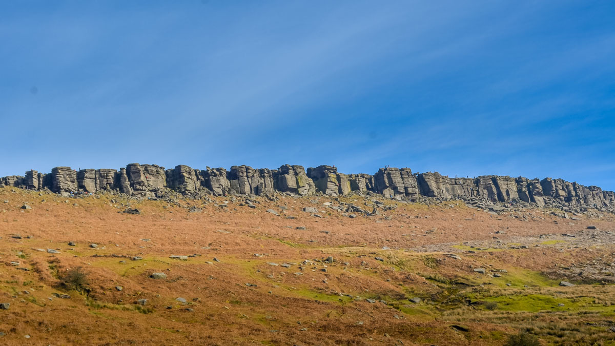
Stanage Edge
-
Gritstone
In 2018, Co90, Jasmin-the-Hippo and I came to the Peak District to go climbing with some friends. The weather was not the best, so instead of climbing, we had a closer look at the rocks themselves and came up with the idea for this Earthcache.
I want to tell you something about the Gritstone which is described by some British climbers as "God's Own Rock" since its rough surface provides outstanding friction so that climbers are able to stand on or grip the subtlest of features in the rock.

Gritstone
is a coarse sanstone, porous but strongly cemented and relativley resistant to erosion. It forms plateaus when stata are horizontal and scarps - "edges" - where anticlines have been eroded. Gritstone reflects its original formation in the form of strong and weak layers and also later faulting that has led to big variations in horizontal strenght of the Gritstone layers.
Around 300 million years ago, in the late Paleozoic era, in the Carboniferous period, a range of mountains were pushed up to the north and a huge river the size of the Amazon spread its delta over much of what is now Engand. As the delta built itself closer, sand and grit were deposed and covered the shale and limestone layers. This was a very dynamic environment with tides and strong currents which often moved and re-sorted the sandbanks and stretches of the delta. This can be seen in exposures such as Stanage Edge.
Gritstone usually has a grain size between 1-4mm and consists mainly of quartz and feldspar.

To log this cache, you will have to go to the header coordinates and walk along Stanage Edge to WP 2. In both places you have to answer some short questions. You can go back the same way or you can come up with an alternative, surely equally scenic route.
At the header coordinates, you will find a block of gritstone that you should have a closer look at:
1. Describe the surface of the rock, its colour, grain size and how it feels to the touch.
2. Check out the northern face of the boulder. How thick are the layers of gritstone here? Are they horizontal or vertical? Explain why you think they are like that.
At Waypoint 2 (N 53° 20.597' W 1° 37.477):
3. What was gritstone used for in the past? What kind of objects do you find here and can you explain why this kind of stone was used for it?
Optional: Take a picture of you with some gritstone behind you. It doesn't matter whether you are climbing, walking, cycling or taking a nap. You face doesn't have to be visible anyway.
Enjoy this little exploration.