 |
Glaciazione e conseguenze |
|
Circa XX milioni di anni fa ebbe inizio l’ultimo processo orogenetico. Forze immani operanti sotto la crosta terrestre spinsero la piattaforma continentale africana contro quella europea. Nacquero le Alpi. Le modifiche più salienti e l’odierna configurazione di montagne e rilievi si devono alle glaciazioni.
Era glaciale. YY milioni anni fa la terra è ricoperta di ghiaccio. Solo le vette più alte spuntano da quel candido mare. Poderosi flussi di ghiaccio, spessi anche un migliaio di metri, si spostano dall’Alta Val d’Isarco alla Val Pusteria dirigendosi verso sud e disegnando crinali e fondovalle. I segni lasciati dalle glaciazioni plasmano il paesaggio. Gobbe tondeggianti, dossi modellati dai ghiacciai, e poderose sedimentazioni di materiale morenico (in Val Riga) testimoniano l’azione di queste forze della natura. La composizione del ciottolame presente in val Riga indica chiaramente come un tempo il fiume Rienza imboccasse la Valle Isarco già a questa altezza.
»Nell’ultima glaciazione intermedia, l’intero fondovalle si riempì di ghiaia e pietrisco fino ad un’altitudine di ZZZ m sull’attuale livello del mare … Sgomberata, la Rienza non riuscì più a ritrovare il suo letto e finì col seguire altre strade«. (Klebeisberg 1912)
Archi morenici scesi dalla Val Scaleres e dalla Val Spelonca ostruirono a occidente il fondovalle, permettendo la formazione dei laghetti di Varna, separati dal materiale proveniente dalla Feuchttal in Lago di Sopra e Lago di Sotto.
LOG:
Puoi loggare immediatamente ed inviarmi le risposte in seguito.
Ricorda: se non invii le risposte entro un periodo di tempo accettabile il tuo log verrà cancellato senza preavviso.
Domande:
- Quanti milioni di anni fa ebbe inizio l’ultimo processo orogenetico che creò le Alpi? (XX)
- Come si chiama la teoria che spiega il movimento della crosta terrestre? Descrivila brevemente.
- Quanti milioni di anni fa avvenne l’ultima glaciazione in questa zona? (YY)
- Nell’ultima glaciazione intermedia fino a che altitudine il fondovalle si riempì di pietrisco? (ZZZ)
Essa corrisponde circa all’altitudine in cui ti trovi ora?
- Guardandoti attorno, riesci a trovare evidenza del fatto che il fiume Rienza imboccasse la valle a questa altezza?
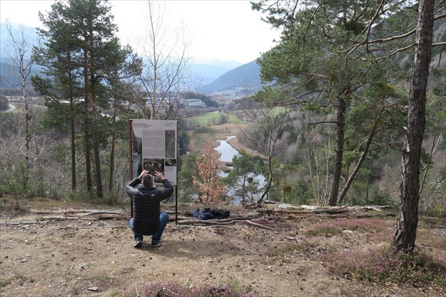
- Aggiungi una foto di te col tuo GPS con in sfondo il Lago di Varna.

 |
Eiszeit und Folgen |
|
Vor etwa XX Millionen Jahren setzt die letzte Gebirgsbildung ein. Durch gewaltige Kräfte im Erdinneren wird die afrikanische Kontinentalplatte gegen die europäische geschoben. Die Alpen entstehen. Die entscheidende Veränderung und heutige Gestalt erhalten die Berge un Täler während der Eiszeiten.
Eiszeit. Vor YY Jahren bedeckt Eis das Land. Nur die höchsten bergspitzen ragen heraus. Über tausend Meter mächtige Eisströme aus dem Oberen Eisacktal und dem Pustertal fließen Richtung Süden, hobeln Bergrücken ab, schürfen Talböden aus. Die Spuren der Eiszeit prägen die Landschaft. Rundbuckel, Gletscherschliffe und mächtige Ablagerungen von Moränenschutt (im Riggertal) sind Zeugen dieser Naturkräfte. Die Zusammensetzung des Gerölls im Riggertal beweist, dass die Rienz damals noch an dieser Stelle ins Eisacktal floss.
»In der letzten Zwischeneiszeit wurde der ganze Talgrund bis an ZZZ m heutiger Meereshöhe hinauf mit Schottern angefüllt … bei ihrer Ausräumung fand die Rienz ihr altes Bett nicht wieder und geriet auf Abwege«. (Klebeisberg 1912)
Schuttfächer aus dem Schalderer und Spilucker Tal riegelten den westliche Talboden ab: die Vahrner Seen entstanden. Durch das Material aus dem Feuchttal wurden diese in den Vahrner Obersee und Untersee aufgeteilt.
LOGGEN:
Du kannst sofort loggen und mir die Antworten später senden.
Denke daran: Wenn du deine Antworten nicht in angemessener Zeit sendest, kann ich deinen Log ohne Ankündigung löschen.
Fragen:
- Vor wieviel Millionen Jahren setzte die letzte Gebirgsbildung ein? (XX)
- Wie heißt die Theorie, die die Bewegung der Erdkruste erklärt? Beschreibe sie kurz.
- Vor wieviel Millionen Jahren war die letzte Eiszeit in diesem Gebiet? (YY)
- Bis zu welcher Höhe war der Talboden in der letzten Zwischeneiszeit mit Schotter gefüllt? (ZZZ)
Bist du an den Koordinaten circa auf dieser Höhe?
- Schau dich um. Findest du Beweise dafür, dass der Fluss Rienz auf dieser Höhe in das Tal geflossen ist?
- Mach ein Foto von dir mit deinem GPS mit dem Vahrner See im Hintergrund.
 |
The Ice Age and its Consequences |
|
The last phase of mountain building began about XX million years ago when enormous forces in the Earth’s interior thrust the African tectonic plate against the European plate, resulting in the formation of the Alps. The mountains and valleys were later reshaped by ice during the Ice Age, and acquired much of their present form.
The Ice Age. YY thousand years ago, the land was covered by ice and only the highest mountain peaks were exposed. Rivers of ice more than a thousand meters thick made their way southwards out of the Upper Eisack/Isarco and Puster/Pusteria valleys, razing mountain ridges and scouring out the valleys floors. The Ice Age has left its mark on the topography of the land: rounded mountaintops, groovers carved by the glaciers, and the massive moraines they left behind (in the Rigger/Riga Valley) testify to the tremendous impact of these natural forces. The composition of the rubble in the Rigger/Riga Valley indicates quite clearly that the Rienz/Rienza River must have previously flowed into the Eisack Valley at this location.
»During the last interglacial period, the entire floor of the valley was filled with gravel to a height of ZZZ meters above sea-level … as a result, the Rienz River was unable to resume its former course along the old river bed ,and sought instead a new route«. (Klebeisberg 1912)
Alluvial fans from the Schalder and Spilucker Valleys blocked off the western valley floor. As a result, the lakes of Vahrn/Varna were dammed up, with the material from these valleys separating the Upper and Lower Lakes.
TO LOG:
You can log immediately and send to me the answers to the below questions later.
Remember: your log will be deleted without notice if you don’t send any answer in an acceptable time frame.
Questions:
- How many millions of years ago did the last phase of Alps building begin? (XX)
- What is the name of the theory that explains the movement of the earth's crust? Describe it briefly.
- How many millions of years ago did the last ice age occur in this area? (YY)
- During the last interglacial period, the floor of the valley was filled with gravel up to what height? (ZZZ)
Does it correspond to the altitude you are in now?
- Look around you, can you find evidence that the Rienz/Rienza River fed the valley at this height?
- Add a picture of yourself with your GPS with Lake of Vahrn/Varna in the background.

