Placed with permission from Kern National Wildlife Refuge. The best way to view the refuge is by the automobile tour that loops you around the wetlands. There are a number of locations to park and enjoy the area.
Logging Requirements
In order to mark this cache as found, send answers to the questions below.
- List the name of this earthcache
- From your observation, what geology makes this area a perfect place for a wetland?
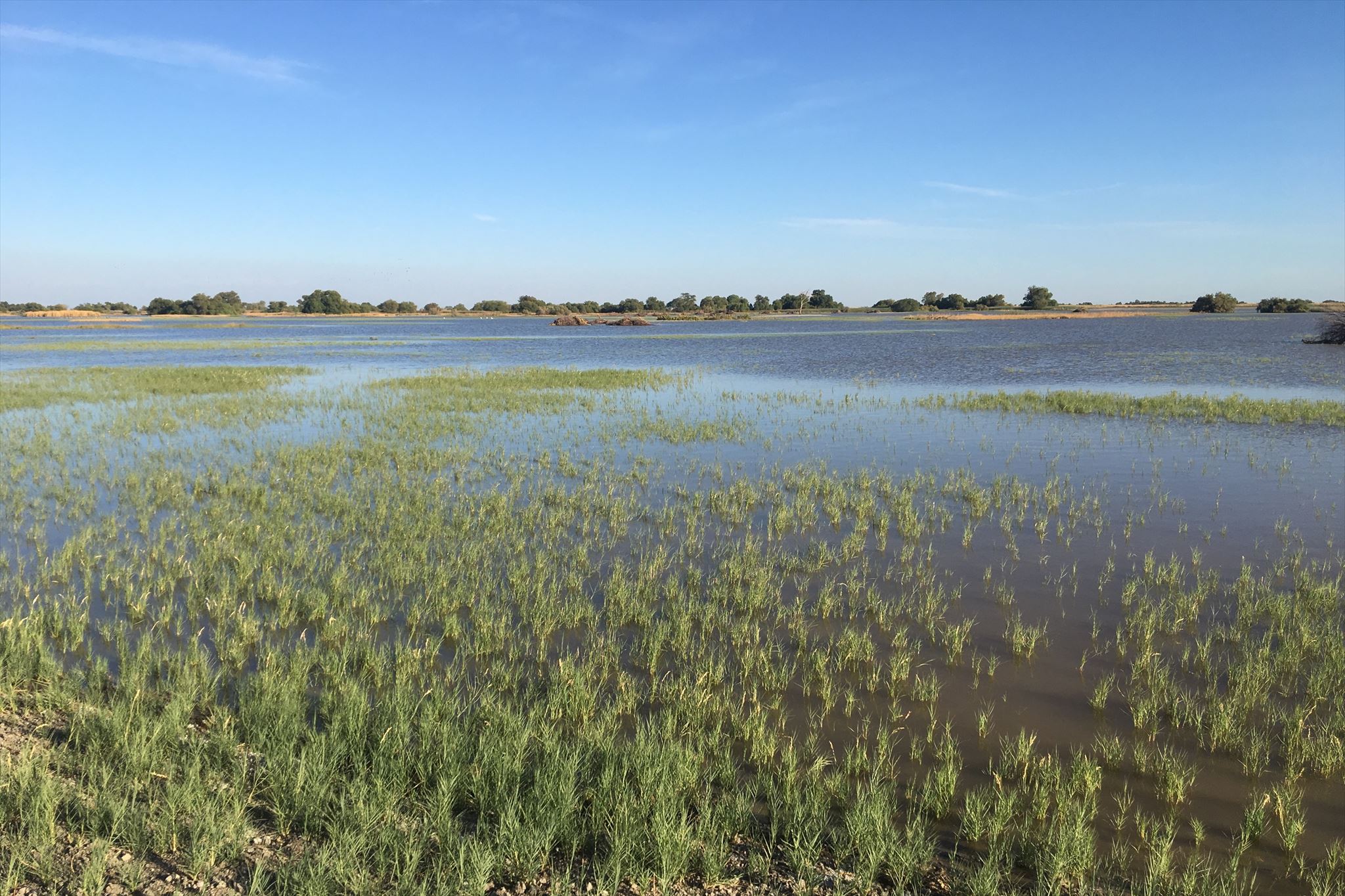
- The wetland conditions change throughout the year. Describe the conditions you see, especially as it pertains to the amount of water in the wetland.
- In your Found log, post a photo showing you were at the site.
Kern National Wildlife Refuge Hours
The refuge is open from sunrise to sunset. The entrance gates close automatically ½ hour after sunset.
October through January – closed to visitors not participating in the waterfowl hunt on Wednesdays and Saturdays.
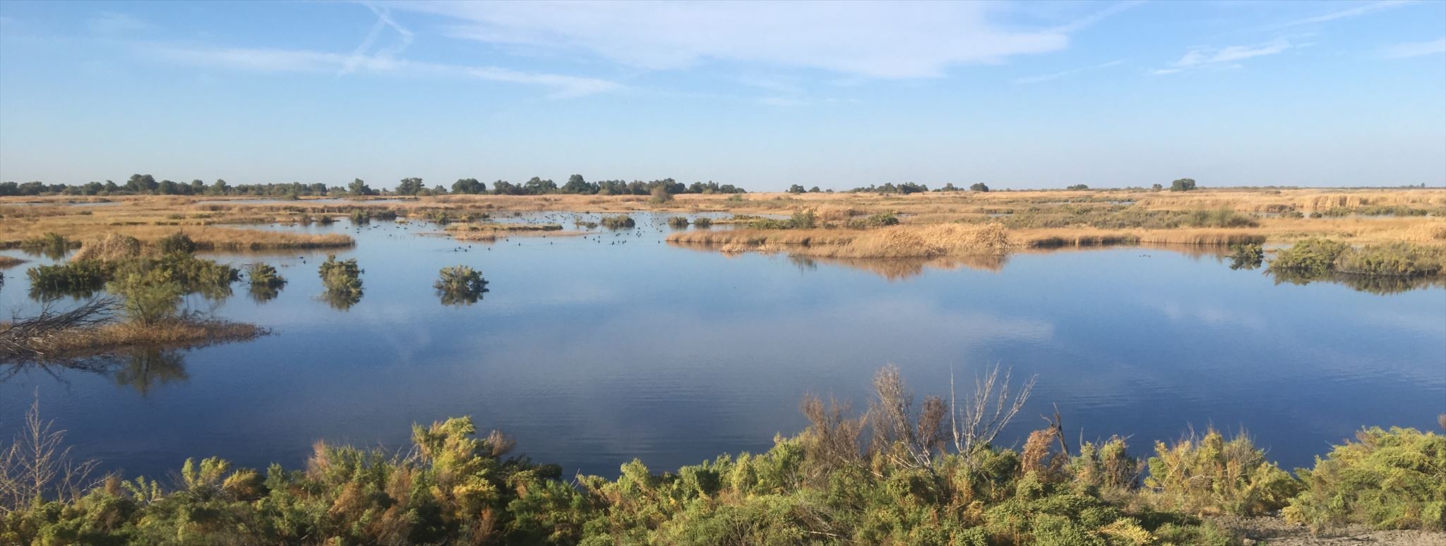
Freshwater Wetlands
150 years ago, you would be standing in the middle the largest freshwater wetland complex in the western United States and the area would appear similar to the photo above. It is hard to imagine a vast lake and wetland area now since the San Joaquin Valley is so dry now. With so little water and rainfall in the valley, how was such a historical wetland created?
The California Central Valley is surrounded by three mountain ranges: Sierra Nevada to the east, Coastal Range to the west, and the Tehachapi Range to the South. Over the millennia, the valley was filled by sediments from these mountains creating an extraordinary flatness along the valley floor. The rivers of the California Central Valley historically flooded in winter and spread over broad, flat expanses of the valley floor creating vast seasonal wetlands. At the time California became a state in 1850 there were approximately five million acres of permanent, seasonal, and tidal wetlands. Since that time, it has been estimated that these wetlands have been reduced by over 90% due to flood control, irrigation, and urban development.

Kern National Wildlife Refuge was established on November 18, 1960 to restore and preserve a portion of the native wetlands and a remnant example of the historic valley uplands in the San Joaquin Desert. The refuge consists of 11,249-acres of natural desert uplands, a relict riparian corridor, and developed marsh — the marsh accounts for over 90% of the refuge.
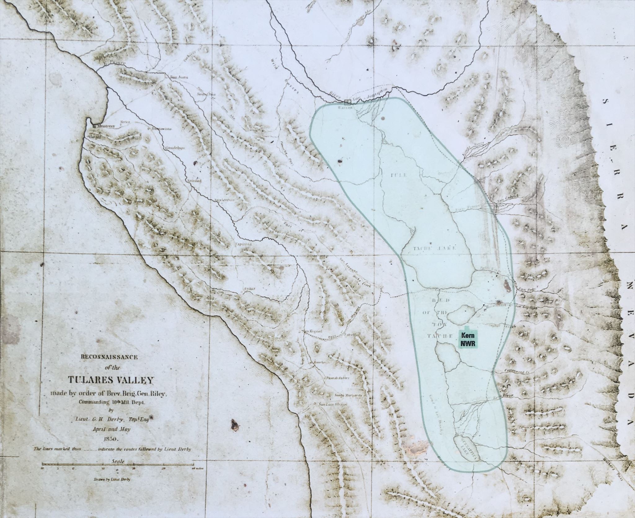
Green area on the map depicts the vast historical wetland area>
Bonus Information
The historic wetlands were a haven for over 60% of the Pacific flyway waterfowl populations as well as vast flocks of other migratory and resident water birds. The refuge manages water to imitate the historical ebb and flow of the wetlands and promote wildlife migration patterns. Through restoration and maintenance of native habitat diversity, the refuge provides optimum wintering habitat for migratory birds – with an emphasis on waterfowl and water birds – and suitable habitat for several endangered species. Here is what you should expect during the different seasons.
Spring
As spring arrives at the refuge, the water levels begin to slowly draw down and thousands of waterfowl have begun their journey north. The exposed mudflats in late February and early March attract large numbers of shore birds to probe for food.
Summer
With temperatures exceeding over 100 degrees on some summer days the majority of the wildlife is keeping cool during the day. The best time to view the wildlife is in the early morning or evening when it is cooler.
Fall
During fall the refuge begins to flood the wetlands and migrating birds that use the Pacific Flyway begin to show up. Thousands of waterfowl, mainly ducks, arrive at the refuge and utilize the habitat. As the fall season goes on, the number of migrating birds on refuge fluctuates as some birds continue their migration south.
Winter
During December and January waterfowl numbers may peak to 80,000. Large concentrations of waterfowl can be seen foraging in the moist soil and seasonal marsh areas. In late winter the waterfowl concentrate on storing energy for the spring migration back north.
Refuge Information
Visitors access the refuge via the Loop Road. Roads throughout the refuge are graveled and visitors must maintain the posted speed limit of 25 miles per hour. Parking is allowed in designated parking areas only. No overnight parking is allowed on the refuge.
Temperatures can be quite cold during the winter months due to the dense patches of tule fog so please dress accordingly. Summer and fall temperatures at the Refuge can be hot and require plenty of sunblock, hat, and water. Insect repellent is recommended.