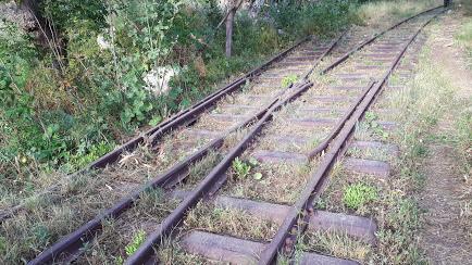
I recently had the opportunity to ride with friends along the remains of the former railroad route Beirut - Damascus.
It was the first railroad built in Lebanon. It worked 80 years, until the beginning of the civil war in Lebanon in 1975.
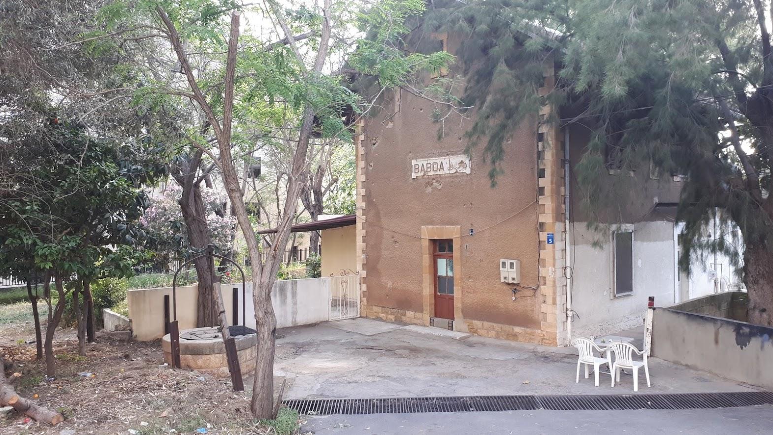
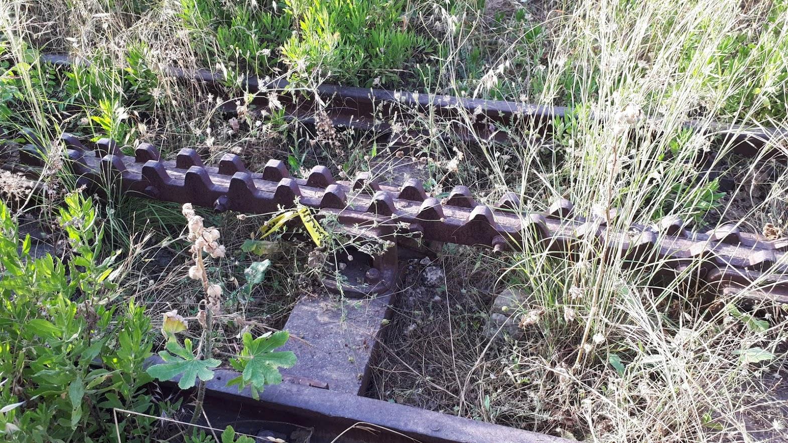
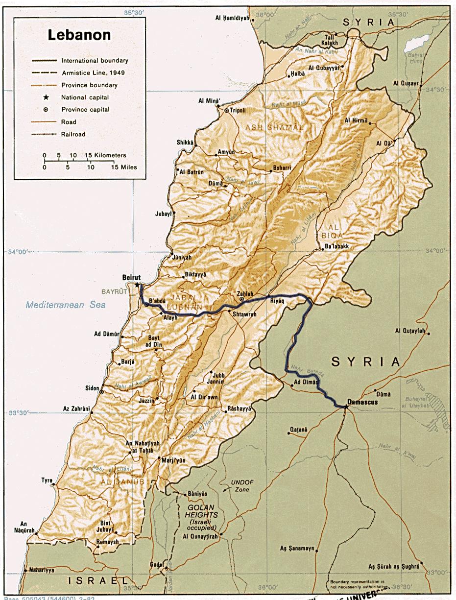
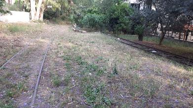
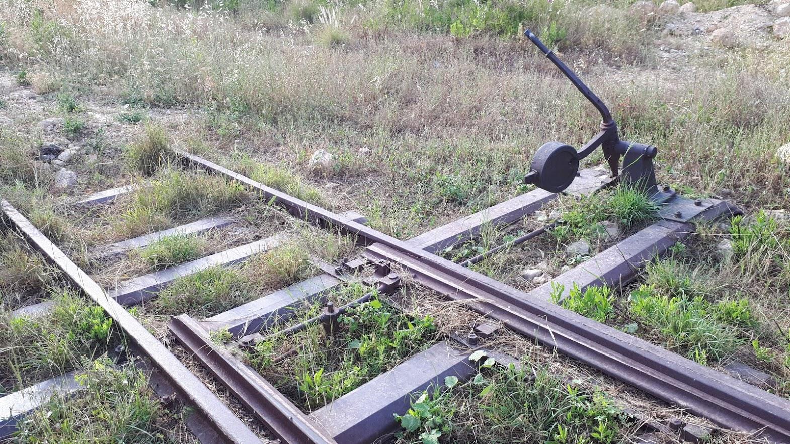
One of our stops was the former railway station Baabda. There is a preserved original railway station and a short stretch of track and crossings. The site can be observed cog guided route.
From history:
In 1891, the Ottoman Empire granted the French societies Societé des Chemins de Fer Ottomans Economiques de Beyrouth-Damas Hauran a concession to build the first railroad in the Middle East.
The French presented the railways as an opportunity to connect the port of Beirut with the Syrian hinterland. Damascus would open this transit access to the Mediterranean Sea. This was a reaction to the proposed British rail project Jaffa - Damascus.
Should the British plan passed, Beirut would not gain the status of primary harbor of the northern Levant.
Both the French and the British predicted great opportunities to invest capital in the region and build a rail network linking strategic business routes across the Ottoman Empire.
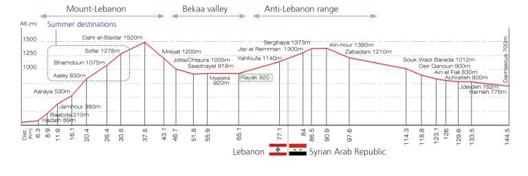
After four years of construction on August 3, 1895, the first train from Beirut Railway Station, Mar Michail, took off for a nine-hour, 147 km long trip to Damascus. The route led through the two Lebanon Mountains (Mont Lebanon and Anti-Lebanon) and the Beqaa valley in between.
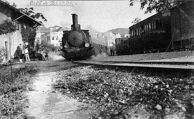
Train Station Baabda In 1941
Railways had to overcome considerable differences in height and and difficult topography of the landscape. With respect, we must pause to consider the ability and skill of the then engineers and builders.
For interest, note the elevation data of individual stations.
In Lebanon: Mar mikhael, Beirut (18m) – NBT, Beirut (12m) – Furn el Chebbak (30m) – Hadath (86m) – Baabda (210m) – Jamhour (380m) – Chouit-Aaraya (530m) – Aaley (830m) – Bhamdoun (1075m) – Sawfar (1278m) – Dahr el Baidar (1490m) – Mreijat (1200m) – Jdita/Chtaura (1005m) – Saadnayel (918m) – Maalaka (alt. 928m) – Riyak (928m)
In Syria: jisr el-Remman (~1300m) – Serghaya (1373m) – Aïn-hour (1380m) – Zabadani (1210m) – Madaya – El-Teqieh – Souk Wadi Barada (1012m) – Deir Qanoun(900m) – Ain el Fijé (830m) – Achrafieh (800m) – Jdeideh (782m) – Al hami (776m) – Doummar – Hijaz, Damas (700m)
Beirut - Damascus railway section shoving all stations´ altitude and distance from Beirut
Lebanon Map with old railway Beirut – Damascus
Present time:
Future?
At present, various options are being considered to restore the railways that once connected various Syrian cities with the Lebanese ports of Beirut and Tripoli. The main reason is to allow rapid and massive transportation of goods and materials needed for the reconstruction of war-affected Syria.
The biggest challenge is to link the Beirut-Damascus because of geography and steep mountains, "Mount Lebanon" between the two cities. Railroad way along the old route is obsolete and inadequate to current needs. Therefore it is necessary to design a new route.
The original route of railways formed cities and landscapes and had significant positive and negative impacts on their development.
Should the future route take into account the anticipated future development of cities, emphasize its social benefits, or should be win the engineering-engineering economic approach?
It depends!
Hint:
Source:
http://sietske-in-beiroet.blogspot.com/2015/11/on-trail.html
https://www.mashallahnews.com/meeting-along-rail-line/