 Deutsche Beschreibung Deutsche Beschreibung
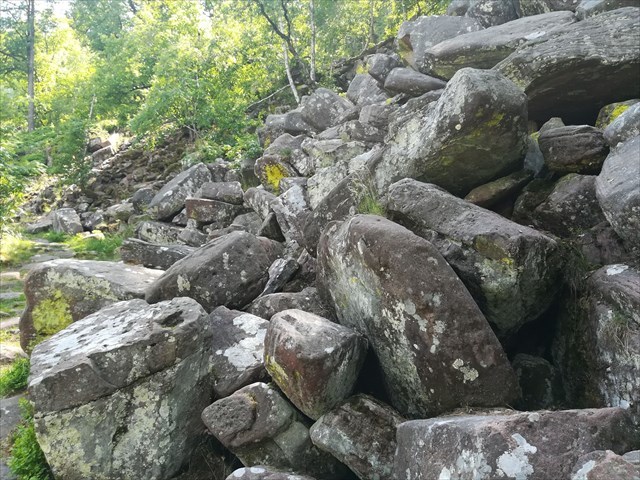
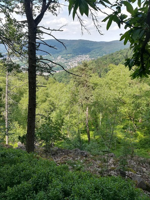
Das Heidelberger Felsenmeer ist ein zirka 5 ha großes Areal im Nordhang des Königstuhls oberhalb von Schlierbach. Auf ihm befindet sich eine Vielzahl von Buntsandsteinfelsen, die sich zu sogenannten Blockhalden angesammelt haben. Das Areal ist Lebensraum für seltene Pflanzen und Tiere und steht seit 1956 unter Naturschutz.
Bei diesem Cache könnt ihr keine Dose finden. Um ihn zu loggen, schickt ihr die Antworten auf die unten im Text stehenden Fragen bitte an uns. Ihr dürft dann sofort loggen. Falls die Antworten nicht stimmen sollten, melden wir uns bei euch.
Gerne dürft ihr ein Foto von eurem Lieblingsstein machen und es eurem Logeintrag anfügen. Dies ist selbstverständlich rein freiwillig und gehört nicht zu den Aufgaben.
Bitte beachtet, dass ihr euch in einem Naturschutzgebiet befindet und zum Schutz der Natur die Wege nicht verlassen werden dürfen.
Gestein im Königstuhl
Am Königstuhl treten mehrere Hundert Meter dicke Schichten aus Buntsandstein an die Erdoberfläche. Buntsandstein lässt sich in Mitteleuropa auf einem sehr großen Gebiet finden: von Frankreich und Luxemburg im Westen bis Polen und Weißrussland im Osten, sowie der Schweiz im Süden und Skandinavien im Norden. Im Bereich des Heidelberger Felsenmeeres handelt es sich um den Mittleren Buntsandstein. Er kann bis zu 300 Meter dick sein und entstand vor etwa 249 bis 245 Millionen Jahren. Das zu dieser Zeit in Mitteleuropa vorhandene Meer zog sich aufgrund von tektonischen Bewegungen zurück und große Flüsse wechselten sich mit wüstenartigen Trockenzeiten ab. Es kam zu unterschiedlichen Ablagerungen, hauptsächlich von Sandstein sowie Konglomeraten, also Gesteinen bestehend aus größeren Einzelkörnern in einem feineren Bindemittel. In den Trockenphasen entstanden netzartig verbundene Risse im Gestein, die noch heute zu finden sind. Fossilienfunde sind im Buntsandstein selten, was auf eine lebensfeindliche Zeitperiode schließen lässt.
1) Frage:
Bis zu wie viele Jahre vergingen während der Entstehungszeit des Mittleren Buntsandsteins, bis sich ein Millimeter des heutigen Gesteins gebildet hat?
Felsenmeer/Blockhalde
Durch die oben erwähnten netzartigen Risse kann Wasser leicht in den Buntsandstein eindringen. In langanhaltenden Kälteperioden gefriert dieses Wasser zu Eis und sprengt dabei das Gestein. Die so entstandenen größeren Steinblöcke können durch erneute Frostsprengungen auch weiter zerteilt werden.
Als gegen Ende der letzten Eiszeit die Temperatur stieg, kam es zu mehreren Auftauphasen. Dabei taute zuerst die obere Bodenschicht auf und der Boden wurde feucht und rutschig, da das Tauwasser durch den weiter unten noch gefrorenen Boden nicht abfließen konnte. Als Folge rutschen die Steinblöcke hangabwärts und sammeln sich häufig in sogenannten Blockhalden, die auch als Felsenmeere bezeichnet werden. Dieser Prozess wird als Solifluktion bezeichnet und tritt auch schon bei sehr flachen Hängen auf. Die Steinblöcke können dabei zwischen 5 und 10 cm pro Jahr rutschen. Dieser Prozess ist je nach Größe der Steine unterschiedlich stark ausgeprägt, sodass sich Steine häufig nach Größe im Hang sortieren.
2) Frage:
Durch Solifluktion sind manche Steinblöcke bis ins Neckartal herabgerutscht. Beim Startpunkt (Station S1) findet ihr ein kleines grünes Schild mit einer Höhenangabe für das Felsenmeer. Der Neckar hat eine Höhe von 114 Metern über NN. Wie viele Höhenmeter müssten Steinblöcke von hier bis zum Neckar überwinden?
Pro Höhenmeter müssen die Steine etwa 4,4 Meter entlang des Hangs rutschen. Welche Zeit bräuchten Steinblöcke, um von hier den Hang bis zum Neckar herabzurutschen?
3) Frage:
Wenn ihr auf dem Fußweg hangabwärts geht, kommt ihr links direkt am Felsenmeer vorbei (Station S2). Wie verändert sich die Größe der Steine entlang des Weges? Was ist der Grund für die Veränderung?
4) Frage:
Geht den Weg weiter hangabwärts, bis ihr zu einer Wegkreuzung gelangt. Wenige Meter weiter hangabwärts (Station S3) findet ihr einen besonders großen Steinblock direkt am Weg. Bei ihm seht ihr gut die oben erwähnten Risse im Gestein. Beschreibt die Risse. Wie viele sind es, welche Abstände haben sie voneinander und wie lang sind sie? Kann man sie auf dem ganzen Stein finden? Sind sie miteinander verbunden oder getrennt?
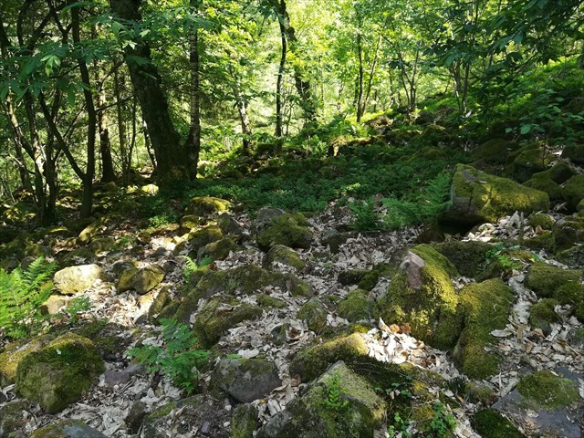
Pflanzenwelt
Wie bei Blockhalden üblich, ist der Anteil an Kies und Sand im Felsenmeer sehr gering. Dadurch kann Wasser gut ablaufen, sodass angewehter Humus schnell weggeschwemmt wird. In diesem seltenen kargen Lebensraum können nur wenige Spezialisten überleben. Beispiele sind Leuchtmoos, Grünes Koboldmoos, Tannenbärlapp und Sprossender Bärlapp, sowie Gewöhnlicher Tüpfelfarn und Heidelbeersträucher. Auch einige Baumarten können hier überleben, wie zum Beispiel Berg-Ahorn, Edelkastanie, Trauben-Eiche und Wald-Kiefer.
|
 English Description English Description
The Heidelberger Felsenmeer is an approximately 5 ha large area at the northern slope of mount Königstuhl above the village of Schlierbach. It accommodates many rocks of variegated sandstone, called Bunter sandstone, which have assembled to a so-called stone run. The area is an habitat for rare plants and animals and is thus designated a nature reserve since 1956.
There is no container hidden for this cache. To log it, you need to send us the answers to the question in the text below. You may then directly log a find. We will get in touch with you in case the answers are not correct.
We are happy about pictures of your favourite rock, but this is of course purely voluntarily and in no way required to log a find.
Please recognise that you are walking through a nature reserve and that you may not leave the paths for its protection.
Rock at Mount Königstuhl
At mount Königstuhl several hundred metre thick layers of Bunter sandstone reach the Earth's surface. Bunter sandstone can be found across a wide area in Central Europe: from France and Luxembourg in the west to Poland and Belarus in the east as well as Switzerland in the south to Scandinavia in the north. In the area of the Heidelberger Felsenmeer there is middle Bunter sandstone. It can reach a thickness of up to 300 metres and formed approximately 249 to 245 million years ago. The ocean, which was present at that time in Central Europe withdrew due to movements of the tectonic plate. Consequently, large rivers alternated with desert-like dry periods. Different types of sediments formed, mainly sandstone and conglomerates, i.e. rock consisting of single grains bound together by finer sediments. During the dry periods, cracks formed in a web-like fashion. They can still be found at present date. There are almost no fossils found in Bunter sandstone, which leads us to believe that is was a harsh time period for life.
1) Question:
Up to how many years passed during the period of formation of the middle Bunter sandstone, until one millimetre of the stone we see today was formed?
Felsenmeer/Stone Run
Due to the above-mentioned web-like cracks, water can easily enter the rock. During long periods of cold weather, the water freezes and fractures the rock. Larger rocks can be fractured into smaller and smaller pieces by repetitive freezing.
When temperature started to rise towards the end of the last ice age, there has been several melting phases. During such phases, the water in the upper soil layer melted first. It could not drain through the still frozen lower soil layers, rendering the surface wet and slippery. As consequence, rocks started to slide downhill and often assembled in so-called stone runs, which are also called Felsenmeer in German. This process is known as solifluction and it takes place even at very flat slopes. Due to solifluction, rocks can slide between 5 and 10 cm per year. The speed differs depending on the size of the rocks, often leading to a sorting of rocks by size.
2) Question:
Due to solifluction some rocks slid all the way down into the Neckar river. At the first stage of the cache, (S1) you find a small green sign showing the altitude of the Felsenmeer. The Neckar river has an altitude of 114 metres above sea level. Which altitude do rocks have to traverse from the Felsenmeer down to the Neckar?
Per metre of altitude, rocks have to slide 4.4 metres across the slope. Which time do the rocks need to slide down the slope all the way into the river?
3) Question:
If you walk down the path, you reach the Felsenmeer (stage S2) on the left hand side. How does the size of the rocks change along the path? What is the reason for the change?
4) Question:
Walk the path further down until you reach a junction. A couple of metres downhill (stage S3) you find an extraordinarily large rock next to the path. You can easily recognise the above-mentioned cracks in it. Describe the cracks. How many are there, how far are they apart and how long are they? Can you spot them all over the rock? Are they connected to each other or separated?
Plant Life
As it is usual for stone runs, the fraction of pebbles and sand is rather small in the Heidelberger Felsenmeer. Thus, it can easily drain, such that drifted soil is washed away by rain. In this rare and harsh habitat only a few specialists can survive. Among them are luminous moss, green shield moss, fir club-moss, and bristly club-moss, as well as common polypody and bilberry bushes. There are also a few trees surviving, such as Celtic maple, Spanish chestnut, durmast oak, and Scotch pine.
|