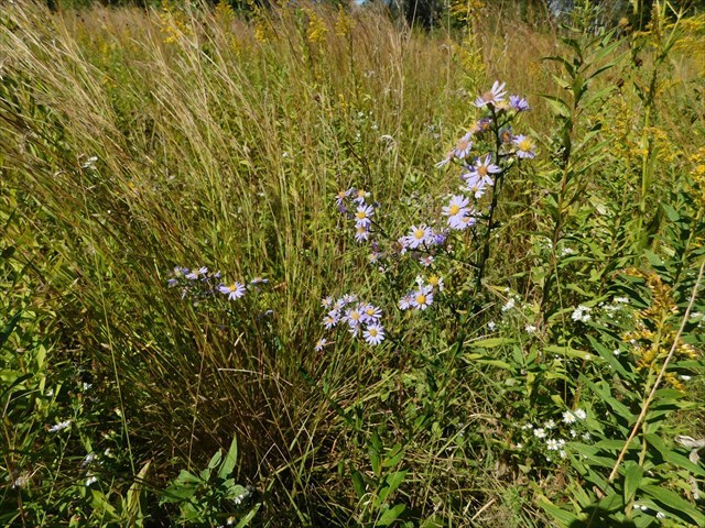
Welcome to the Granville Sand Barrens, a Niches Land Trust property that includes the finest twenty-two acres of sand barrens remaining in the state of Indiana. This unique landscape was created by wind-blown sand from the bed of the glacial Wabash River over-topping the outwash of the Wea Plains. Sand barrens are a globally rare type of habitat, home to some equally rare flora and fauna.
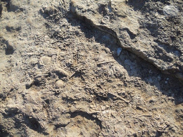
During the Silurian Period, some 50 million years ago, the landmass that became North America was situated over the equator, and was therefore much warmer. The region that now includes Indiana was a low basin covered by an inland sea. Over time, the sea filled up with sediments, which became compressed and hardened into sedimentary rock. In the southern third of the state, you can see Indiana topography much as it once was, with parallel, mainly horizontal layers of sedimentary bedrock, and fossil beds of ancient sea creatures.
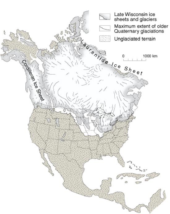
The topography in the northern part of Indiana, however, was dramatically altered about 10,000 years ago, during the last stage of the Ice Age. During this stage, known as the Wisconsin Stage, glaciers formed and traveled down from the north to cover about two thirds of the state. As the large sheets of ice moved, they carved and scraped out softer sections of sedimentary rock and carried the sediments along with them. While road cuts in southern Indiana reveal layers of bedrock, road cuts further north reveal layers of glacial till. The central third of the state, which includes Lafayette and the Granville Sand Barrens, lies within a topographical area known as the Tipton Till Plain. This is a mainly flat landscape composed of glacial till that was deposited as the Ice Age ended and the ice sheets retreated to the north.

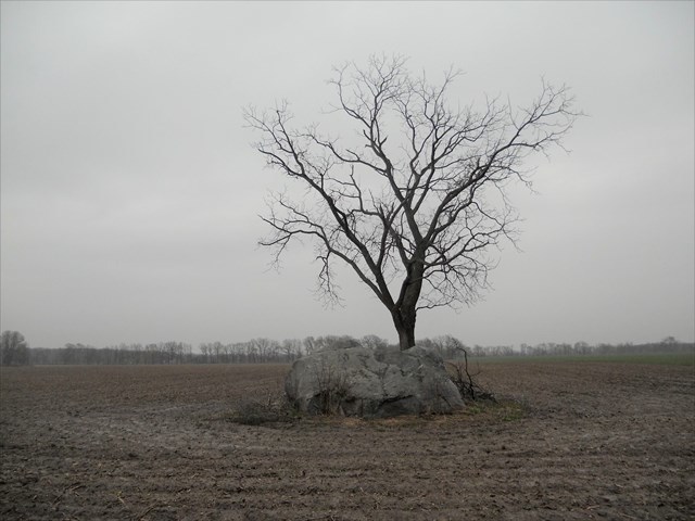
In addition to the churned up sediment from other areas of Indiana, the glaciers also brought erratics from elsewhere. Erratics are types of stones which do not naturally occur in an area, but have been carried by glaciers and left behind when they melted. For example, granite is fairly common in Indiana, yet there is no granite bedrock in the state. Erratics range in size, but large boulders are the easiest to spot, especially in otherwise flat and even terrain.
An outwash plain is formed from sediment deposited by meltwater at the terminus, the end point at a given time, of a glacier. Larger boulders tend to be pushed to the front and are left at the furthest reaching end, while smaller particles remain trapped in the ice longer and travel further before being deposited. This natural sorting process makes it possible to estimate the progress of a glacier and the distance it covered.
To log your find, take a short walk on the on the trail (0.5 mi) connecting the Granville Sand Barrens and Roy Whistler Wildlife Area and message me with answers to the questions below.
1. Stand at N 40 23.717 W 87 03.502 and take an elevation reading. Look northwest toward the Wabash River valley and try to imagine how much water must have been rushing down the Wabash when this landscape was formed. By way of estimation, pretend that the 40 acre area of the sand barrens is flat, and a perfect square. Given that there are 43560 square feet in an acre, and 7.5 gallons of water fit in a cubic foot, how many gallons of water would there have to be to go over your head?
2. At N 40 23.878 W 87 03.310 you can see several large boulders that a farmer has moved out of the neighboring field. These are erratics, carried to this area by glaciers and then deposited when the glaciers melted. Using the information provided above, what is one way to prove the previous statement?
3. The majority of the trail is covered by vegetation, but in shady areas beyond the boulders, you will find some large bare patches. What do you notice about the soil?
4. Optional: upload a photo of yourself or your group along with your GPS.
Please be aware that this location is strictly a nature preserve and there are no facilities of any kind (food, drink, restrooms, etc). The nearest "civilization" is the small town of West Point, about 5 miles away, and Lafayette, about 12 miles away. Please practice CITO and carry out all trash.

Leave only footprints. :)
Congrats to PamperedParakeet for the FTF!