From the southern approach to the bridge over the Te Awaoteatua Stream (looking north), the old line of the road can be seen in the hill-face. The road was aligned to its current route sometime in the late 1960s/early 1970s. Originally, like many roads in the region, this was a tramline, used to haul out milled logs from the forest beyond. The bridge is an unusual design it that it is on a curve. 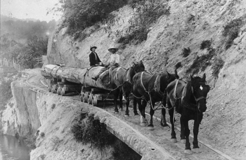
This photograph taken by Charles Wildbore, was likely taken early in the 20th century (see Wildbore: A photographic legacy, 2018 for more information).
Cache is plastic container.
Logged finds not matching log-sheet will be removed.
Cache +/- 2m.
BYOP.
FTF: Pushn_East