
THE MAJESTIC WITWATERSRAND
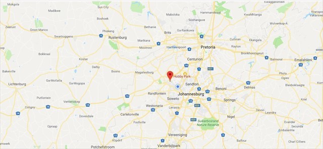
When one stands here at GZ, one can look down this majestic escarpment towards the North, one is able to appreciate the majesty of the Witwatersrand. Beyond your left shoulder would be the western Gauteng and if one could see that far, Rustenburg would be at about 10 o’clock, Pretoria at about 1 o’clock and the far East Rand would be to your right.
The Witwatersrand is a 56-kilometre-long, north-facing scarp. It consists of a hard, erosion-resistant quartzite metamorphic rock, over which several north-flowing rivers form waterfalls. This east-west-running scarp can be traced with only one short gap, from Bedfordview (about 10 km west of O.R. Tambo International Airport) in the east, through Johannesburg and Roodepoort, to Krugersdorp in the west.
The scarp forms the northern edge of a 7-to-10-kilometre-wide plateau which rises about 200 m above the surrounding plains of the Highveld. The elevation above sea-level is between 1700 and 1800 metres.
The Witwatersrand plateau forms a continental divide, with the run-off to the north draining into the Indian Ocean via the Crocodile and Limpopo rivers, while the run-off to the south drains via the Vaal into the Orange River and into the Atlantic Ocean.
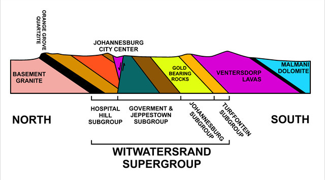
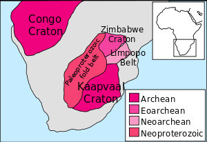
If we were able to turn back the clock and view the whole area before man, and if we were able to see a cross section of the Rand, we might be able to see that the Witwatersrand is made up of the major subgroups of rocks, each of which is made up of many separate layers of varying composition, as the cross section above shows. The harder layers form the hills, and the softer layers the valleys. The oldest rocks of the Witwatersrand Supergroup form the Orange Grove Quartzite layer. This forms the escarpment in the north, from which the Witwatersrand derives its name. The granite to the north of the Orange Grove Quartzite escarpment is around 3200 million years old and is an exposed portion of the underlying Kaapvaal Craton.
The Witwatersrand System, is a major division of Precambrian rocks, (the Precambrian began about 3.8 billion years ago and ended 540 million years ago), and is of great economic importance owing to its valuable deposits of gold and uranium.
In all, the Witwatersrand System consists of about 8,100 m of rocks that have been segregated into an upper and lower division, each of which is further divided into series and consist of alternating shales and quartzites in addition to pebbly layers that contain gold deposits; it also contains indications of a period of extensive glaciation. The most economically important series is the Main-Bird Series, largely quartzitic conglomerates that are extremely rich in uranium and gold. Large quantities of gold are also found in the Kimberley-Elsburg Series of shales, quartzites, and dolomites.
That’s it! We have now (vaguely) covered the bigger picture!
********
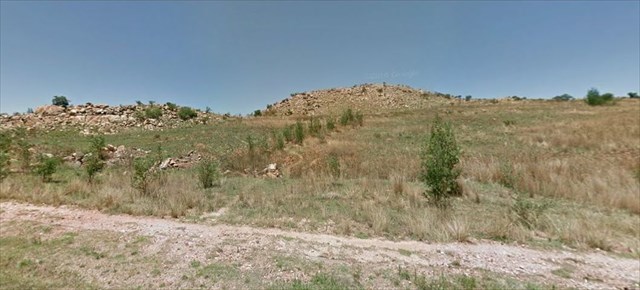
Now- we have a really interesting site here. If you were to look right under your feet, you would see the most beautiful, ragged rocks with a mostly reddish/brown hue,
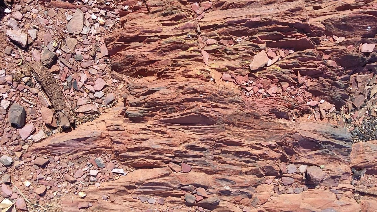
Here the Ridge consists of quartzites and other sediments of the Hospital Hill Group of the Lower Wits. Deposited in a shallow marine environment some 2,900 million years ago. The sediments were derived from the North-west during the erosion of mountains caused – like the Himalayas today – by the collision of 2 small continents. It would be the Kaap-vaal here and the Zimbabwe sub-continent from the NW.
The particular rocks here were possibly deposited in slightly deeper water as they appear somewhat finer grained than most of the quartzites. The thin bedding also indicates this. They are steeply dipping to the SW. The colouring is due to the iron content. This gives the reddish-brown staining especially on the outside where it has been oxidised (like rusting). The centres still show some grey material that indicates a muddier environment.
Questions:
1) (Location question) Look towards the north and see if you can identify the two big complexes below and in the distance?
2) Examine and describe the rocks and their texture?
3) While looking north-ish, describe the rocks and the distinctive physical appearance?
https://en.wikipedia.org/wiki/Witwatersrand
www.britannica.com/science/Witwatersrand-System
Acknowledment: David Mourant