This is an EARTHCACHE, which means there are no physical containers to find. Instead answer the logging tasks detailed below...
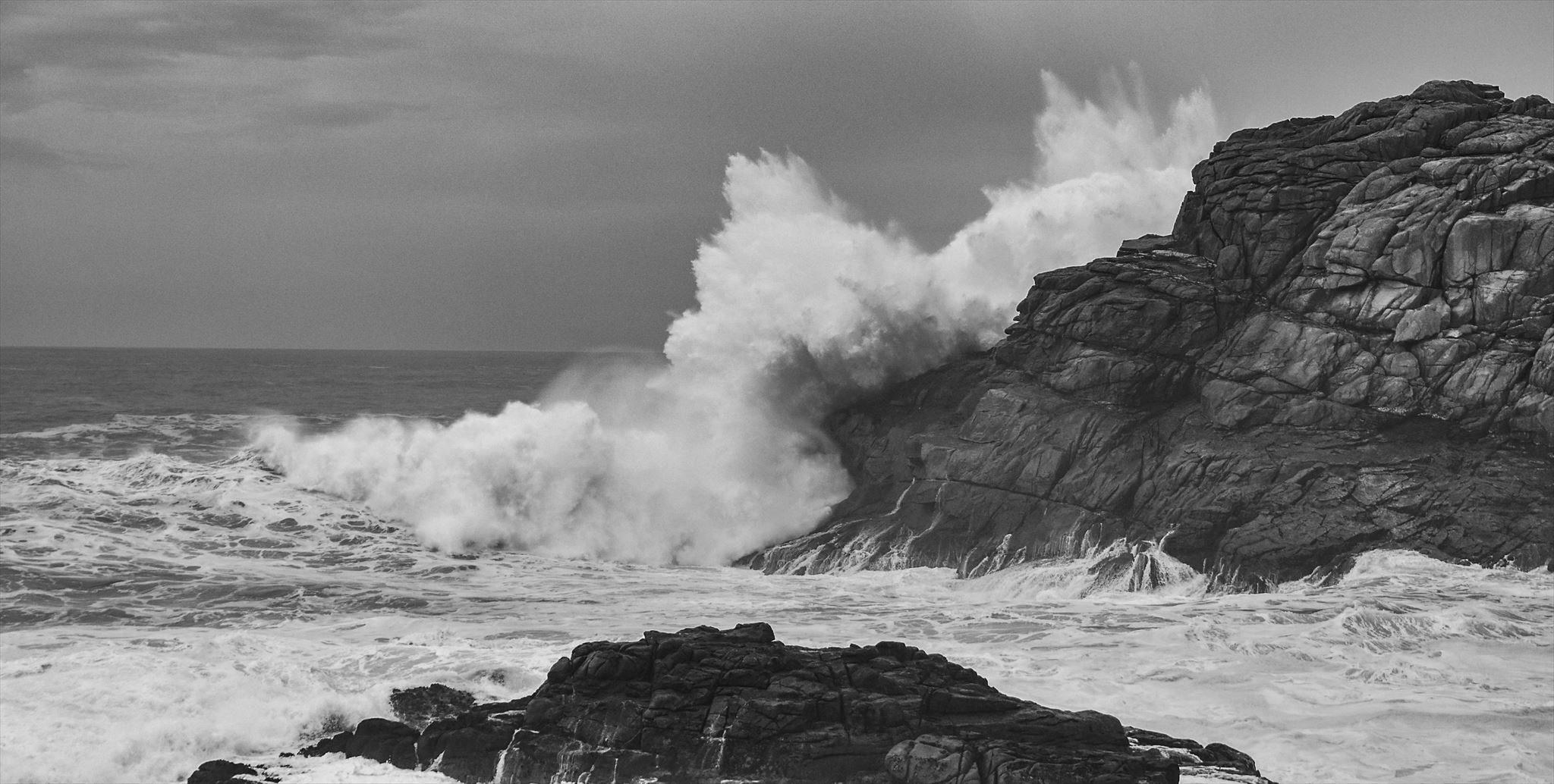
This Earthcache will take you to two geological points of interest on the Western side of Bryher, at the aptly named Hell Bay. On a sunny day, with no wind, it can seem as far from hellish as is possible - indeed it is a lovely place for a picnic - but on a wet, windy day there is nothing to the west to stop the waves which can travel thousands of miles across the Atlantic to reach here.
Due to the extreme power of the waves, Hell Bay is subject to a large amount of erosion, which you will see when doing this Earthcache.
There are two stages to visit in order to log this earthcache, and both show different examples of coastal erosion.
Stage 1: The Gulf
To the north of you is Shipman Head, which is cut off from the rest of Bryher by the Gulf, a narrow but deep channel which is gradually being eroded by the sea.
1. At the headline coordinates, describe the rock you can see that makes up the Gulf and the surrounding area.
2. What do you notice about the sides of the Gulf? Explain why you think they are like that.
3. Around you is a flat expanse of rock, about five metres above sea level. Explain how you think this will have formed.
4. If the Gulf was made of chalk or sandstone, rather than granite, how would the rate of erosion differ? What difference would there be in the appearance of the area?
5. Estimate the length, width and depth of the Gulf
Stage 2: Undercut Cliff
There is no need to leave the coast path or go too close to the edge to answer the questions at this stage
1. Ahead of you, you will see a large area where the cliff has been undercut. Describe it, and explain how it would have been formed.
2. What will happen to this part of the coast as time progresses?
3. Compare the rate of erosion here to that at the Gulf. Do you think it would be faster or slower? Why?
4. Do you think that overall, the rate of erosion in Hell Bay is fast or slow (in geological terms)? Give two reasons for your answer
To log this cache as a find, please send your answers to me (do not put them in your log) through email or the Message Center. There is no need to wait for a reply before logging a find, if there's a problem I'll let you know. If I have not received any answers from you within 24 hours of logging a find, your log is at risk of being deleted...
Coastal erosion processes create a number of significant landforms. There are a number of factors which affect the rate of this erosion. Firstly, rock types. A more resistant rock, such as granite, will be eroded slowly, whilst a less resistant rock, such as clay or mud, can be eroded very quickly. Secondly, the more faults and joints a rock has the more susceptible it is to erosion from coastal processes.
The diagram below details the different types of coastal erosion, which can be found at Hell Bay:
.

1.
Hydraulic Action is the process where air becomes trapped in joints and cracks on a cliff face. When a wave breaks, the trapped air is compressed which weakens the cliff and causes erosion.
2.
Abrasion is where bits of rock and sand in waves grind down cliff surfaces like sandpaper, leaving a smooth, polished surface
3.
Solution is where acids contained in sea water will dissolve some types of rock such as chalk or limestone. The Scillonian granite you see here is harder than chalk and limestone so this process of erosion would not be predominant here.
4.
Attrition is where waves smash rocks and pebbles on the shore into each other, and they break and become smoother.
The biggest factor affecting coastal erosion is the strength of the waves breaking along the coastline. A wave’s strength is controlled by its fetch and the wind speed. Longer fetches & stronger winds create bigger, more powerful waves that have more erosive power. As waves approach a coastline they lose energy though because friction with the seabed increases. This means that the depth of the ocean also impacts the strength of waves.
IMPORTANT NOTES
This Earthcache has been placed with kind permission from the Isles of Scilly Wildlife Trust. Please DO NOT attempt to cross the Gulf on to Shipman Head as it is one of their bird nesting areas and is closed all year.

There are a few hazards to be aware of here. As always you are fully responsible for your own safety when doing this cache. At stage one the rocks may be slippery after wet weather, so please take care and do not attempt if you feel unsafe to do so. The path is also fairly exposed down to the Gulf, however there is no need to go too close to the edge of the Gulf. Please do not attempt this cache in a storm. It is not a good idea.
At Stage two you will be above an undercut cliff. Again there is no need to go too close to the edge - follow the coastal path please.
I would advise that this cache is not suitable for young children