NEMO PLATEAU EARTHCACHE
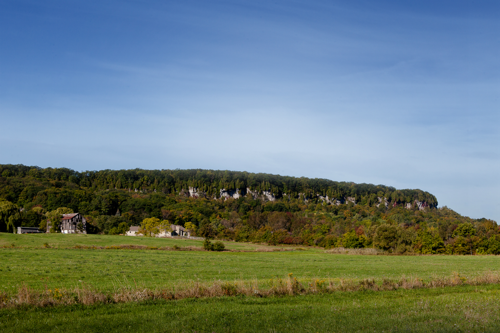
Mount Nemo Conservation Area
Mount Nemo is the place to hike away from the crowds of Rattlesnake Point or Kelso Conservation Area. There are five kilometres of trails to explore, and the views over the escarpment are breath-taking. Birders will love to see the Turkey Vultures floating on the thermals. Mount Nemo is also a naturalist’s dream: in the spring and summer you’ll see bees and butterflies flying in and around the wildflowers. The unique cliff-edge eco-system is one of very few in Halton Region. Bring your favourite four-legged friend for a walk around Mount Nemo. The trails are challenging enough for a work-out, but friendly enough for dogs and children to enjoy.
If you like a little more adrenaline, and more of a work-out, try the rock climbing routes at Mount Nemo. After a long day of hiking, caving, and rock-climbing, end the summer day at the look-out point and watch the turkey vultures soaring while the sun sets on the escarpment.
Nemo Plateau
More than 450 million years ago, a shallow tropical sea covered a vast area of Ontario and beyond. Along the shore stood what we now know as Mount Nemo. Today the Nemo Plateau in north Burlington is part of a world-renowned biosphere reserve. It has been recognized by UNESCO for its ecological importance.
What is a Plateau?
In geology, a plateau, also called a high plain or a tableland, it is an area of a land, usually consisting of relatively flat terrain that is raised significantly above the surrounding area, often with one or more sides with steep slopes. Plateaus can be formed by a number of processes, including upwelling, volcanic magma, extrusion of lava, and erosion by water and glaciers, and cover about 18% of the earth’s land surface.
Plateaus are classified according to their surrounding environment as: 1) Intermontane Plateaus; 2) Piedmont Plateaus; 3) Continental Plateaus; 4) Volcanic Plateaus; 5) Dissected Plateaus
Intermontane Plateaus
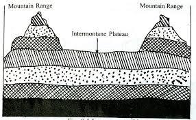
Intermontane plateaus border mountain ranges (generally fold mountains) or are partly or fully enclosed within them. The term ‘intermontane’ means ‘between mountains’, and are the highest in the world.
Piedmont Plateaus

Piedmount plateaus are situated at the foot of a mountain and is locked on the other side by a plain or a sea/ ocean. The word ‘piedmont’ means ‘foot of a mountain’. They are also called as Plateaus of denudation as the areas once were high to the level of mountains, have now been reduced to the foot level of the mountain by various agents of erosion.
Continental Plateaus
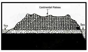
Continental Plateaus are formed either by an extensive continental uplifting or by the spread of horizontal basic lava (less viscous) sheets completely covering the original topography. This kind of plateau shows an abrupt elevation in contrast to the nearby lowland or sea. The Continental Plateaus are also known as Plateaus of Accumulation.
Volcanic Plateaus

A volcanic plateau is a plateau produced by volcanic activity. There are two main types: lava plateaus and pyroclastic plateaus. Lava plateaus are formed by highly fluid basaltic lava during numerous eruptions, through numerous vents, without violent explosions. Pyroclastic volcanic plateaus are produced by massive pyroclastic flows and they are underlain by pyroclastic rocks.
Dissected Plateaus
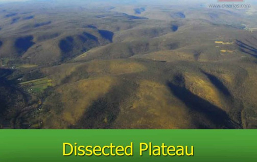
A dissected plateau is an area that has been severely eroded so that the relief is sharp. Such an area may appear as mountainous. Dissected plateaus are distinguishable from other mountain belts by the lack of folding, metamorphism, faulting, or magmatic activity.
Importance of Plateaus
Storehouse of minerals: Most of the minerals in the world are found in plateaus. The extraction of plateau minerals are easier than on mountains.
Generation of hydro-power: The edges of plateaus form waterfalls which provide ideal sites for generating hydro power.
Cool climate: The higher parts of the plateaus even in tropical and sub-tropical regions have a cool climate.
Animal farming and agriculture: Plateaus have large grassland areas suitable for sheep, goat, and cattle farming, and are rich in minerals making the soil is very fertile for farming crops.
Requirements
In order to log this EarthCache, send the answers to the following questions to the CO at the top of this page:
1) According to the sign at GZ, Nemo Plateau is the source of the headwaters for two major creek systems. What are they?
2) After walking between the two waypoints provided, and driving to this Conservation Area on the Nemo Plateau. Describe the unique characteristics you observed, that make this area a Plateau.
3) After reading the information on the cache page, and the information found at GZ, and of course your own observations of the surrounding area, What type of Plateau do you believe Nemo Plateau is?
4) Take an altitude reading at the Look Out Point, or another point along the edge of the Escarpment, and determine the height of the plateau, by taking a second reading at the waypoint provided on Walker's Line.
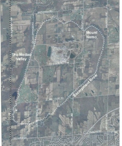
5) [Now for the difficult task] Using Google maps (distance and area tools), calculate the surface area of the plateau, and the distance around the Escarpment Brow. Remember, the Nemo Plateau is much larger than just this conservation area. There is a map on the cache page, that will help in coming up with your estimation.
5) Optional (of Course)
Include a few photos with you "Found it" log showing some of the Plateau features you recognized on your walk to the lookout, or your drive on the Nemo Plateau.
Information Sources
https://en.wikipedia.org/wiki/Plateau
http://bayobserver.ca/mt-nemo-heritage-designation-questioned/
https://www.clearias.com/major-landforms-mountains-plateaus-plains/