Overbilke in english click here
Der Name Oberbilk entwickelte sich aus dem Namen Arenbilk(e) (arena = Sand(platz)), da es sich um bewaldetes und sandiges Gebiet handelte bzw. später daraus mundartlich Orenbilke, Orembilke oder auch Orrenbilke und aus dem Wort Overbilke, der auf die höhere Lage im Vergleich zu Bilk anspielte. Seit 1677 ist Oberbilk geläufig. Oberbilk gehörte damals zu der Ortschaft Bilk, die 1384 zu Düsseldorf eingemeindet wurde.
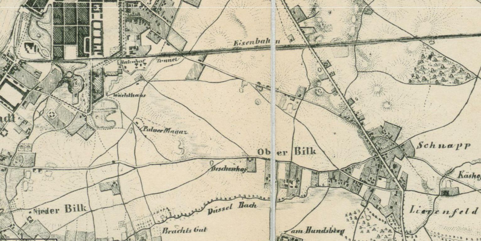
In dieser Zeit gab es nur eine befestigte Straße, die „Chaussee nach Benrath“ (die heutige Kölner Straße) und einige Feldwege. Entlang der Düssel gab es einige Häuser und Höfe (zum Beispiel hat der Gangelplatz seinen Namen von dem alten Gangelshof, der dort in der Nähe an der Düssel stand). Insgesamt gab es ca. 30 bebaute Grundstücke Anfang des 19. Jahrhunderts.
Oberbilk um 1835
Gegen 1840 wurden die Trassen der Düsseldorf-Elberfelder Eisenbahn und die Cöln-Mindener Eisenbahn-Gesellschaft durch Oberbilk gelegt. Die Nachfrage nach Stahl stieg mit dem Eisenbahnbau und in Oberbilk gab es günstige Bodenpreise, sowie eine gute Eisenbahnverbindung zu den Kohlegruben im Ruhrgebiet. Dadurch wurde Oberbilk das erste Industrieviertel in Düsseldorf. Der Standort in Oberbilk entwickelte sich zu einem der Bedeutendsten in Deutschland und gleichzeitig zum größten Wohnviertel von Düsseldorf.
Das Zentrum des neuen Stadtteils war die Kölner Straße und in der Mitte der Oberbilker Markt. Bis zum zweiten Weltkrieg gab es drei Kinos, 20 Kneipen (darunter eine mit Hausbrauerei) und gut einhundert Geschäfte.
Über den folgenden Link erhältst du weitere Informationen zu den Stationen. Als Geocache-Besitzer versichere ich, dass diese Datei sicher ist. Sie wurde weder von Groundspeak, noch von einer Reviewerin/einem Reviewer auf schädlichen Inhalt überprüft. Du lädst diese Datei auf dein eigenes Risiko herunter: Informationen zu den Stationen (PDF)
Der Cache beginnt am und endet in der Nähe vom Düsseldorfer Hbf. Es ist eine Wegstrecke von etwa 5 km zu absolvieren.
Für die Stationen benötigt ihr:
- Einen Drucker zum Ausdrucken der Informationen für die Stationen
- Ein GPS-Gerät zum Peilen / SmartPhone mit einer entsprechenden App
- Ein Smartphone mit QR-Code Scanner (muss DataMatrix lesen können) & Taschenrechner
Quellen:
1. Buch "Oberbilk: Die Geschichte eines Industrieviertels" von Anne Mommertz
2. https://de.wikipedia.org/wiki/Oberbilk
The name Oberbilk developed from the name Arenbilk(e) (arena = sand (square)), because it was a wooded and sandy area. From this follows later in dialect Orenbilke, Orembilke or Orrenbilke. And from the word Overbilke, which alluded to the higher position compared to Bilk. Oberbilk belonged to the village Bilk, which was suburbanised in 1384 to Düsseldorf.
At this time there was only one paved road, the “Chaussee to Benrath” (today’s Kölner Straße) and some field paths. Along the Düssel river there were a few houses and farms. For example, the Gangelplatz takes its name from the old Gangelshof, which stood there on the nearby Düssel river. In total, there were about 30 properties at the beginning of the 19th century.
Oberbilk about 1835
Around 1840, the routes of the Düsseldorf-Elberfelder railway and the Cöln-Mindener Railway-Corporation were laid through Oberbilk. With the railway construction increased the demand for steel and in Oberbilk were favourable land prices as well as a good railway connection to the coal mines in the Ruhr area. This made Oberbilk to the first industrial district in Düsseldorf. The location in Oberbilk became one of the most important in Germany and at the same time the largest residential district of Düsseldorf.
The centre of the new district was the Kölner Straße and in the middle the Oberbilker Market. Until World War II there were three cinemas, 20 pubs (including one with an own brewery) and over one hundred shops.
The following link will give you more information for the stations. As a geocache owner, I assure you that this file is safe. It has not been reviewed by Groundspeak or any reviewer for harmful content. You download this file at your own risk: Information for the Stations (PDF)
The multi-cache starts at and ends close to Main Station of Düsseldorf. It is a distance of about 5km to complete.
For the stations do you need:
- A printer to print the information for the stations
- A GPS device for bearing of a direction / smartphone with an according app
- A smartphone with QR code scanner & calculator
Sources:
1. Book "Oberbilk: Die Geschichte eines Industrieviertels" by Anne Mommertz
2. https://de.wikipedia.org/wiki/Oberbilk