When hiding these caches I walked over 18000 steps. I started off at Metropolitan Parkway and Garfield Road and walked to Maple Lane and 14 Mile
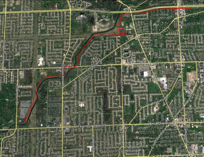
Above is a rough estimate of the trail that I followed marked in red. Luckily for me my buddy Bruce of BAPMAN CREW picked me up at the end and gave me a ride back to my truck. By the end of that day I was worn out. Thanks for the ride Bruce. :)
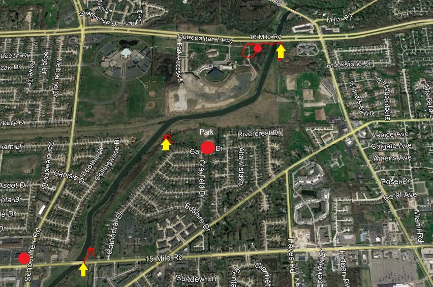
Below is a map of the section of trail behind Freedom Hill. Over the years people have had a hard time getting back to these caches so hopefully this map will help. The yellow areas show access points to get in to the trail. The red dots are possible parking spots.
Most of the cache names might help you find the cache so keep them in mind while searching. Not always the case but they should help.
Hope you enjoy this hidden trail, maybe one day it will be paved and used for a bike trail.