This is a 7 stage Wherigo taking you to some very seldom seen historical places around Durham City that are not on many maps, not many people know about and some will take some finding even with coordinates as they are off the beaten track and yet surprsingly close to familiar landmarks.
****Please be sensible around each location - there are some potential hazards and you attempt this cache at your own risk. Stage 6 is steep and possibly slippy and awards the 5 terrain rating. I dont want anyone ending up in the river!****
You will have to arrive at the location and answer some questions and use some of the information given below at the relevant stages to move to the next stage.
Wherigo Information
Click here for link to the Wherigo cartridge's page
If you have not done a Wherigo cache before then don't be afraid to give it a go!....to get started you only need either a compatible GPS or a smartphone with a wherigo app installed.The Wherigo app is easy to download to your phone just like any other app. Once you have downloaded your wherigo app and logged in using your usual geocaching username and password then you just need to find this cache page. You could search for it by its title or GC number.You will then need to download the cartridge and will be given a drop down box to which you will probably choose 'Pocket PC Device'. You'll then be ready to go!
The Start -Stage 1
The listed coordinates take you to the bottom of a steep path where you need to ascend - ducking under the railing and using the rocky steps is the best option.
St Cuthbert's Well -Stage 2
St Cuthbert’s body was brought to Durham in 995 AD, 120 years after monks first fled with it from Lindisfarne to escape the Vikings. He now lies secure in the Cathedral above this well dedicated to him. A large sandstone surround with a rounded head-height archway has been built over the well. The arch over the actual well bears the inscription "Fons: Cuthbert" and the date 1690.
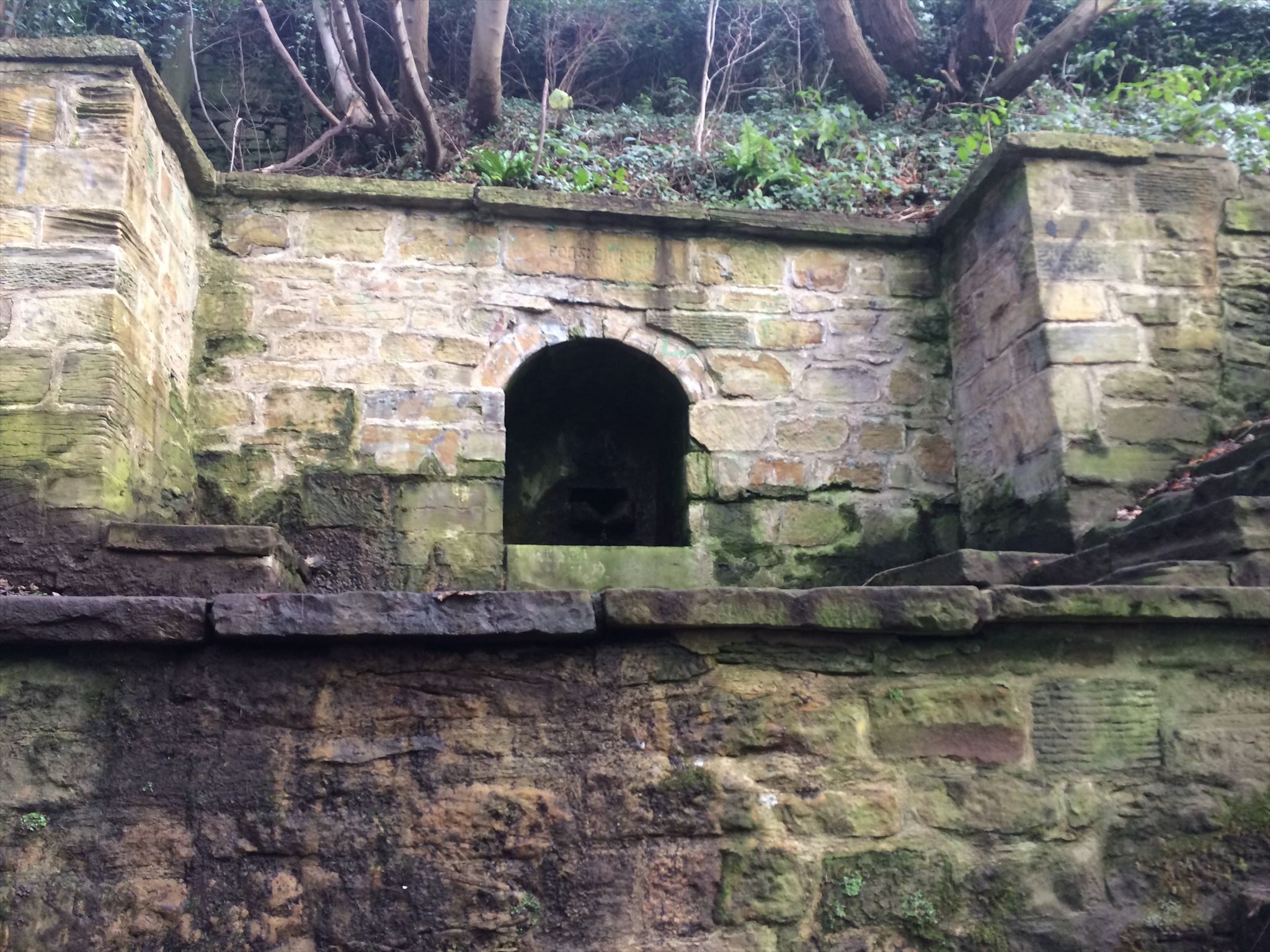
Despite being a listed structure, the site has not been maintained and the public can be forgiven for being oblivious to its existence. A few years ago the land agent for the cathedral stated there were “no plans to restore the well” because of a subsidence issue affecting the access steps. The quoted cost to rectify the issue was £1-2m with no guarantee of prolonged success. Further, it was claimed the well was kept unkempt “in order to persuade people not to clamber into the unstable area”.
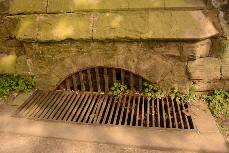
Galilee Well -Stage 3
This can be seen on the path from Windy Gap to Watergate, adjacent to the Galilee Chapel of Durham Cathedral. The west end of the cathedral is actually built over the well. A metal grill covers a large hole in the pathway, with a stone surround and a very low archway in the cathedral wall, also grilled. The well was not known for any particular virtues, but is a notable, although not widely known, example of a Christian building over a well.
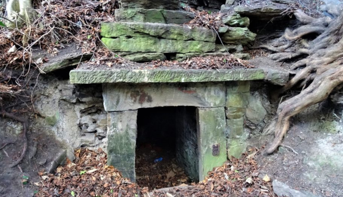
The Ice House -Stage 4
Many will be familiar with the Count Józef Boruwłaski's House, which is a small Greek-style summer house on the southern point of the Bailey near the river. However, few will be aware of the secrets lurking in the trees behind the house, the remains of the stone staircases and other masonry once part of long forgotten and overgrown gardens that stretched all the way to the river from the townhouses on the Bailey can be found here. The real gemstone though is the ice house. Dated circa 1800, the listed ice house is a stone tunnel leading four meters into the bank where ice could be stowed during the winter months for use around the year. At the end of the tunnel is a deep storage well which you can look into but I suggest not climb down to!
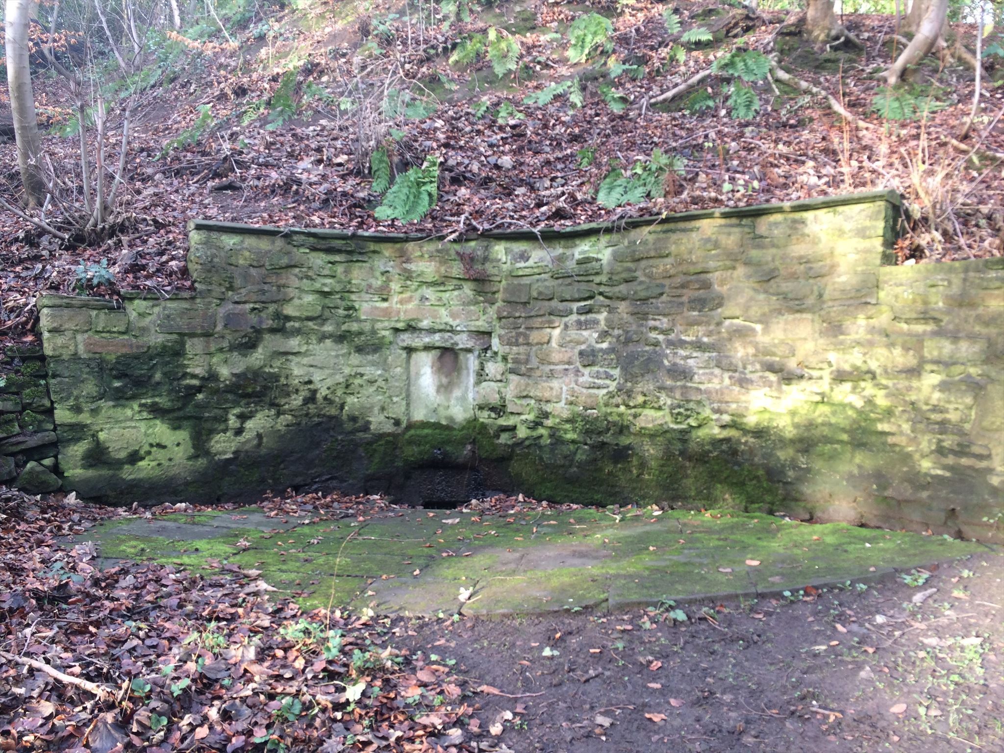
St Mary's Well -Stage 5
This is said to be a Holy Well or Sacred Spring. In the 19th century this well was in popular use, "of great repute", "much resorted to".It consists of an arc of stone walling with a small hollow where water collects. Whether this is in fact St Mary’s Well I have been unable to verify. It tends to be known as ‘South Street Well’ today.
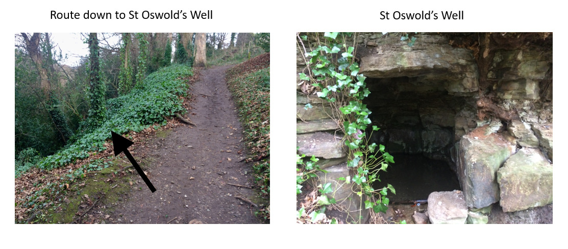
St Oswald's Well -Stage 6
Similarly forgotten is the well behind the river path at the back of St Oswald’s Church. St Oswald’s Well was once a site of beautiful arches and basins. Unfortunately, these were destroyed by vandals in the 19th century, although what remains today is still impressive. The well consists of a large cavern hewn into a sandstone outcrop part-way down the steep banks of the River Wear. It is roughly three metres deep and one-and-a-half metres wide and high. The cavern is filled with water which flows out down the slopes to the Wear. Access is extremely precarious as one must go off the footpath to descend the steep river bank in order to view it.
The Final -Stage 7
Simply head to the final coordinates to get the cache