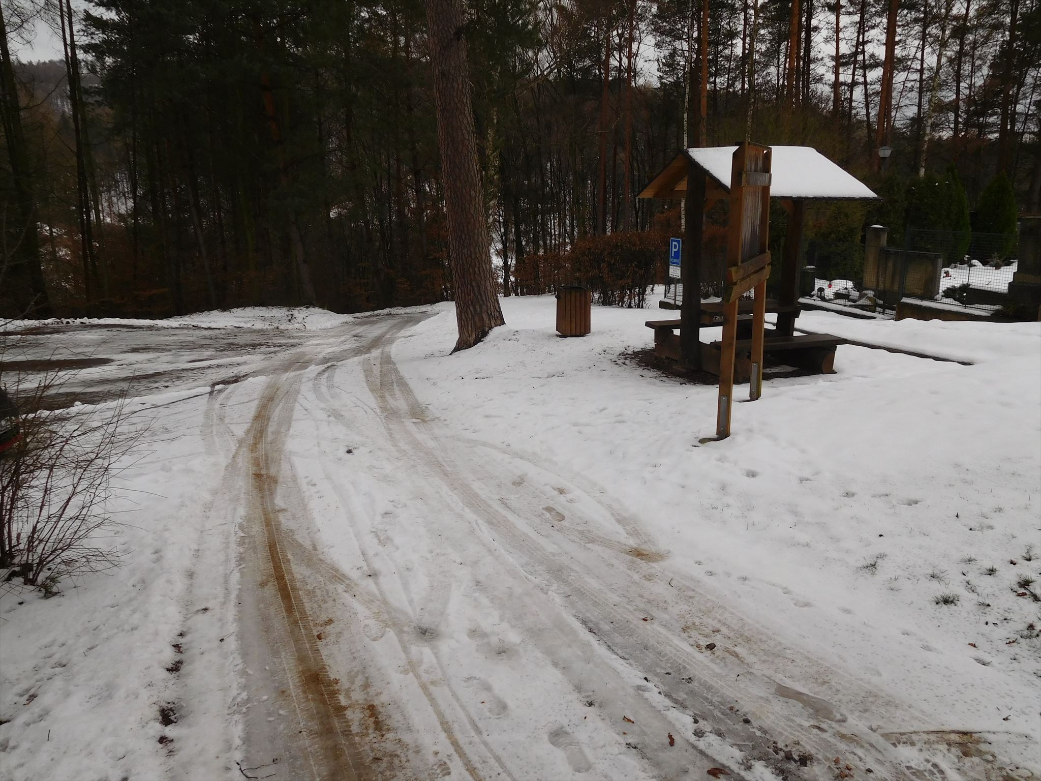
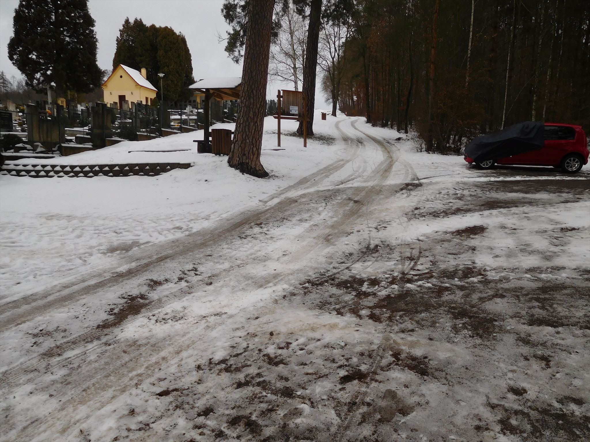
Tato mikro keš (vlastní propisku mějte s sebou) se nachází ve výchozím bodě turistické stezky v Řícmanicích, která prošla v roce 2018 rekonstrukcí a která nabízí možnost nenáročné procházky pěknou přírodou.
Keš se nenachází v areálu přilehlého hřbitova.
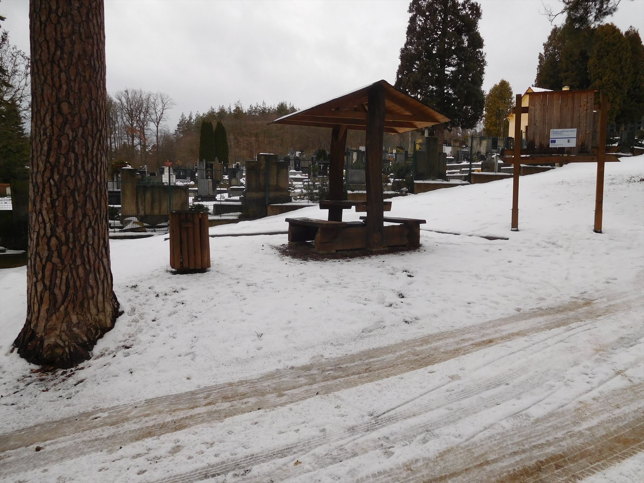
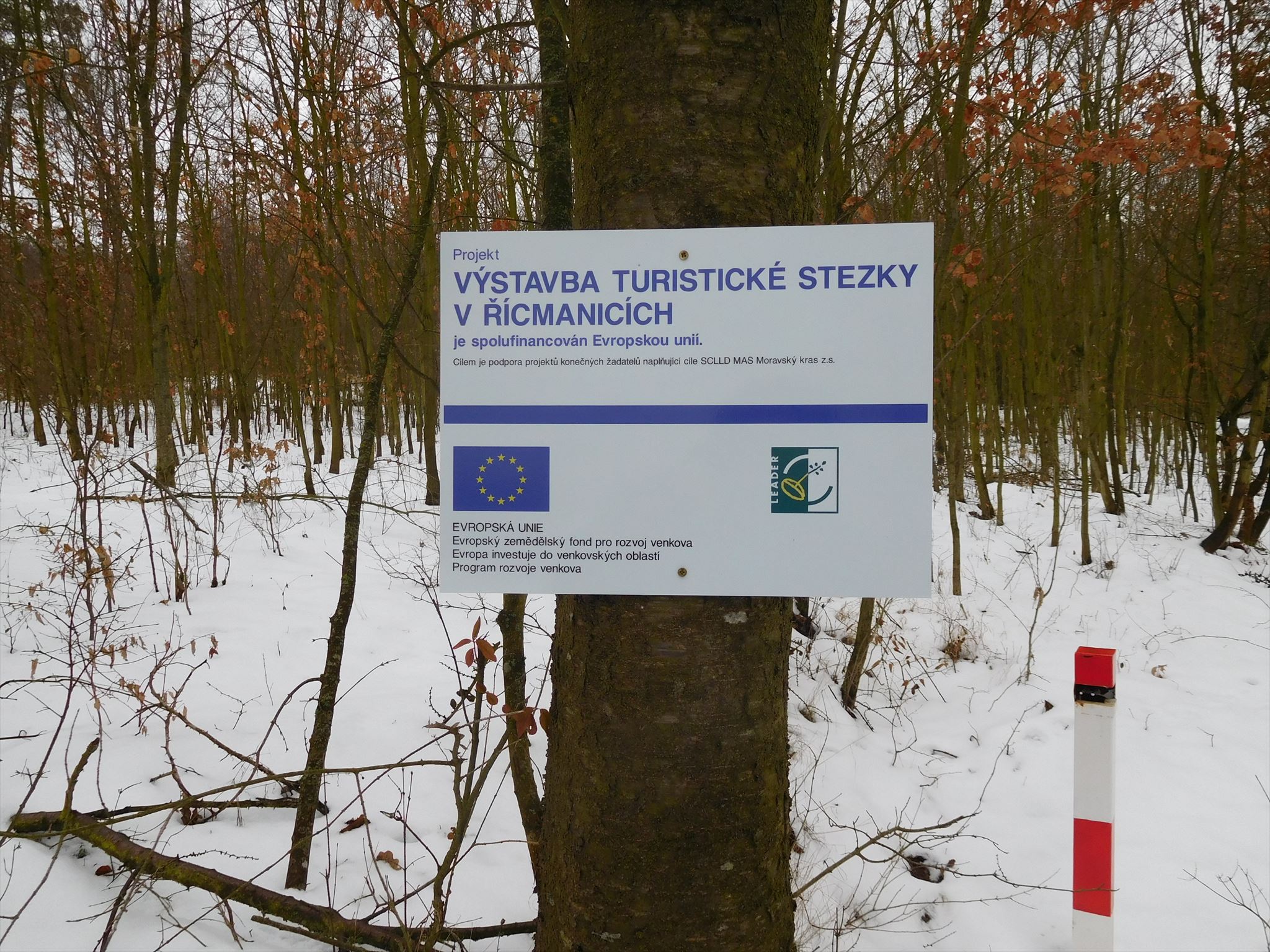
Na začátku stezky najdeme nově vybudovaný přístřešek a informační tabuli.
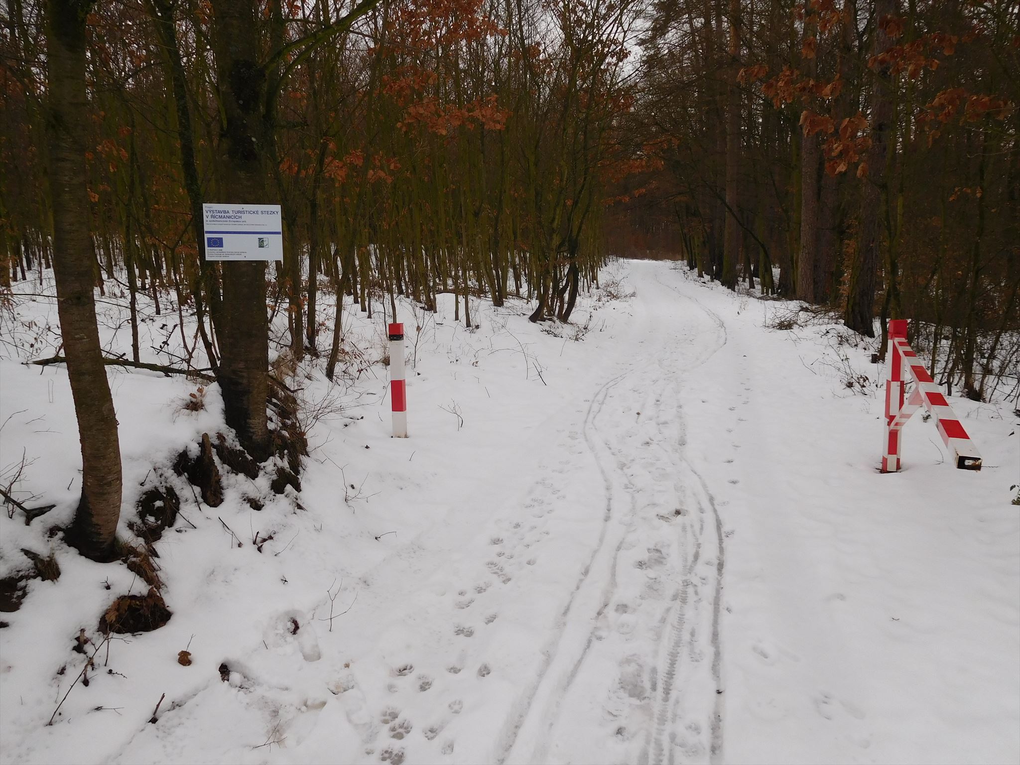
Bohužel zde nejsou žádné informace o tom, kudy stezka vede. V celé své délce stezka také není nijak značena. Proto níže přikládám mapu, kde jsem stezku zaznačil.
Stezka začíná v těsné blízkosti hřbitovu v Řícmanicích, kolem kterého vede nahoru směrem na Kanice. Zhruba po 250 metrech se nám otevírá výhled na velkou část obce Kanice.
Stezka dále pokračuje lesem nad místní chatovou oblastí a končí v části obce Řícmanice zvané Na Vinohrádkách.
Právě na konci stezky se nabízí krásný výhled na sousední obec Bílovice nad Svitavou. Dále za Bílovicemi je k vidění už Brno. Zejména panelové domy na Lesné. Při dobré viditelnosti je k vidění i Kohoutovický vodojem charakteristický svou trojúhelníkovou siluetou.
Stezka plynule navazuje na ulici Tyršovo návrší, což umožnuje dojí až do centra Řícmanic na Masarykovo náměstí.
Pokud budeme pokračovat ulicí Tyršovo návrší až na Masarykovo náměstí, tak celý výlet zabere kolem půl hodiny a urazíme přitom necelé 2 kilometry.
Na Masarykově náměstí v Řícmanicích je startovní bod Stezky zdraví HVOZD, která vybízí k pokračování výletu.
Součástí Stezky zdraví HVOZD je také multikeš.
Trasa stezky až na Masarykovo náměsí v Řícmanicích
Odkaz na trasu na Mapy.cz
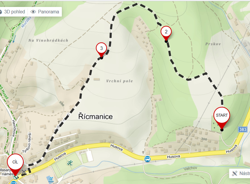
Výchozí bod stezky
Konec stezky
This micro-cache (take your own pen) is located at the starting point of the Hiking trail in Řícmanice, which was reconstructed in 2018 and which offers easy walk through beautiful nature.
Cache is not located in the adjacent cemetery.
At the beginning of the trail we will find a newly built shelter and information board.
Unfortunately there is no information on where the trail is leading. Throughout its length, the trail is also not marked.That is why I attach the map where I traced the trail.
The trail starts in close proximity to the cemetery in Řichmanice, around which leads up to Kanice. Approximately 250 meters away, you will have a view of a large part of Kanice village.
The trail continues through the forest above the local cottage area and ends in the part of the village Řícmanice called Na Vinohrádkách.
Just at the end of the trail there is a beautiful view of the neighboring village Bílovice nad Svitavou. Beyond Bílovice there is also Brno. Especially panel houses on Lesná. With good visibility we can see the Kohoutovice water reservoir which characterized by its triangular silhouette.
The trail is continuously connected to the Tyršova hill, which allows continue to the center of Řícmanice on Masarykovo náměstí.
If we continue along the Tyršovo hill to Masaryk Square, the whole trip will take about half an hour and we will travel less than 2 kilometers.
At Masaryk Square in Řícmanice is the starting point of the HVOZD Health trail, which invites you to continue the trip.
Part of the HVOZD Health trail is also a multi-cache.