Mount Arthur (Tuao Wharepapa in Maori) is in the Arthur Range. Mount Arthur, named after Captain Arthur Wakefield, lies within Kahurangi National Park and has a peak elevation of 1,795 metres (5,889 ft).
Flora car park is 75 km from Nelson and 36 km from Motueka.
The Motueka Valley Highway links Nelson and Motueka. Turn off this road at Ngatimoti and cross the Motueka River. Turn left onto Motueka River West Bank Road, then right into Graham Valley Road, which climbs steeply to the car park. The last 5.8 km is unsealed and turning a vehicle on the road can be difficult. 4WD is recommended at all times of the year.
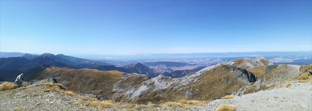
Follow the Mt Arthur Hut Track from Flora car park to Mt Arthur Hut (1.5 hours). From there, a marked route follows the Wharepapa/Arthur Range and offers panoramic views and a good look at the rock formations that make this mountain special (2 - 3 hours)
Mount Arthur is an alpine environment and is very likely to have snow and ice in the winter. Take water with you, there is nothing past the hut and it's not guaranteed at the hut especially in summer.
The cache is practically at the summit just a little way away from the muggles that are likely to be there, please try to be discrete and make sure the container is hidden