***PLEASE NO SPOILER PICS IN YOUR LOGS***
THE SERIES
**An added CITO element with this one. The lane from here to Bryntirion is a notorious fly tipping spot, keep your eyes peeled and do report anything suspicious, the more eyes on the ground the better*** Let me know if this area suffers any and I'll come and clear it.
This is a 5mile, figure 8 type of stroll around the pretty and historic village of Laleston. You could, of course, break it up into two, or do them randomly, whatever suits your day. Due to the small size of the village, and quite a bit of interesting stuff to see, I've had to detour out into the countryside quite a bit, and still some things could not have their own cache. So I've written in the descriptions if there are other interesting things to see en-route. There's parking all around the village, especially near the church and post office, please park considerately and don't block any access. The route goes over farm fields, so some of the caches will not be available to wheelchairs or buggies, check the attributes. You might want to solve some nearby puzzles before setting off.
THE CACHE
The Ffordd y Gyfraith is an old pilgrimage route that runs through the village of Laleston near Bridgend and continues northwards into the hills around the historic village of Llangynwyd (The burial place of the ‘Maid of Cefn Ydfa’). These medieval routes still make good walking today. They have a sort of resonance from all those footsteps of people travelling in hope. Looking at the fragments of wayside crosses and the little platforms that are all that’s left of peasant cottages and bigger farmhouses, you realise that these empty hills were once home to a thriving and complex society.
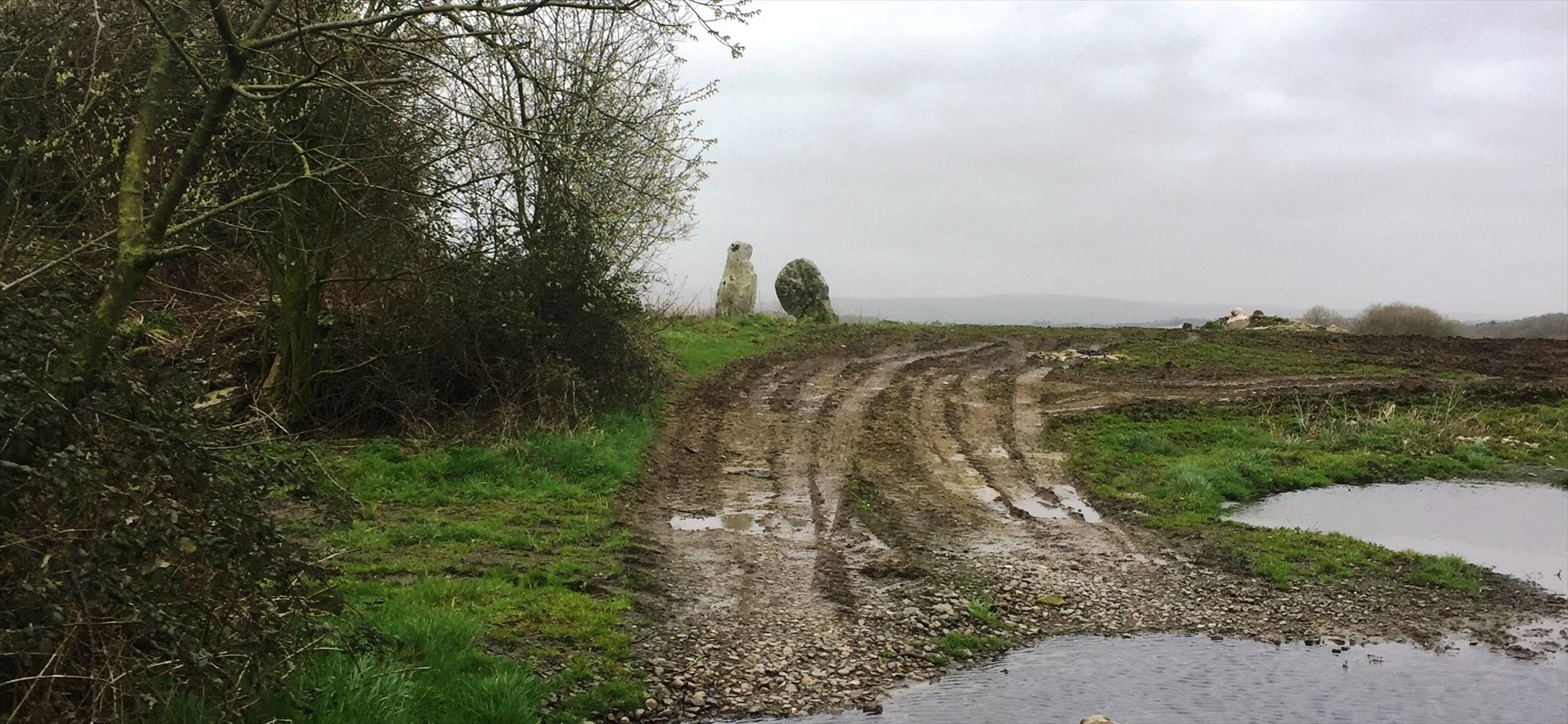
The two stones in the field are all that remains of the medieval church and village of Llangewydd. Two carved ‘Celtic’ crosses were found here and are now in the National Museum.
So what happened to the settlement – in a word, the Cistercians. This reformed religious order spread from France across Europe in the early twelfth century, reaching Wales in 1131. Part of their ethos was that they wanted to farm their own land. They preferred to settle on unused land and bring it under cultivation themselves. But there was very little unused land in England and Wales – and when they were given land which was already being farmed, they sometimes used a combination of persuasion and moral blackmail to remove the tenants. The Cistercian monks of Margam were given the land around Llangewydd in the middle of the twelfth century and within fifty years they had removed the church and the little settlement around it.
For more information about the the whole route, please check out :
https://indd.adobe.com/view/91d158b9-1da1-4c83-a562-cdd77cc61f23/

Only room for log - Bring your own Pen
`'•.¸ ¸.•'´`'•.¸ ¸.•'´ CONGRATULATIONS ---> Welshman65 <--- FIRST TO FIND `'•.¸ ¸.•'´`'•.¸ ¸.•'´