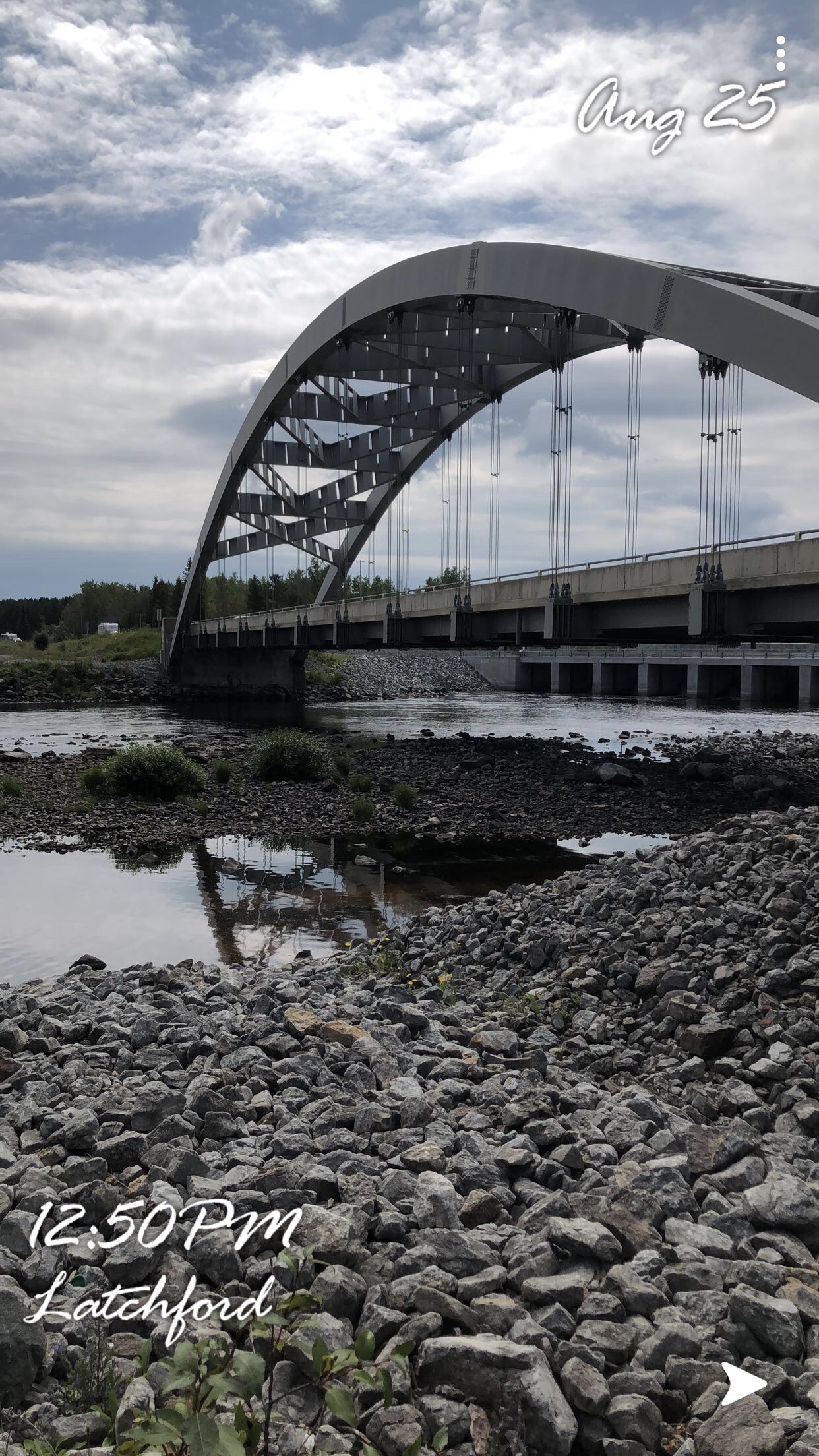
Welcome to Latchford! At the posted coordinates, it will take you to the park, and the viewing spot where you can observe the waterlevels changing.
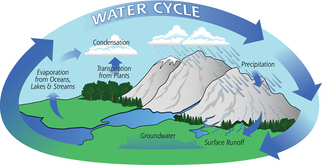
Why Do Waterlevels Change?
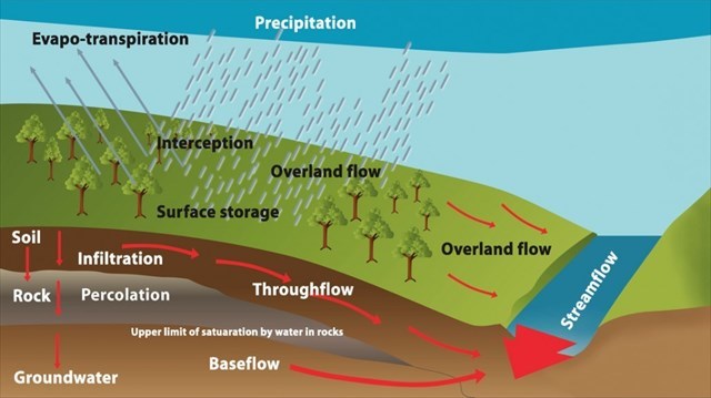
1. Percipitation
Sleet, Snow, Rain, or Hail falling in a certain area. Can be responsible for waterlevels growing or shrinking due to water being moved to different locations.
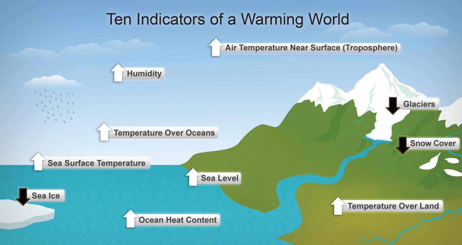
2. Climate Change
Climate change can cause waterlevels to rise or drop, the atmosphere is heating up and becoming warmer due to Greenhouse gasses and emissions being polluted, can cause lower or higher water levels depending on the region, due to the new heating, or cooling of an area.
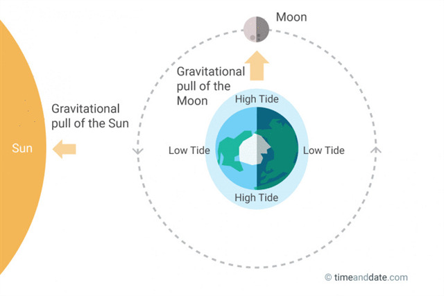
3. Tide
Occouring in Oceans, such as; the Atlantic or the Pacific Oceans. Tide changes due to the gravitational pull of the moon, and will grow in certain areas, and shrink near the shore
Why Are Reduced Waterlevels Bad For An Ecosystem?
Reduced waterlevels are not healthy for an ecosystem, because it alters the way the ecosystem functions. The lower levels put the fish and animals that thrive in the ecosystem at risk, reduced levels could mean altering conditions for the animals, that could possibly result in death from the changes that occour. The reduced levels also affect vegetation in a negative effect, it cuts off the water supply to the plants, which can result in plant death, if the waterlevels do not rise back, the vegetation will die off.
Why Is Increased Waterlevels Bad For An Ecosystem?
Increased waterlevels, create erosion on the shoreline and can possible damage the ecosystem as well. Increased waterlevels could mean anything increasing from a foot, to a flood. Waterlevels increasing can damage plant life in an area, and also cause damage on an animal perspective as well, because it can ruin dens or habitats near the bank and also make hunting for food in the water more difficult, due to increased current rates.
What Is Erosion?
Erosion is the process of being eroded by wind, water, or other natural factors. Erosion can occour quickly to an area, and can also take place over a period of time.
Why Do Water Levels Change In Latchford
Latchford's water levels change for a variety of reasons. The river in Latchford is known as the Montreal River, which borders Ontario and Quebec. The Montreal River then connects to the Ottawa River, which after an amount of time connects to the Saint Lawrence River. This location is very unique and important in geological means. The water contains part saltwater due to the connection to the Atlantic Ocean. This locations water levels fluctuate significantly throughout the day. The elevation at this location is higher than at other locations nearby, and sometimes can result in lower water levels than elsewhere due to effort the water requires to reach the location. Some interesting facts about the location is that sometimes tide can affect this area, because of the connection to the Atlantic Ocean. Also sometimes just like other areas fluctuating water levels in the area can sometimes be caused by elevation and natural occurrences such as; precipitation. Although tide does not affect the area too often, when it does occur it is a very neat phenomenon. Also, the Montreal River in this location connects to Bay Lake which partially contains Salt Water due to the connection to the Atlantic Ocean through the Saint Lawrence River.
Questions:
Q1. Is the Waterlevel low or high?
Q2. What would you estimate the waters depth is?
Q3. Can you view any forms of erosion happening nearby that would suggest waterlevels changing?
Q4. Could wind be eroding those spots as well, or do you believe water is the sole reason?
Q5. Do you see much vegitation near the water, why or why not?
Q6. Look closely, can you see any tree roots, would that suggest waterlevels changing?
Optional: Upload a photo of your experience
Latchford @ Low Levels: