What Is A Glacier?
Glaciers are a slowly moving mass or river of ice formed by the accumulation and compaction of snow on mountains or near the poles.
What Glacier Created The Kawartha Lakes?
The Kawartha Lakes area was created by the Wisconsin Glaciation Period that ended about 10,000 years ago. This Glaciation Period also created the area of Wisconsin.
What Are Finger Lakes?
Finger Lakes are a series of elongated lakes that dip down or upwards in a finger shape.
Where Are The Finger Lakes?
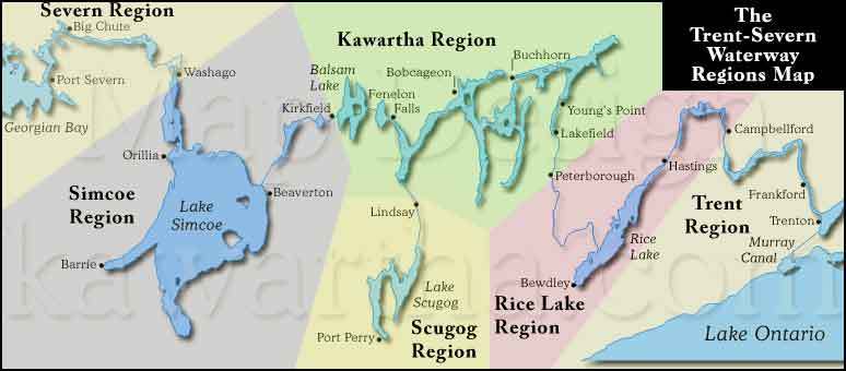
This includes Canal Lake, Mitchell Lake, Balsam Lake, Cameron Lake, Sturgeon Lake, Pigeon Lake, Chemong Lake, Buckhorn Lake, Lower Buckhorn Lake, Stoney Lake, and White Lake, some people even consider Lake Simcoe a finger lake.
Questions:
Q1. What finger lake do you believe is the biggest in size in the Kawartha Lakes region?
Q2. How long (roughly) do you believe the stretch of finger lakes is?
Q3. What is the elevation from ground zero? How may this suggest this area was created by the Glaciation Period?
Q4. Are there any signs in the nearby land or lakes that would suggest erosion or proof of glaciation, such as (Hills, Drumlins, or features in the lakes)
Q5. Would you expect a different elevation reading at each of the following lakes; (Stoney Lake, Balsam Lake, and Buckhorn Lake) Why do you think that?
Optional: Feel free to upload photos from your experience at the finger lakes