GLENCAR - EARTHCACHE
Listed coordinates - N 54° 20.320 W 008° 22.165 = Parking area
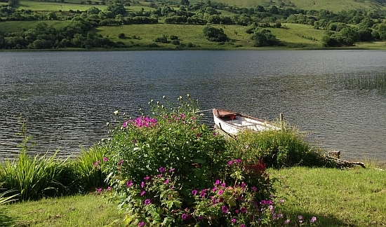
What a beautiful lake ...
But let's have a closer look
Glencar
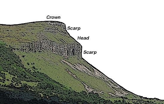
Towards the end of the last ice age Glencar was filled with a valley glacier whose ice flowed westward.
The erosive action of the glacier eroded the rock and produced steep slopes on its margins.
When the ice melted, the steep slopes lost the support given by the ice and in places huge rock
masses broke away and slipped into the valley floor.
This action causes the formation of landslips and in Glencar led to the formation of the Swiss Valley.
The base of the landslips were within the Benbulbin shale, a soft rock that occurs beneath
the Glencar limestone.
Today large crevices which have an east-west orientation can be found just north of the cliff edges
which mark the backs of the landslips.
This is a magnificent example of a glacial U-shaped valley with a ribbon lake.
Example for a rotational landslip :
Glencar Lough / Glencar Lake
The Glencar Lough covers an area of about 1.15 square kilometres.
It is 2500 m long from west to east and 600 m wide.
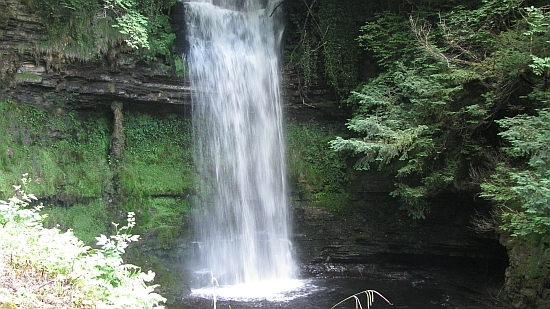
Glencar Lough is primarily fed by Glencar Waterfall, on the lake's northern shore,
and by the Diffreen River, entering at the lake's eastern end.
To log your find, please send me a Mail with the answers to the following questions.
There is no information board, you have to answer the questions by your own observation.
1. When was the last ice age ?
Go to the waypoint "Lake" at N 54° 20.420 W 008° 22.390 ,
and take a look along the lake shore to the west.
2. Imagine how this valley was formed, and try to describe the slopes with your own words.
3. Tell me the angle of the steepest scarp you can see.
Go to the waypoint "Waterfall" at N 54° 20.421 W 008° 22.082
4. Try to estimate the height of the waterfall ,
and try to estimate the diameter of the plunge pool.
Photos are welcome but optional
You can log your find after sending me a Mail with your answers.
You don‘t have to wait for my reply, I will contact you if something is wrong.
Logs without any answers will be deleted.