Achtung! Attention! Uwaga! Hoj!
Dieser Cache darf nur bis zu einem Maximalpegel von 410cm am Pegel Maxau angegangen werden.
Alle Logs die bei höherem Pegel erfolgen dürfen - wenn überhaupt - als "write note" geloggt werden, da die Einhaltung des angegebenen Maximalpegels eine Logbedingung darstellt. (gerade darin besteht je der Witz der Aufgabenstellung)
Kurzanleitung:
obligatorisch:
Geht diesen Cache nur bis zu einem Pegelstand von höchstens 410cm am Pegel Maxau an
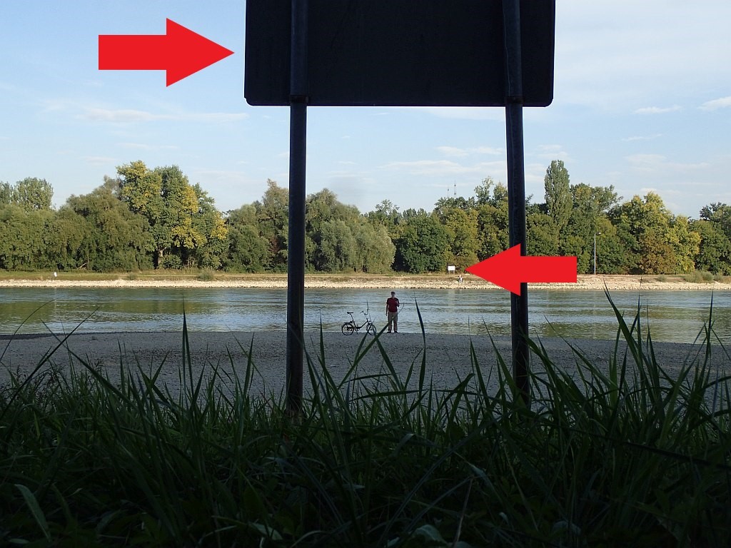
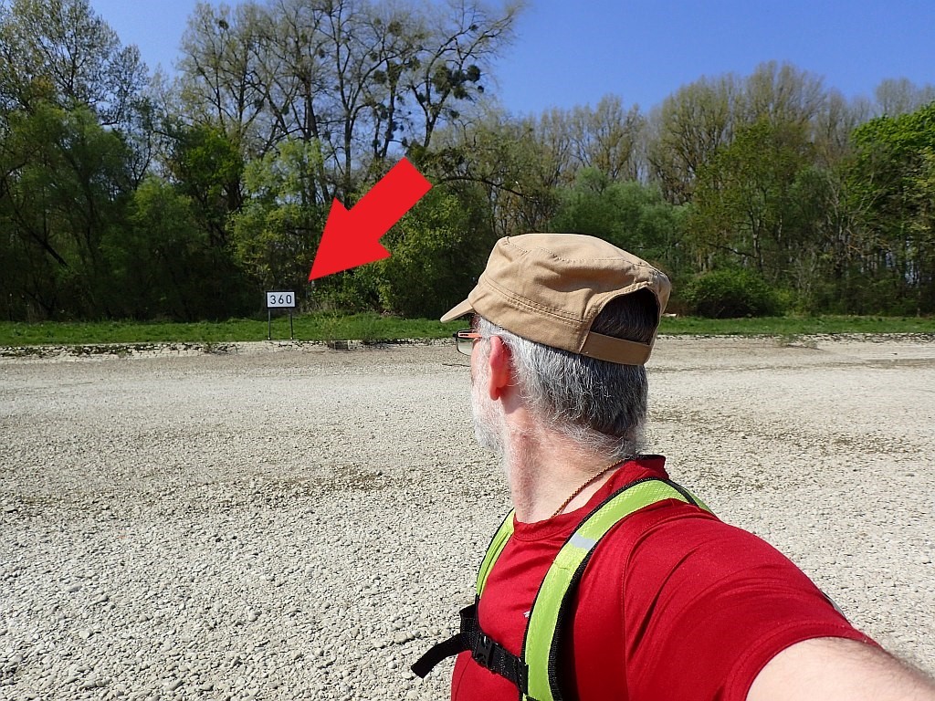
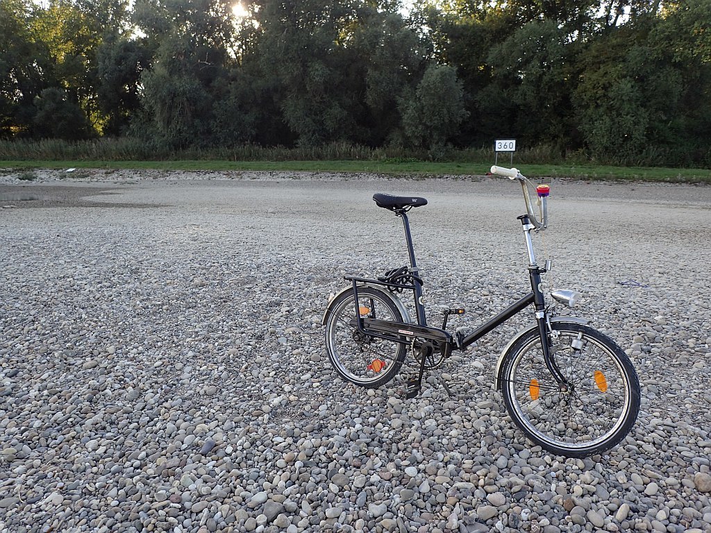
Macht vor Ort ein Foto welches euch auf der trockenen Kiesbank zeigt, eines oder beide der Kilometerschilder muß dabei mit auf dem Foto sein
Schreibt in euren Logeintrag den aktuellen Pegel zum Zeitpunkt eures Besuchs.
optional:
Macht von Station 1 aus ein Foto der Pegeluhr auf der anderen Rheinseite
Siehe auch die write note vom 22.11.2020
Edit 28. November 2021
Die Parkplatzangabe am Goldgrund wurde entfernt, da die Zufahrt wohl permanent gesperrt wurde.
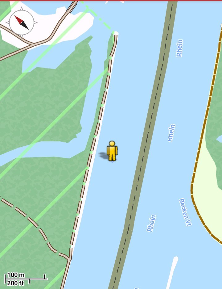
Ergänzt wurde eine Parkplatzangabe direkt am Rhein (P1, Parkplatz Frohnau), dieser ist erreichbar über die Zufahrt des Kieswerks bei Neuburg. Der Zuweg ist offiziell befahrbar aber recht schmal und teilweise unübersichtlich!
Von dort aus sind es gut 2,5km (eine Richtung) bis zum Cache, der Weg führt immer direkt am Rheinufer entlang.
Achtung: Dieser Cache ist nur bis zu einem Pegelstand von 410cm am Pegel Maxau machbar!
Die Wegstrecke von und zum Parkplatz beträgt ca. 5km
Der Weg führt durch das Naturschutzgebiet Goldgrund. Innerhalb des Naturschutzgebietes müssen die offiziellen Wege nicht verlassen werden.
An dieser Stelle des Rheins ragt bei Niedrigwasser eine Kiesbank aus dem Flussbett.
Eure Aufgabe:
Geht zu den angegebenen Koordinaten und macht ein Foto welches eure Anwesenheit auf der Kiesbank im Flussbett dokumentiert.
Es muß ein oder beide Stromkilometerschilder darauf zu sehen sein.
Euer Gesicht muß auf dem Bild selbstverständlich nicht erkennbar sein.
Schreibt in euer Log den Pegelstand zum Zeitpunkt eures Besuchs.
Gerne dürft ihr auch weitere Bilder und Screenshots einstellen.
Wer möchte darf zusätzlich noch folgende Aufgabe erfüllen:
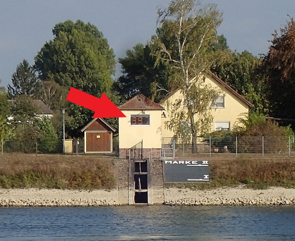
Begebt euch zur Station 1. Von dort kann man die Pegelanzeige auf der anderen Rheinseite gut erkennen. Macht hier ein Foto wie im Beispiel gezeigt.
Noch einmal zur Erinnerung: Dieser Cache ist nur bei einem Pegelstand von weniger als 410cm am Pegel Maxau machbar!
Logs, die bei erkennbar höherem Pegel gemacht wurden, werden gelöscht!
Hier geht es zum aktuellen Pegelstand: Link--> Pegel Maxau
English version
Edit 28 November 2021
The car park at Goldgrund has been removed, as the access road seems to be permanently closed.
A car park directly on the Rhine (P1, Frohnau car park) has been added, which can be reached via the access road to the gravel works near Neuburg. The access road is officially passable but quite narrow and sometimes confusing!
From there it is a good 2.5 km (one direction) to the cache, the path always leads directly along the banks of the Rhine.
Edit 09 August 2023:
Attention: This cache is only accessible up to a water level of 410cm at Maxau gauge!
Attention: The maximum water level to log a "found it" is 410cm precisely! Any logs taken at a higher water level may only be logged as "write note".
The distance from and to the car park is about 5km
The trail leads through the Goldgrund nature reserve. Inside the nature reserve it is not necessary to leave the official paths.
At this point of the Rhine, a gravel bank protrudes from the river bed at low tide.
Your task:
Go to the given coordinates and take a photo which documents your presence on the gravel bank in the river bed.
One or both river kilometre signs must be visible on it.
Your face needs not to be visible on the picture.
Give in your log the water level at the time of your visit.
You are also welcome to post more pictures and screenshots.
Optional task:
Go to station 1, from where you can see the water gauge indicator on the other side of the Rhine. Take a photo here as shown in the example.
Edit 09 August 2023
Once again as a reminder: This cache is only feasible with a water level of less than 410cm at the Maxau gauge!
Logs that were made at a noticeably higher level will be deleted!
Once again: "found it" logs are only and solely accepted at water levels less or equal to 410cm! Logs that were made at higher levels can only qualify for "write note" logs.
Click here for the current water level: Link--> Pegel Maxau
Virtual Rewards 2.0 - 2019/2020
This Virtual Cache is part of a limited release of Virtuals created between June 4, 2019 and December 31, 2020. Only 4,000 cache owners were given the opportunity to hide a Virtual Cache. Learn more about Virtual Rewards 2.0 on the Geocaching Blog.