THE THREE STAGES OF THIS VIRTUAL CACHE ARE SITED ON OPEN MOUNTAINSIDE WITH VERY LITTLE SHELTER FROM THE ELEMENTS. PREPARATION FOR A MOUNTAIN HILLWALK AND THE WEATHER IS PARAMOUNT.
I DO NOT ADVISE ATTEMPTING THIS VIRTUAL WHEN SAWEL IS BLANKETED IN SNOW AS THE GULLY WILL MOST LIKELY BE FULL OF DRIFTED SNOW!!
This Virtual Cache will have you at the top of Sawel Mountain and exploring the gully from whence this mountain derives its name, Samhail Phite Méabha - I'll let you find out what that means! Ahem.
I have listed three car parking places as Additional Waypoints and would advise to park respectfully and securely. The most popular walk route up Sawel starts just down the road from the 'Suggested Parking' coordinates (the Trailhead is listed as an Additional Waypoint), and directly follows the County March westward. An average ascent time to the summit Trig Pillar is and one hour and twenty-five minutes (1hr 25mins.)
Sawel Mountain, (Samhail Phite Méabha), is the highest mountain in the Sperrins. It tops out at 2224 feet, or at 678m. Its summit is marked with a Trig Pillar, or for the pedants - an OSNI Triangulation Station. This Trig Pillar was mounted upon an earlier summit marker circa 1950.
The Catchment Area of the northern side of Sawel drains into the Faughan River (An Fhochaine) and in turn that river empties into Lough Foyle. The Catchment Area of the southern side of Sawel also drains into Lough Foyle.
The gully you will be exploring drains into the Oughtnamwella Burn which makes it way to Lough Foyle via the Glenelly (Gleann Eallaigh), the Owenkillew (Abhainn Choilleadh), the Strule (Abhainn na Sruthaile), the Mourne (An Mughdhorn) and Foyle (An Feabhal) rivers.
There are three tasks to complete in order to log and claim a Find on this Virtual Cache.....
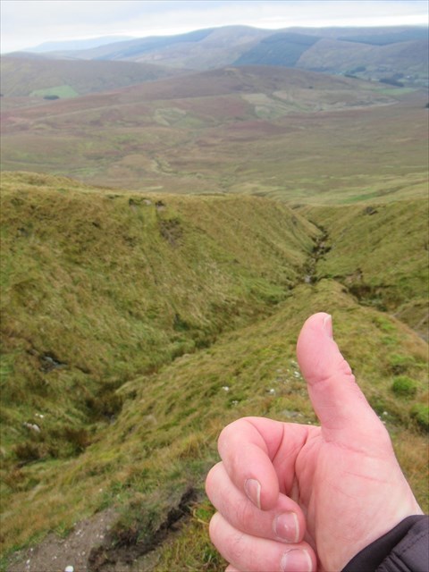
1. At the listed coordinates capture a photograph of yourself OR your thumbs-up photo to also include the spur and the horizon of Carnanelly and Goles Forest, see example.
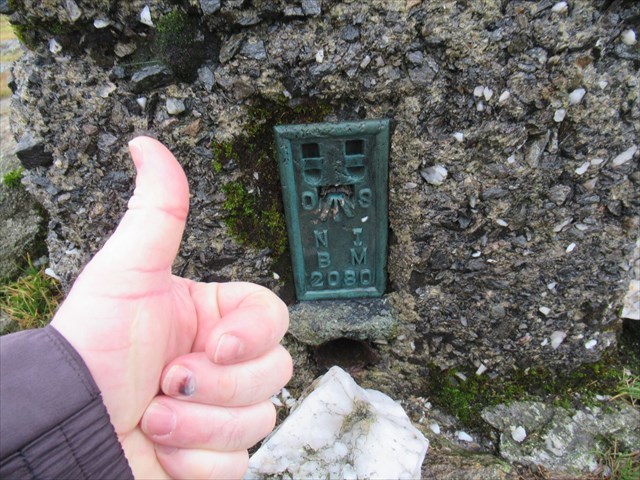
2. At Virtual Stage 2 capture a photograph of yourself OR your thumbs-up photo capturing the Trig Pillar's Flush Bracket, see example.
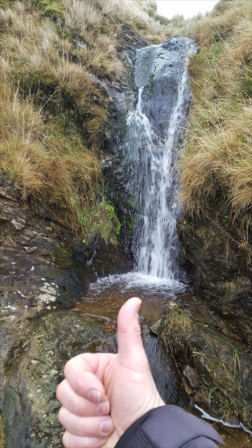
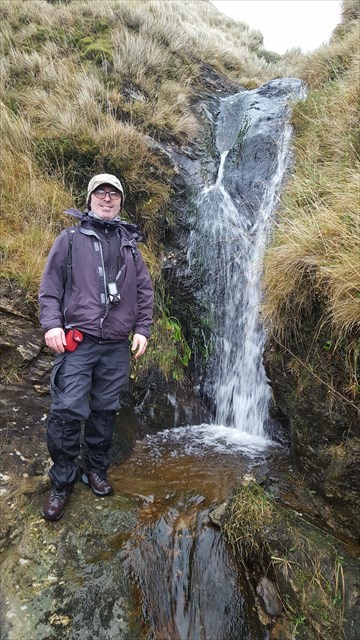
3. At Virtual Stage 3 capture a photograph of yourself OR your thumbs-up photo capturing the waterfall, see example.
The advised route is to make for the Trig Point (Stage 2) from the Suggested Parking, then head for the Listed Coordinates (Stage 1) and then from there to the Waterfall (Stage 3) You can return to the car by following the gully and stream down and using the Additional Waypoint for the Parking at the Sheep Pen...or plan your own route AND HAVE FUN!
ONLY THOSE LOGS WITH THE THREE PHOTOGRAPHIC REQUIREMENTS MET AND ATTACHED WILL BE ALLOWED TO LOG A FIND.
There is no need to email me. I will check each log and if the pictures are missing, I will contact you to remind you to attach them. If they are still not uploaded after the reminder, I will delete the log....and you wouldn't want that after climbing the highest mountain in The Sperrins! Have the tools you need with you all charged up....GPSr, camera, or phone to ensure that you meet the requirements of the photo logging.
Virtual Rewards 2.0 - 2019/2020
This Virtual Cache is part of a limited release of Virtuals created between June 4, 2019 and June 4, 2021. Only 4,000 cache owners were given the opportunity to hide a Virtual Cache. Learn more about Virtual Rewards 2.0 on the Geocaching Blog.