Harwoods Hole
Is a cave system located in the northwest of the South Island of New Zealand. It is one of several important cave systems in Takaka Hill, between Golden Bay and Tasman Bay. Starting at the surface as a 50-metre round entrance and descending 183 metres, Harwood Hole is New Zealand's deepest vertical shaft. A water-enlarged (but now dry) sinkhole, further in it connects with Starlight Cave then drops to an underground river that emerges below and flows into Gorge Creek and then into the Takaka River. The long rope descent is considered one of the most spectacular parts of the caving experience at Harwood's. Harwood's Hole has an overall depth of 357 m.
Henry Harwood (1844–1927), with John Horton and Thomas Manson (my great great grand uncle), opened up the Canaan Downs area and discovered Harwoods Hole, though it was not immediately entered. It remained untouched until cavers winched down in 1958. Upon completion of exploration in 1959, Harwoods Hole became the deepest explored cave in New Zealand, a record that stood for many years.
Getting There
From State Highway 60, near the top of the Takaka Hill, follow an unsealed 11 km side road to Canaan Carpark where there is a campsite, toilet, water and orientation sign.
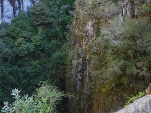
From Canaan Carpark, a 45 minute walking track leads through beech forest with stunning limestone rock formations framing the track. At a junction in the track, the right-hand branch leads to spectacular Gorge Creek Lookout with stunning views of the Takaka Valley and Gorge Creek. The left-hand branch stops near the shaft of Harwoods Hole.
It is very dangerous to approach the edge of the hole. There are no barriers. It is not possible to see down the shaft. Do not throw anything into the shaft as there may be cavers below.
The descent into Harwoods Hole and exit via Starlight Cave is a serious undertaking. It should only be attempted by experienced cavers with correct equipment. All party members must be proficient at single rope techniques and be equipped to ascend the rope if required. Those with rock climbing experience only, should not attempt this descent. If in doubt, do not attempt it.
Care is also required reaching the lookout as the track traverses very sharp limestone rock formations and high cliffs. Please keep an eye on geokids.
Logging Requirements
To log this virtual cache you need to answer the 2 questions below and send your answers to me either via email or message, DO NOT post the answers in your online log. And also post a photo with your log taken either near the posted coordinates or at Waypoint 3 (Gorge Creek Lookout).
NOTE: I DO NOT expect you to go near the edge or clamber over rocks if you do not feel comfortable at either location to claim this find
Question 1 At Waypoint 1 is the track junction to Gorge Creek Lookout or Harwoods Hole. There is a DOC sign here displaying the times and distances to both viewpoints, on the back of the sign is a identifying number screwed onto one of the posts, send me that number
Question 2 At Waypoint 2 there is a plaque showing "A Cross Section of what is Under Your Feet". The stream that now never reaches Harwoods Hole sinks underground how far from here and resurges 500 m below here in the bottom of Gorge Creek?
Photo Either at Harwoods Hole or at Waypoint 3 Gorge Creek Lookout. This photo must include something that shows that you are visiting the site as a geocacher eg your gps, a trackable, a piece of paper with your caching name etc.
You don't need to wait for confirmation of your answers before posting your log, but logs where the answers haven't been received or that don't include a photo may be deleted.
Don't forget to find the historic Cavernous GC1C4A cache while you are here.
Virtual Rewards 2.0 - 2019/2020
This Virtual Cache is part of a limited release of Virtuals created between June 4, 2019 and June 4, 2020. Only 4,000 cache owners were given the opportunity to hide a Virtual Cache. Learn more about Virtual Rewards 2.0 on the Geocaching Blog.