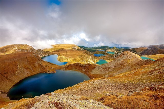
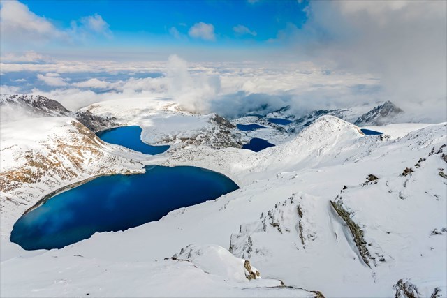
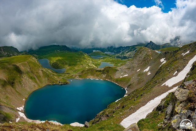
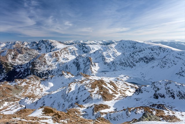
The famous Seven Rila Lakes are a group of glacial lakes, situated in the northwestern Rila. They are the most visited group of lakes in Bulgaria. The lakes are situated between 2 100 and 2 500 meters elevation above sea level.
Each lake carries a name associated with its most characteristic feature. The highest one is called Salzata ("The Tear") due to its clear waters that allow visibility in depth. The next one in height carries the name Okoto ("The Eye") after its almost perfectly oval form. Okoto is the deepest cirque lake in Bulgaria, with a depth of 37.5 m. Babreka ("The Kidney") is the lake with the steepest shores of the entire group. Bliznaka ("The Twin") is the largest one by area. Trilistnika ("The Trefoil") has an irregular shape and low shores. The shallowest lake is Ribnoto Ezero ("The Fish Lake") and the lowest one is Dolnoto Ezero ("The Lower Lake"), where the waters that flow out of the other lakes are gathered to form the Dzherman River.
The Urdini Lakes are not as popular with the tourists as the Seven Rila Lakes further west, because they are situated in the most difficultly accessible areas of the mountain range. The Urdini lakes are located in the western section of the homonymous cirque between the summits of Damga (2 670 m) to the northwest and Dodov peak (2 661 m) to the south. They consist of six lakes: Suhoto (Dry), Ribnoto (Fish), Triagalnoto (Triangle), Botanicheskoto (Botanical), Golyamata Panitsa and Malkata Panitsa. The lakes are drained by the river Urdina, a right tributary of the Cherni Iskar, which is considered the main stem of Bulgaria's longest river that runs entirely within the country, the Iskar.
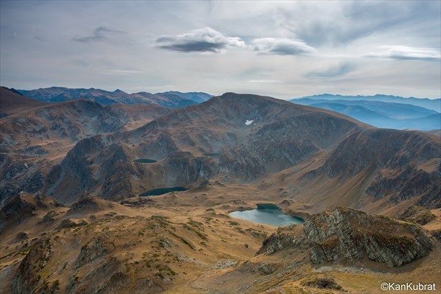
The individual lakes have a relatively small size, between 0.8 and 2.5 hectares. At smallest one is Ribnoto Lake (at an altitude of 2 348 m), which due to its proximity to the summit of Damga, at about 500 m to the southeast of the peak, is also called Damgsko Lake. Although this lake is the smallest in size, it has the largest catchment area in the group. The largest lake in both size and volume is Golyamata Panitsa Lake with an area of 2.5 hectares and volume of 89 500 m³. With an altitude of 2 278 m, it is the lowest in the lake group. The second largest is Triagalnoto Lake Triangle with an area of 2.34 hectares. The highest lake is Suhoto Lake, located not far from Dodov peak at an altitude of 2 375 m. It has a circular shape and reaches 5 m in depth. The deepest lake at 7.6 m is Malkata Panitsa (2 336 m), situated to the east of the Ribnoto. Its outflow forms a small waterfall before it pours into Golyamata Panitsa Lake and then into the Urdina River.
Your task:
- Visit the area of the Seven Rila Lakes or Urdini Lakes.
- Share some photos and impressions of the area in your log.
Swimming in the lakes of Rila National Park is absolutely forbidden!
It is highly recommended to use BGMountains or other map for additional orientation.

Virtual Rewards 2.0 - 2019/2020
This Virtual Cache is part of a limited release of Virtuals created between June 4, 2019 and June 4, 2020. Only 4 000 cache owners were given the opportunity to hide a Virtual Cache. Learn more about Virtual Rewards 2.0 on the Geocaching Blog.