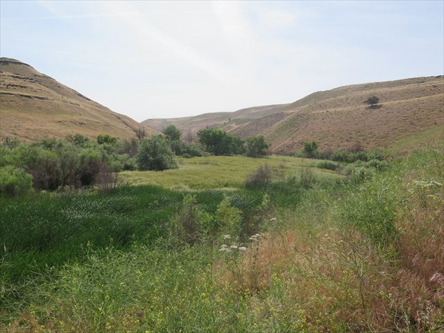
Juniper Canyon was created by lava floods, water erosion and Aeolian (wind driven) loess. Lava floods flowed from 100 mile long fissures between 6 and 16 million years ago. The lava layers stacked one upon another and some up to one hundred feet thick. Tectonic pressure from the Yakima anticline (upward lifted) folded the area into the Horse Heaven Hills plateau. Next came the great Missoula flood, 13-15,000 years ago, and with the draining of Lake Lewis, carved out the canyon that continues to be eroded as seasonal drainage from the Horse Heaven Hills. Many canyons in the area were created in the same manner, but this canyon is unique.
Juniper Canyon is a special place because it was carved out east to west which is against the prevailing winds in the Pacific Northwest which blow southwest to northeast. This orientation creates a trap, dead zone or wind shadow on the south bank of the canyon. Winds from the southwest picked up fine flour rock particles, silt, and other light minerals called loess and moved the material up and over the plateau. Over time, some the Aeolian loess drops, collects and was not blown away. I think of the fall leaves stacking up on the northeast side of my house where the wind is unable to blow them away.
The south bank of the canyon was first settled by Aeolian basalt sands over the basalt lava floods. These sands are not silica but basalt. The basalt sands were covered by volcanic ash and finally the top layer was covered by silt, dirt, and soil. In between some of these layers is debris material from the Missoula flood and other volcanic eruptions.
Over time from erosion of top soil, the Aeolian basalt sands are exposed in parabolic shaped blowouts. Some of these blowouts are small, some are large and in other places whole dunes have been exposed.
Parking: Park at the pullout, 17 miles south of Wallua, on US 730.
Trail-head: Juniper Canyon.
After going through the entrance, note the path that travels above the quarry. You may want to use this path for the final. To start, travel straight through at the base of the quarry. Neither trail is well defined.
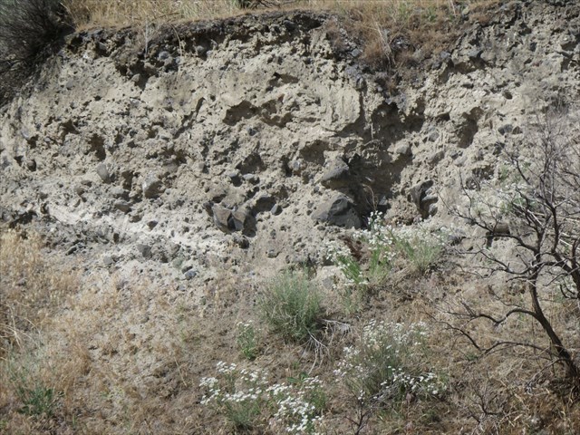
Waypoint 1: Layered Strata
At this waypoint, look south and up the wall of the quarry and observe the sediment layers from top to bottom: top soil, loess (which includes silt, ash, dirt, sand), flood layer of mixed rock, loess (which includes silt, ash, dirt, sand), Basalt, lava layer, Cobblestone basalt.
Waypoint 2: Thick white Mazama Ash Layer at the top of the quarry.
At this waypoint, look south and up to the top of the quarry wall. Observe the thick white layer of ash from Mount Mazama (Crater Lake, Oregon) laid down 5 to 7,000 years ago.
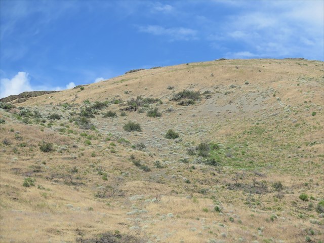
Waypoint 3: Aeolian Sand Dune Steps
At this waypoint, look southeast around the mound and upwards to view the Aeolian Sand Dunes steps now covered by Loess.
Final: Depending on your stamina, chose either the Upper Aeolian Sand Dune blowout or the Lower Aeolian Sand Dune blowout to visit.To get to the final, the cacher has two options, 1. Climb the steep loose gravel basalt trail up the ridge of the mound at waypoint 3 to the top of the quarry or travel back to the trail-head and take the gradual incline across the rim of the quarry to the final. At the final or optional final, you will be at the base of an Aeolian Sand Dune blowout. Season water helps interlock and settle the basalt ash in place.
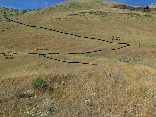
Waypoint 4: Traverse the old boundary fence. At this point, you may choose to go the upper blowout or the lower blowout by following the lower step or the higher step.
Optional Waypoint 5: Optional lower Aeolian Sand Dune blowout
Optional Waypoint 6: Large Aeolian Sand Dune blowout
Before attempting optional waypoint 6, please prepare for the extended hike.
1. Review Google Earth of Juniper Canyon to familiarize yourself with the terrain and cross county hiking. The trail is unmaintained and has virtually disappeared and besides, the best way to access waypoint 6 is going high and not via the canyon floor.
2. Dress appropriately with hiking shoes, long pants, hiking stick, bug repellent and water for the extended 2 mile round trip hike. Foxtail is abundant and will drive its way through socks, shoes and clothes. There may be a possible rattlesnake in the area because of the abundance of small game and water. Before leaving the trail-head, spray clothes with tick repellent as a precaution. Always bring enough water for the round trip adventure for there is no shade.
3. This extended hike will travel across McNary National Wildlife Refuge and onto Bureau of Land Management lands. Caution: Traveling further east than Waypoint 6 will put the hiker on private property.
To log this Earthcache, please send a private message to me with answers to the following questions.
1. At Waypoint 1: Layered Strata
Describe the thickness of the flood layer jumbled rocks between the two layers of loss and the size of basalt rocks in the layer.
2. At Waypoint 2: Mazama Ash Layer
Estimate the thickness of the ash layer at the quarry rim.
3. At Waypoint 3: Aeolian Sand Dune Steps
Compare the north canyon wall verses the south canyon and any differences in erosion patterns.
4. At the final: Aeolian Sand Dune Blowout
Report the results of an experiment. Place some basalt sand in the palm of your hand, clean out any debris and add a drop or two of water. Does the basalt sand clump?
Optional: Upload a photo to the page of any local wildlife, unique vegetation or geology in the area.
This earthcache was created in conjunction with and the permission of the McNary National Wildlife Refuge.
U.S. Fish and Wildlife Service
64 Maple Street
Burbank, Washington 99323
If you would like to learn more about Juniper Canyon and its geology read:
Juniper Canyon, Wallula Gap: An “Oasis in the Desert” by Marin Axtell, Chelsea Cordell, Heidi Dobson, Bob Carson and Mike Denny, 2015
Topographic and climatic influences on accelerated loess accumulation since the last glacial maximum in the Palouse, Pacific Northwest, USA by Mark R. Sweeneya,T, Alan J. Busaccaa,b, David R. Gaylorda 2005