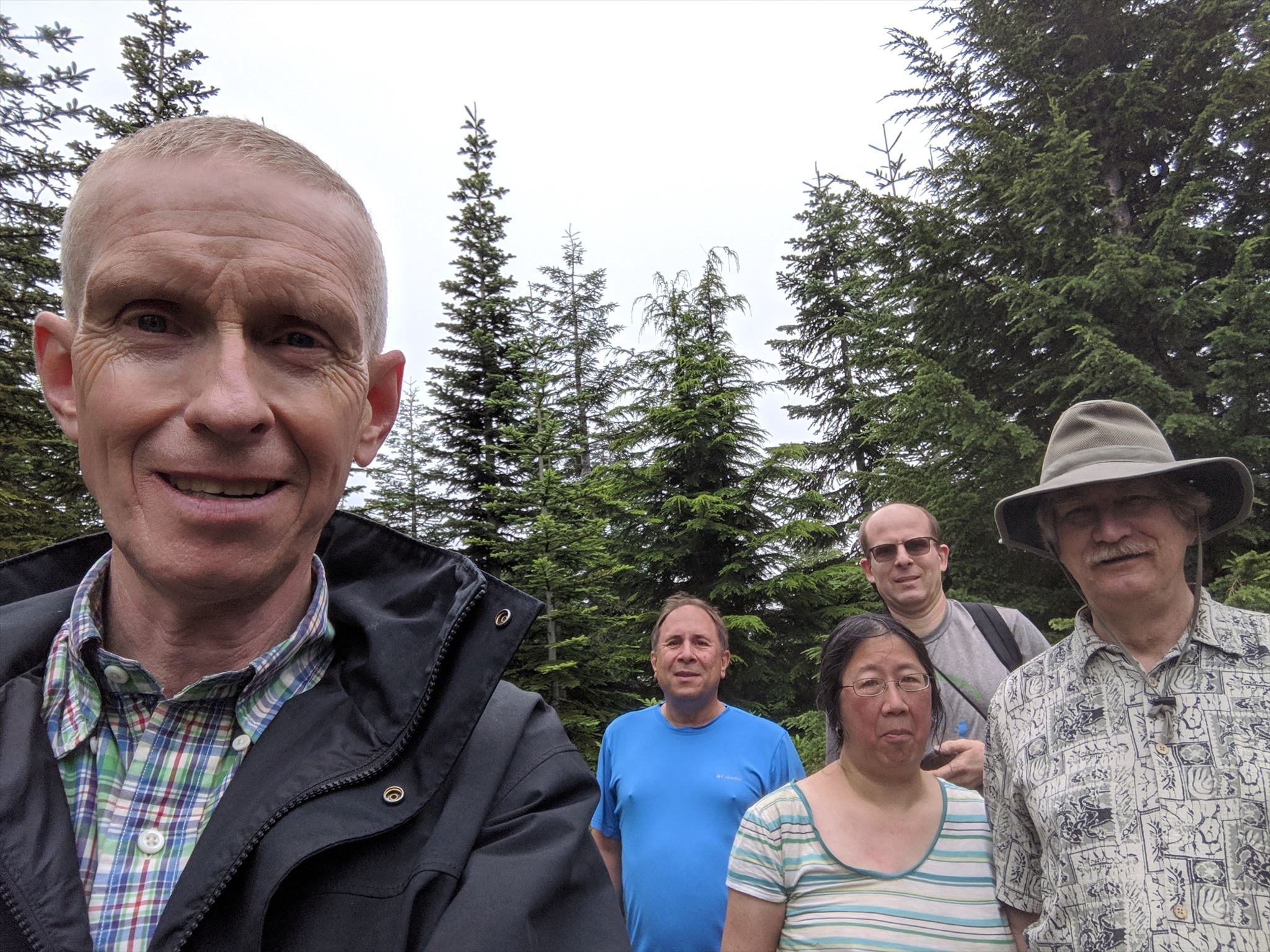
Wildcat Mountain Flash Mob Crowd
Wildcat Mountain is located in the Salmon-Huckleberry Wilderness that is part of the National Wilderness Preservation System.
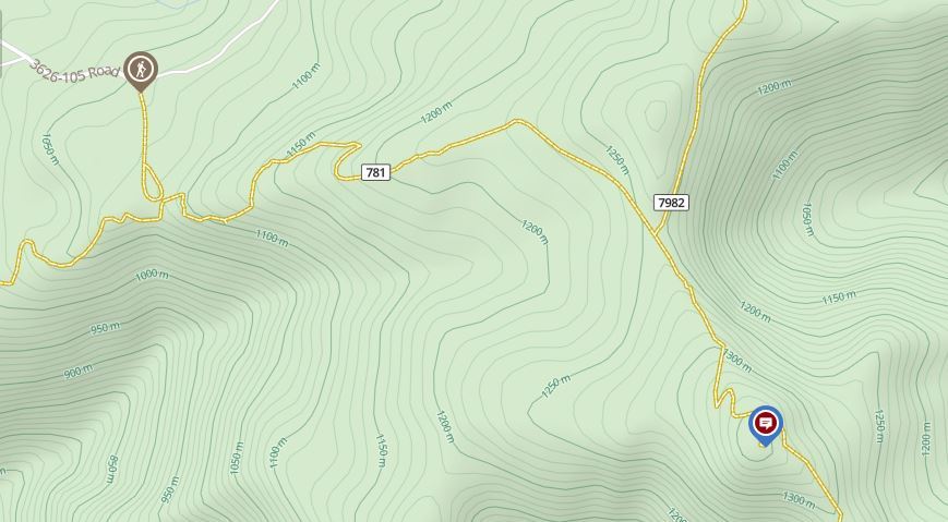
Wildcat Mountain Flash Mob takes place at the summit of Wildcat Mountain. Travel to the summit is along a well defined trail with sections of loose rock, exposed tree roots, and fairly steep terrain. Check out the hiking / route options described below to reach the Event site.
Trip Logistics
Length: 3.5 mi RT
Elevation Change: 1 050' gain
Season: Late Spring thru Fall
Difficulty: Easy to moderate range as there is a well defined trail.
Wildcat Mountain Trail Terrain Map
Event Parking: Park at: N 45° 18.596' W 122° 4.509
Event Description: When: Saturday, July 27th, 2019 - 1:00 p.m. through 1:30 p.m. at the Wildcat Mountain Summit.
1. We suggest leaving the trail head to reach the Wildcat Mountain Summit between 10:00 and 11:30 a.m. to be on time for the event and to find the caches along the trail on the way up. Please pace yourself for this unique Event by leaving early and taking as many rest breaks as you require.
2. Wildcat Mountain Flash Mob at the Wildcat Mountain Summit will begin at 1:00 p.m. and will last until 1:30 p.m.
3. A group photo will be taken at 1:25 p.m. at the Wildcat Mountain Summit.
4. At 1:30 p.m. we will clean up the site and head back down to the trail head. Be sure to stay with the group on the way down to enjoy the photo opportunities and caching stories from the trail!
Further details (activities) will be added in the next couple of weeks - maybe we could fly a few kites! Perhaps the most important activity will be the chance to chat with your caching buddies at this elevated location. Come on out and enjoy the fun!
Mt. Hood National Forest Wilderness Regulations:
Wilderness permits:
A wilderness permit is required to enter a wilderness in Mt. Hood National Forest from May 15 through October 15. You must have a copy of the completed permit in your possession during your visit to wilderness. Permits are free and self-issued at trail heads and wilderness boundaries. These permits help the Forest Service keep tally of how many visitors come to each wilderness every year.
Extra copies of the Wilderness Permits will be available for those attending the Flash Mob at the Trail Head.
Wildcat Mountain Trip Report:
There are two basic and common ways to hike to the top of Wildcat Mountain. One is to follow McIntyre Ridge Hike 62 from the East Wildcat Mountain Road trail head off US 26 for approximately 5.25 miles, and the other is from Wildcat Mountain Drive trail head off Hwy 224 between Eagle Creek and Estacada. This description illustrates the shorter hike.
The hike begins in what appears to be an old rock quarry, and I didn't see any signs or indications that I was in the right place. But there is an obvious trail, so I followed it and behold, it was the correct choice. Be aware that a very short distance away is a shooting range, so you are likely to hike to the tune of rifle, pistol, and small cannon fire as you try to enjoy the extraordinary beauty of this hike.
The trail begins in a young dense forested area, but within a quarter mile it breaks out onto an open cliffy area, and you have great views to the southeast toward Old Baldy, Tumala Mountain, and Wildcat Mountain itself. This view area is brief, and soon you will spend most of the next mile in dense new forest. The trail doesn't climb very steeply, but steadily. At about a mile you will come to the junction of the trail from McIntyre Ridge, which is the other popular route to Wildcat Mountain. Just keep straight ahead, as the trail now becomes noticeably steeper.
The trail offers a couple of options as you climb up the north side of Wildcat. I always choose any option that takes me to the left (north), because from this route you get exhilarating views of the Cascade Mountains, including Mt. St. Helens, Mt. Rainier, Mt. Adams, and nearby Mt. Hood.
There once was a fire lookout on top of Wildcat Mountain, but since its removal, the trees on top have grown considerably. Therefore there isn't a good view in any direction from the actual top of the mountain. So, when you get there, just walk across the top and through the trees to the south side of the peak, and you will be treated to great views, including Mt. Jefferson.
Directions to the Trail Head from Sandy OR: (Courtesy of ORNITH)
1. Start from Sandy, Oregon @ N 45 23.788 W 122 15.553 (Quite close to a great place for donuts and coffee!!).
2. Continue East on Highway 26 and turn right at SE 427th Avenue [N 45 22.707 W 122 13.556], it comes up pretty quickly after a right bend on Hwy 26.
3. Go South until right turn to SE Firwood Rd @ N 45 22.052 W 122 13.471.
4. Go Left at N 45 21.193 W 122 14.237.
5. Left on to Wildcat Mountain Drive at N 45 20.310 W 122 14.092.
6. Continue on Wildcat until it becomes Forest Road 3626 and head for GC15V8K (“Gateway to GC12 & GC17’ coordinates are N 45 18.659 W 122 04.581).
7. Turn right off 3626 just past this Cache and Park at about N 45 18.596 W 122 04.509.
DIRECTIONS TO GC17 from Parking:
Carrying and using a walking stick is recommended -- especially in that portion of the Quarry that was decommissioned and a couple of other places along the trail.
1. After you pass GC15V8K and make your right turn and to where you Park for hiking to GC12, continue on that same paved road to N 45 18.221 W 122 03.961 where you will find a newly created trail that gets you through the area that used to be a road that was also “decommissioned” by the Forest Service.
2. Hike up the trail and when you reach the ‘mine field’ that was the Quarry, head up and across it to N 45 18.047 W 122 03.908.
3. Where you will find the trail that heads toward an Archived Cache that used to be a landmark on the way to GC17 “Hynotoad Cache” @ N 45 18.157 W 122 03.123 Hypnotoad is a large, decaying stump on the left side of the trail. Keep going on this trail until you can see a Forest Service Bulletin Board up ahead (this part of the hike is a little bit of a letdown as your GPSr will tell you that you are moving away from GC17).
4. When you can see the bulletin board (it usually has 4 or 5 sheets of notices on it) WATCH for a trail that goes off to the left -- N 45 17.982 W 122 02.760. The trail is BEFORE you get to the Bulletin Board. TAKE IT!! You are now on the way to GC17, finally!
Thanks to ORNITH for the detailed route description to the Trail Head and GC17.