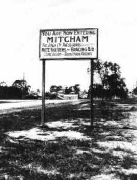
“You are now entering Mitcham the apex of the suburbs. Note the views and bracing air. Come again - bring your friends.”
This cache was nominated in the 2019 Victorian Cache of the Year Awards (Best 'Other' Cache).
Estimated time to complete: 20 min
Estimated distance to travel: 600m
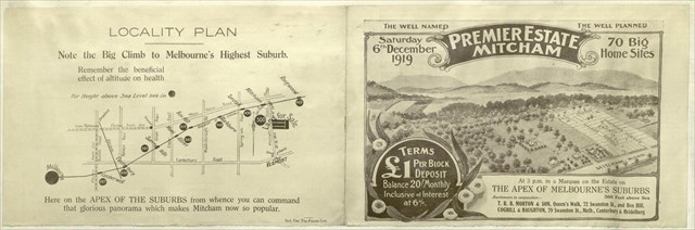
“Note the Big Climb to Melbourne's Highest Suburb. Remember the beneficial effect of altitude on health.”
Interestingly, prior to being named Mitcham this area had been known as Air Hill. Back in the day, estate agents loved to highlight the suburb’s position as the highest station on the rail line; however, mountain views and "salubrity unsurpassed in Victoria" did not attract many suburban settlers prior to the Second World War.
Ref: Whitehorse Historical Society
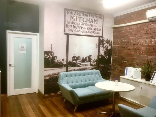
Real Estate agents still highlight Mitcham's altitude today
(RJ Hooker, cnr Mitcham & Whitehorse Roads)
Antonio Park
The listed coordinates will bring you to a park named after the Antonio family. The site of their original weekend shack is now part of the Antonio Park Primary School grounds. In the early 1900s the family bought what is now the main body of the park and built a permanent home in Deep Creek Road. Remnants of the garden and well are still present in the formal part of the park. Paths through the bush reserve also lead you to Schwerkolt Cottage (15 minutes) and Yarran Dheran (45 minutes).
The park is a valuable corridor for many bird species, allowing them to link up with the Yarran Dheran reserve, the Mullum Mullum Creek and beyond. Commonly sighted birds include: Grey Kookaburras, Grey Butcherbirds, White-plumed Currawongs, Silvereye Honeyeaters, Rainbow Lorikeets and Fan-Tailed Cuckoos. Infrequently seen species include: Tawny Frogmouths, Brown Goshawks, Spotted Pardalotes, Golden Whistlers and Boobook Owls.
4.5 Terrain Rating
This Letterbox hybrid cache is a tree climb which I’ve given a terrain rating of 4.5, reflecting a demanding free climb over potentially hazardous terrain. It may not be for everyone! Although climbable without specialised equipment, a ladder will get you there if you’re not quite ready to climb unaided.
***APRIL 2021 UPDATE*** The sister tree that has assisted with the climb is dead and may not last much longer. However, I can confirm that the ascent is still possible as a free-climb using the main tree alone.
Calculating Coordinates & Combination
At the listed coordinates you will find a brass plaque outlining the history of the park. You will need to gather the following information:
1AF8 - Year the Antonio family settled on this site
B - Number of letters in Mrs Antonio’s first name
E - Number of letters in the first name of the son who bequeathed the property to the Nunawading City Council in 1953
C - The last digit of the third line
D - Number of times Peter Antonio is mentioned
Checksum = A + B + C + D + E + F = 27
From this information you will need to construct two sets of coordinates and the final lock combination. Please navigate to the waypoints in order, thus avoiding bushbashing through the reserve.
1. S37 48.ABC E145 12.BDA
Navigating to this first waypoint will take you along a gravel path to a junction with a much older track.
2. S37 48.ABE E145 12.BEF
This second set of coordinates will then take you from the junction, along the older track strewn with fallen branches, to GZ.
3. ABCD
Final lock combination
***CONGRATULATIONS to jascat on the FTF***
“Gone but not forgotten”
In memory of other caches that were once also here:
GC8VQRB Where‘s Wally?
July 1, 2020 - July 11, 2022
GC19P2A Take a Break
February 25, 2008 - June 9, 2017