This small tube container is located on the 3,450m summit of Mount Joffre. Perched atop the Continental Divide, Joffre is the highest mountain in all of Kananaskis. Expect a significantly challenging mountaineering adventure covering a round trip distance of 40 kilometers with 2,000 meters of elevation gain. The easiest route follows up the North Face, which is a snow or alpine ice climb that can be ascended in both the summer and the winter. This geocache is an extreme challenge which requires mandatory glacier travel, mountaineering experience and all associated equipment.
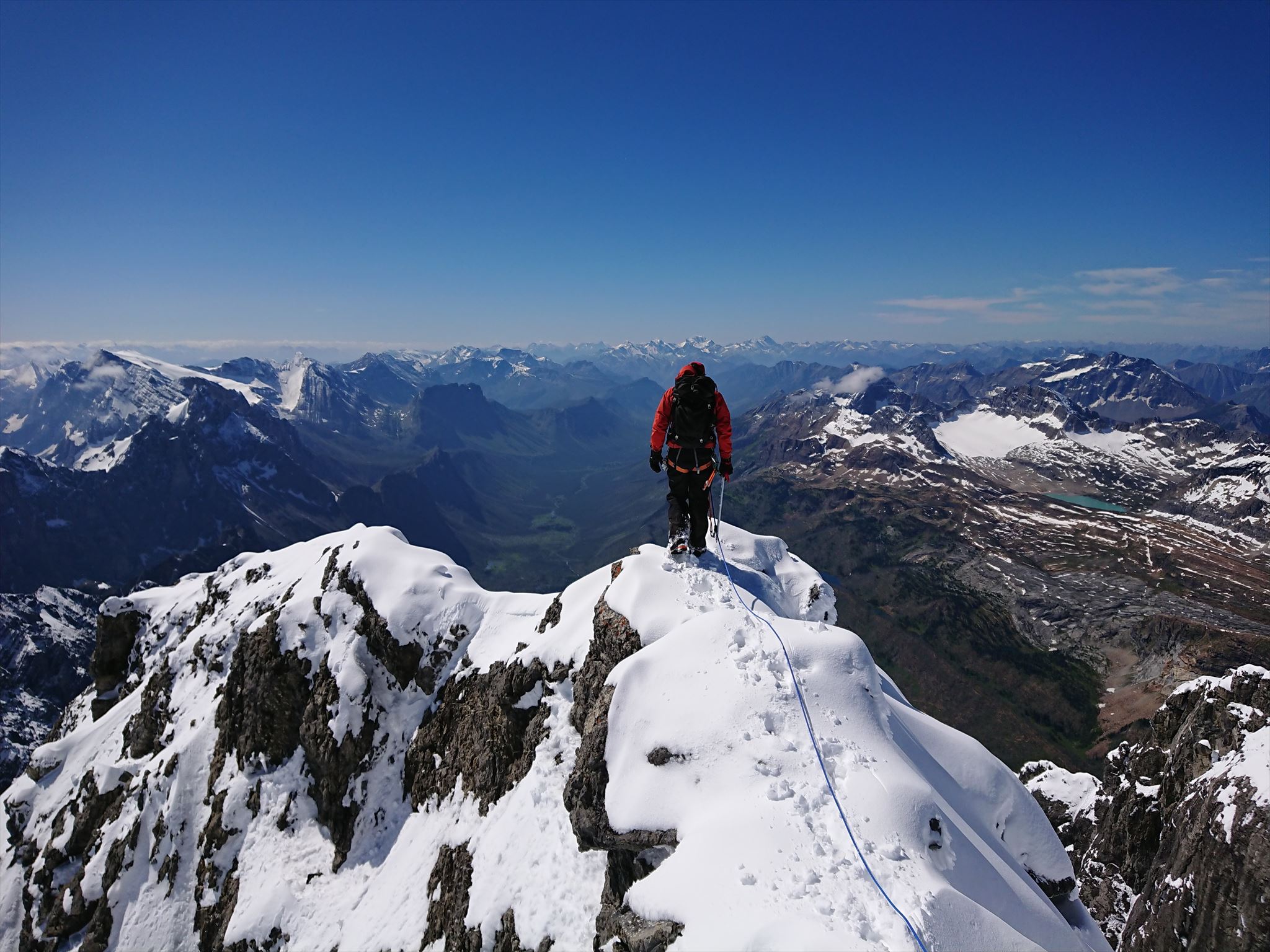
Brendan714 on the Summit of Mount Joffre:
About the Mountain
The North Face of Mount Joffre in Late Summer:
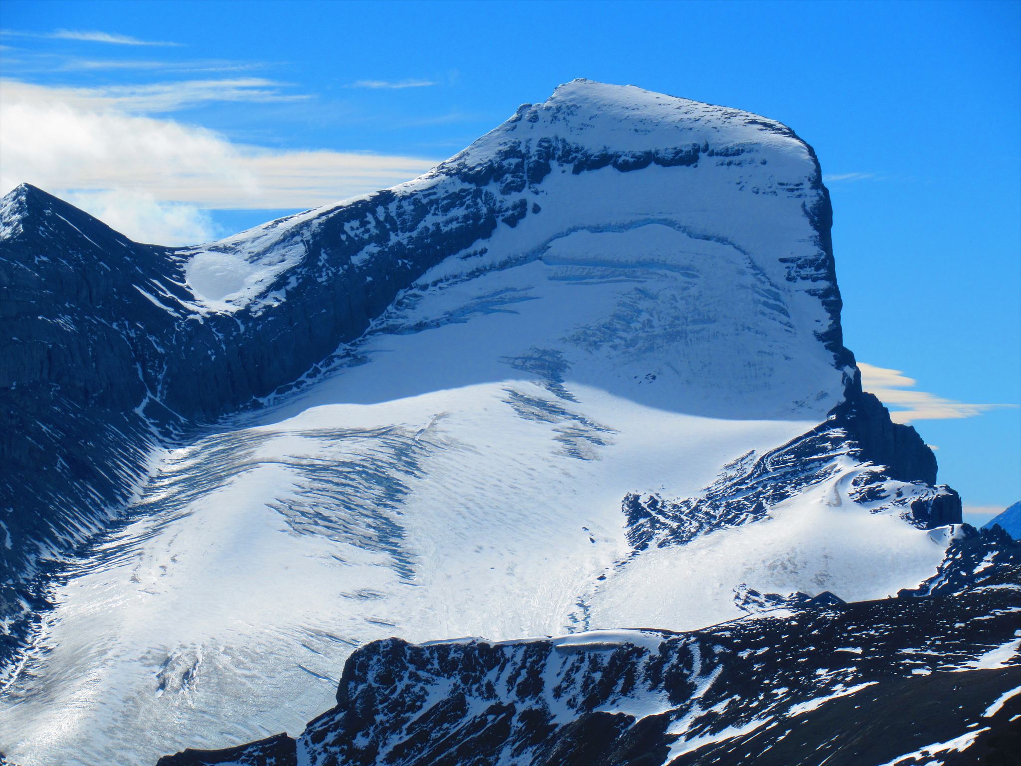
Mount Joffre is the highest peak in all of Kananaskis Country, and is also the highest between the US border and Mount Assiniboine. Tucked into the southwest corner of Peter Lougheed Provincial Park and perched on the Continental Divide, Joffre and its shining, glaciated North Face is infrequently seen, except from nearby high vantage points. Joffre’s North Face is a fantastic moderate route of up to 40 degrees on snow and/or ice. If the face is not in shape, the Northeast Ridge offers an alternative route, on snow and rock, of comparable difficulty. For a nice loop, you can go up one route and down the other. While Joffre can be climbed in one very long day, car to car, the approach and Aster Lake environs are sufficiently lovely to warrant a more leisurely two or three day trip.
Season: March-April on skis, July-September on foot.
Trip Time: 2-3 days total, 8-10 hours return from Aster Lake
First Ascent: August 18, 1919: Joseph Hickson, Edward Feuz, Jr.
First Winter Ascent: March 1970: E. Grassman, J. Jones and A. Simpson
Naming Note: The Alberta/B.C. Boundary Commission named the peak for Joseph Jacques Joffre, commander in chief of the French army at the outset of World War I.
The Approach & Routes
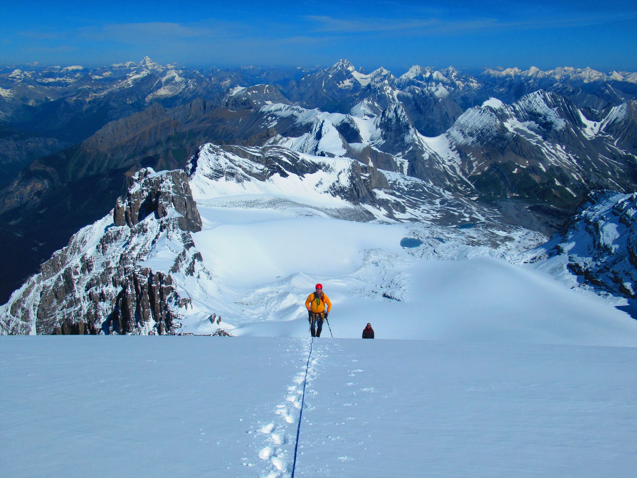
Coming up the North Face:
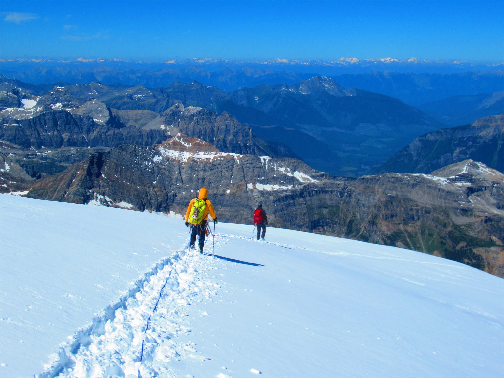
Approach: From the Trans-Canada Highway 60 km west of Calgary, drive 50 km south on Highway 40, turn right and follow the Kananaskis Trail for another 13.5 km to the Upper Lake day-use parking lot. The trailhead is at the far end of the parking lot. From the parking lot, follow the trail along the south side of Upper Kananaskis Lake for 5 km. Shortly after the trail turns north at the end of the lake, take a subsidiary path left, which leads through heavy forest to Hidden Lake in less than 1 km. If you’re in luck, the water will be sufficiently low to enable walking along the left-hand shoreline and thus avoiding the unpleasant trail in the trees. Follow a rough trail up through the talus as it works its way diagonally across steep slopes and up through a rock band to gain the top of the headwall well to the east of Fossil Falls, the prominent waterfall down the headwall. Above the falls, follow a well-trodden trail to Aster Lake, which has a backcountry campsite with bear-proof food containers (camp sites must be booked in advance). From the south end of Aster Lake, follow gravel flats west and then south around the end of Mount Marlborough’s Northwest Ridge. Turn left around the ridge and proceed up the gravel flats before turning right and angling up the moraine. At the top of the moraine is an established primitive bivy site (bivy approval required). The toe of the Mangin Glacier lies only a few minutes beyond the bivy site. From the glacier toe there are two route options: a) North Face; b) Northeast Ridge.
The North Face: Follow the low-angled, lightly-crevassed glacier to the base of the North Face. Cross the berg-schrund and switchback up the right side of the face, to the right of a narrow cliff band, on snow or ice up to 35-40 degrees. At the top of the face, follow the West Ridge to the summit, the last section involving a short, exposed scramble on rock.
The Northeast Ridge: Follow the low-angled, lightly-crevassed glacier to just before the North Face, traverse left and go up a narrow and sometimes icy gully that splits a rock wall (some risk of rockfall). Beyond, gentler snow slopes lead to a col to the right of a subsidiary summit on the Northeast Ridge. Follow the ridge to the true summit over snow and some rock.
Descent: Descend down either route and retrace your steps back to the parking lot.
Safety Blurb
The terrain to reach Mount Joffre is very technically challenging, requiring a significant approach, glacier travel over a crevassed icefield, snow, alpine ice and/or rock climbing, travel through avalanche terrain, likely an overnight stay, etc - all at high elevations deep in the backcountry. Do not underestimate the challenge of this summit. You must be trained in and have experience with glacier travel, crevasse rescue, snow climbing, ice climbing and backcountry travel. You must also come prepared with all the required mountaineering equipment and at least one similarly skilled and equipped partner. Do not travel on glaciers by yourself and/or without crevasse rescue gear and skills. If you do not come prepared and you fall in a crevasse, you will die. If you are not 100% confident in your skills or abilities, hire a mountain guide.
Note: Without the hint and spoiler photos, this geocache will be nearly impossible to find. Bring copies or have access to the spoiler photos to aid in your search.
If you are an experienced mountaineer, Mount Joffre is a fantastic scenic peak that must be on your list. Joffre is a suitable objective for novice mountaineers who have all the necessary skills and equipment to travel on glaciated terrain. I can promise that it will be an adventure you won't soon forget. Have fun & stay safe!