Notice: "Cache seekers assume all risks and responsibilities involved in seeking this earthcache."
Warning: This is an agricultural area where many long-haul trucks full of wheat, corn, onions, potatoes, carrots, sugar beets and other commodities are busy going down the road. Most of us locals are accustomed to these trucks. If you don’t feel safe or comfortable stopping alongside the road or in a pullout to observe the geology, “Don’t Stop”. Don’t let earthcaching control you, but rather you control earthcaching. “Just because it is there, doesn’t mean you have to stop!”
“For your safety, even though the shoulder may be wide enough to stop and make observations, please park in the designated parking pullout and walk to the final. The road does get busy at times. If you feel uncomfortable with the suggested parking location, find a wider spot down the road and walk back.”
Wallula Fault Zone and Fracture
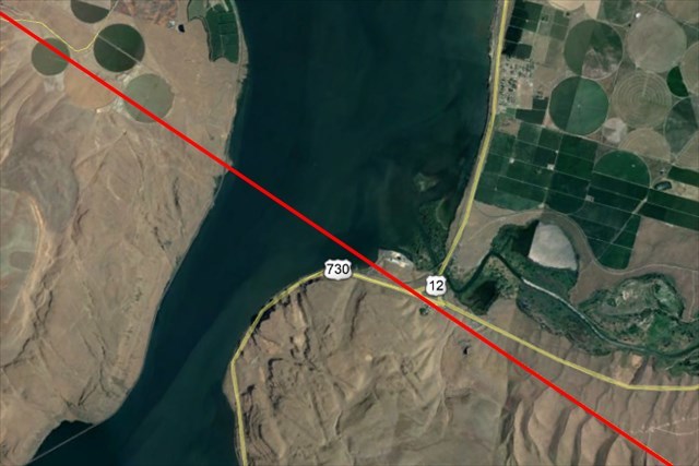
Approximate location of Wallula Fault Zone using Google Earth
In 1945 Erwin Raisz, a cartographer, noticed on the Pacific Northwest portion of continental United States relief map that if a line were to be drawn from Cape Flattery, Washington to the Wallowa Mountains, Oregon, there were more basins on the northeast side of the line than on the southwest side. The line was named Olympic-Wallowa Lineament (OWL). He postulated whether there may be an underlining geological structure that created the lineament. The OWL has probably been active during the whole Cenozoic Era. The lineament has been studied and analyzed for evidence of connecting structure. Geologists have found faults zones and anticlines (upward thrust mountains and hills) that coincide with the lineament but have yet come to fully understand the OWL structure and origin. One of these alignments is the Wallula Fault Zone which crosses the Columbia River at Wallula Gap.
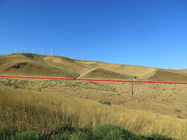
Red line indicates location of Wallula Fault Zone
There are many fault zones and folds throughout central and southeast Washington within the Yakima Fold and Thrust Belt and the eastern portion of the OWL. The Wallula Fault Zone is just one of these features. The zone stretches 100 km from Kennewick, Washington to Milton-Freewater, Oregon. The fault is a northwest striking slip. This means the underlining basalt is moving horizontally and in line with the fault. The striking slip movement from the fault occurred 15,000 years ago. The fault is currently under stress with almost no movement.
Visual evidence of surface disturbance resulting from the fault may be observed several miles east on US12 from Wallula junction.
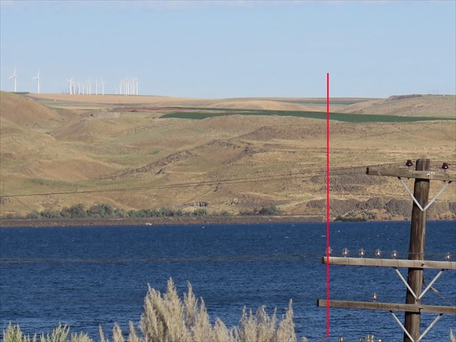
Wallula Fault continues west across Columbia River (Lake Wallula). The Red line indicates approximate location of the fault zone.
Much of the fault is non-observable from surface deformation. The fault has been located through aeromagnetic, ground magnetic surveys, quarrying and surface trenching. Just below where the red line intersects the horizon is a valley where geologist studied the fault in the Finely Quarry. It just off Meals Road. In addition, to the left of the red line is an eroded valley where the Yellepit fault lies.
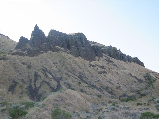
Weathered basalt northeast of trail to summit
There have been dozens of earthquakes related to the Wallula fault in the past hundred years.
In 1936, a 5.0-6.0 earthquake hit Walla Walla, Washington and Milton-Freewater, Oregon with 54 aftershocks. Milton-Freewater has recorded over 60 quakes since 1991 and Athena, Oregon with a 3.7 quake in 2015.
The resulting earthquakes from the Wallula fault has produced fractures in the exposed basalt. The basalt was laid down 15 million years ago and is part of the Frenchman Springs member of the Wamapum basalt. Over the last 15 thousand years, with the occurrence of the Missoula flood and erosion, the basalt is observable southwest of the fault in the Wallula Gap on US730.
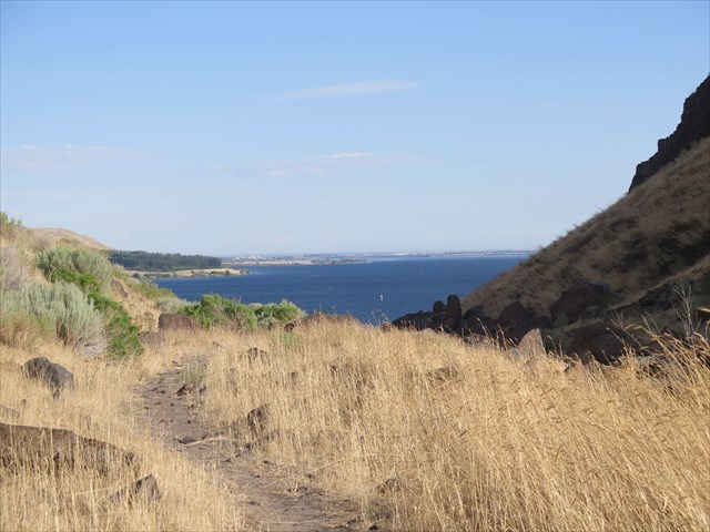
Looking northwest over Lake Wallula from Earthcache Final Stage
Before you leave, enjoy the view of Lake Wallula and try to locate trapped boulders in the basalt fractures “…probably transported and trapped in place during an ice age flood.” As indicated by Bruce Bjornstad in his book: On the trail of the Ice Age Flood: A geological field guide to the Mid-Columbia Basin, page 124.
To log this Earthcache, please send a private message to me with answers to the following questions.
1. At waypoint 1, you will observe three triangular shaped escarpments in a line created by the fault. When were these escarpment created and what additional factors created their triangular shape?
2. At waypoint 2, look west across the Columbia River (Lake Wallula) to where the Wallula fault continues northwest to Finley, Washington. Are there any visual or observable indication of surface deformation resulting from the fault?
3. At the Final waypoint, look at the northeast wall of the canyon, you will observe two parallel fractures in the basalt. What is the distance between the two cracks and what observation may be made that these fractures were created from an earthquake, tectonics or weathering?
Optional: Upload a photo to the page of local wildlife, unique vegetation or basalt formations in the area.
If you would like to learn more about Wallula fault and its geology read:
Local Geology by Bob Carson
Bruce Bjornstad On the trail of the Ice Age Flood: A geological field guide to the Mid-Columbia Basin
Carson, R.J., and K.R. Pogue, 1996, Flood basalts and glacier floods: Roadside geology of parts of Walla Walla, Franklin, and Columbia Counties, Washington: Washington Division of Geology and Earth Resources Information Circular 90, 47 p.
Carson, R.J., ed., 2008, Where the great river bends: A natural and human history of the Columbia at Wallula: Sandpoint, Idaho, Keokee Books, 220 p.