FRANÇAIS
Un « pog », est l'interprétation libre, par Napoléon Peyrat, d'une forme ariégeoise du mot occitan « puèg / puòg », du latin « pŏdĭum », signifiant « éminence », puech à Nîmes, voire puy ailleurs en France, pour désigner la montagne en forme de pain de sucre de Montségur. Cette version est désormais communément admise, mais exclusivement au bénéfice de Montségur.
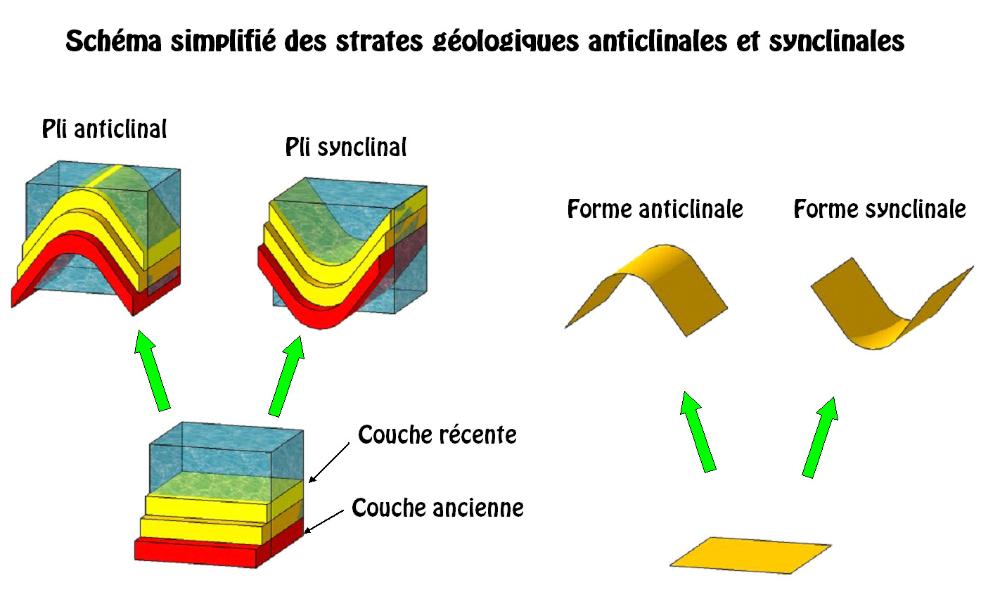
Le pog de Montségur culmine à 1207m d’altitude. Au cours des glaciations du Quaternaire, ce pog barrait la vallée au glacier du Lasset, qui venait encore buter contre lui il y a 60 000 ans. Les roches de ce pog sont formées de calcaire dont les sédiments se sont accumulés au cours des ères secondaires et tertiaires. Ils ont été plissés à la suite de la collision entre les plaques tectoniques environnantes. Ces plis ont formé une succession de synclinaux et anticlinaux.
En géologie, un synclinal est un pli dont la concavité est tournée vers le haut, l'anticlinal ayant, lui, la concavité vers le bas. Dans des conditions normales, les couches les plus jeunes étant les couches supérieures, on trouve, après érosion, les strates géologiques les plus récentes dans le cœur du synclinal. Ce critère permet de mettre en évidence la succession de synclinaux et anticlinaux sur une carte géologique. Il existe des anticlinaux et synclinaux à différentes échelles d'observations, depuis les microplis, affectant un échantillon, jusqu'aux plis régionaux, visibles uniquement en cartographie.


Pour valider votre découverte, vous devez répondre aux questions suivantes :
- Le pog de Montségur est il positionné sur un synclinal ou un anticlinal ?
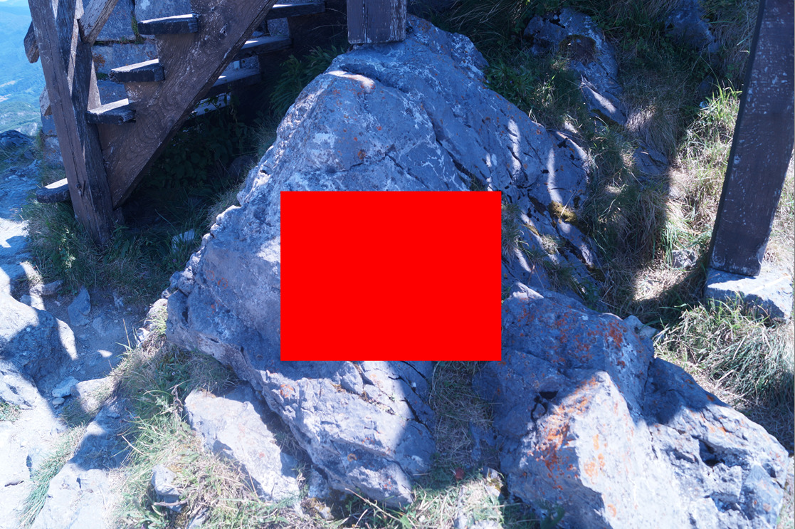
- Etudier attentivement le bloc de rocher situé au waypoint 1(voir photo ci-dessous), décrivez votre observation en précisant son aspect détaillé (rugosité, aspérité, uniformité, couleur(s) ?
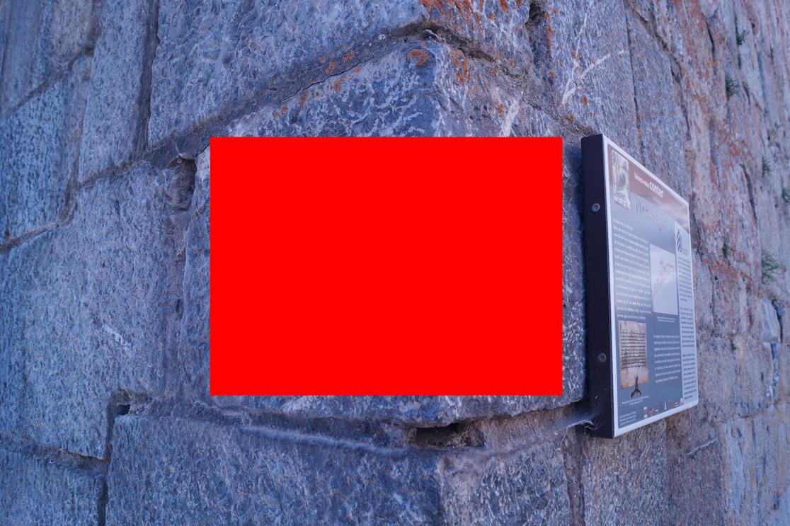
- Etudier attentivement la pierre de taille située à l’entrée nord est waypoint 2 (voir photo ci-dessous), décrivez votre observation en précisant son aspect détaillé (rugosité, aspérité, uniformité, couleur(s) ?
- D’après vos deux observations, pouvez-vous dire si ces deux blocs ont une même origine géologique ?
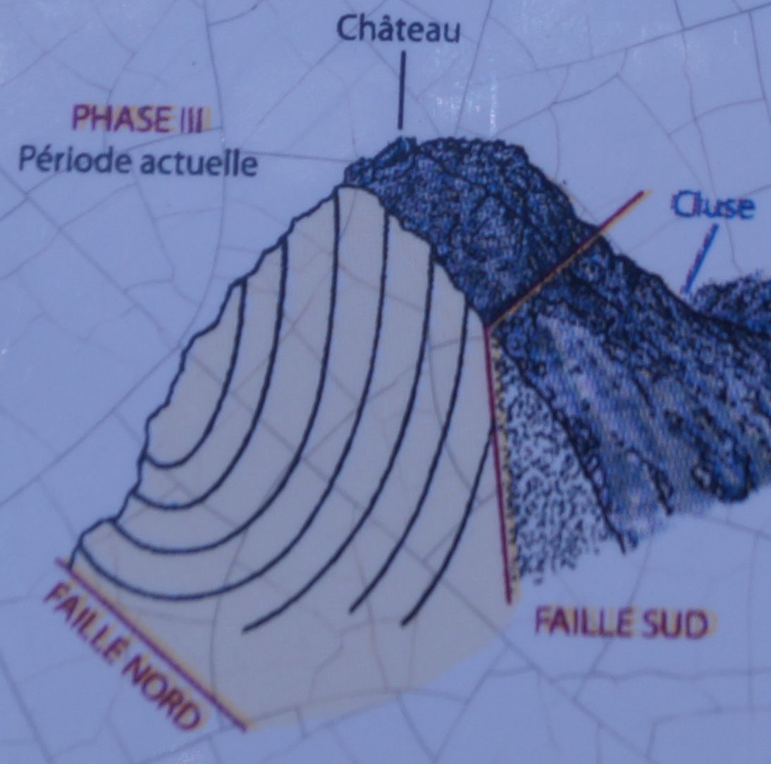
- Optionnel : une photo de vous ou votre GPS aux coordonnées de la cache avec le château en arrière-plan n’est pas obligatoire mais sera fortement appréciée
Vous pouvez vous loguer sans attendre notre confirmation, mais vous devez nous envoyer les réponses en même temps soit par mail via notre profil, soit via la messagerie geocaching.com (Message Center). S'il y a des problèmes avec vos réponses nous vous en ferons part. Les logs enregistrés sans réponses seront supprimés.
ENGLISH
A "pog" is the free interpretation, by Napoleon Peyrat, of an Ariège form of the occitan word "puèg / puòg", of the Latin "pŏdĭum", meaning "eminence", puech in Nîmes, even puy elsewhere in France, to designate the mountain shaped sugar loaf of Montségur. This version is now commonly accepted, but exclusively for the benefit of Montségur.
The pog of Montségur culminates at 1207m of altitude. During the Quaternary glaciations, this pog barred the valley to the Lasset glacier, which had come up against it 60,000 years ago. The rocks of this pog are formed of limestone whose sediments have accumulated during the secondary and tertiary eras. They were wrinkled as a result of the collision between the surrounding tectonic plates. These folds formed a succession of synclines and anticlines.
In geology, a syncline is a fold whose concavity is turned upwards, the anticline having concavity downwards. Under normal conditions, the youngest layers being the upper layers, one finds, after erosion, the most recent geological strata in the heart of the syncline. This criterion makes it possible to highlight the succession of synclines and anticlines on a geological map. There are anticlines and synclines at different scales of observations, from microplots, affecting a sample, to regional folds, visible only in cartography.
To validate your discovery, you must answer the following questions:
- Is the pog of Montségur positioned on a syncline or an anticline?
- Study carefully the block of rock located at waypoint 1 (see picture below), describe your observation by specifying its detailed aspect (roughness, roughness, uniformity, color (s)?
- Carefully study the cut stone located at the north entrance waypoint 2 (see photo below), describe your observation by specifying its detailed appearance (roughness, roughness, uniformity, color (s)?
- According to your two observations, can you say if these two blocks have the same geological origin?
- Optional: a photo of you or your GPS in the coordinates of the cache with the castle in the background is not mandatory but will be highly appreciated
You can log in without waiting for our confirmation, but you must send us the answers at the same time either by mail via our profile, or via geocaching.com (Message Center). If there are any problems with your answers we will let you know. Saved logs without answers will be deleted.
Sources documentaires : Wikipedia