Carnac Point is at the tip of a breakwater separating River Ness from Beauty Firth. It has splendid views in all directions. There are several benches where you can enjoy a picnic after your stroll here.
Archaeology Notes
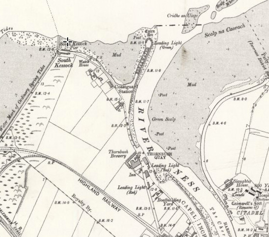
(NH 6597 4726) Cairn Arc (OE)
OS 6" map, (1938)
"Cairn Arc... This name is applied to an ancient cairn of stones situated near the end of the Breakwater at the mouth of the Ness. In it a post is set to warn approaching vessels to the danger and hence its name "airc" (Gaelic) meaning danger. The Anglicised form is that now used by the Town Authorities."
"There is at some distance from the mouth of the river Ness, a considerable way within flood mark, a large cairn of stones...It is called Cairnairc, that is, cairn of the sea. There is a beacon erected on Cairnairc, to apprize vessels coming into the river, of danger from it".
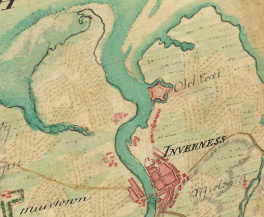
“Tradition has it that the level of this portion was higher of old than now and that the rivers Beauly and Ness ran down as rivers all the way to Fort George".
A line of boulders extends in a north-westerly direct- ion from the breakwater at the mouth of the River Ness for a distance of c. 50m terminating in a low mound of small stones c. 1m high and c. 6m across. This mound would appear to be all that remains of Cairn Airc. The line of boulders leading to the mound no doubt formed an earlier or additional breakwater with the cairn at the end, being utilised as a beacon as mentioned by Name Book 1878 and OSA 1793. The cairn is now in a very ruinous condition.”
Visited by OS (W D J) 29 April 1960.
Background about Inverness Harbour: https://canmore.org.uk/site/13345/inverness-harbour
The posted coordinates will take you to a bench near the beacon.
When did two halves meet? = ABCD
The cache can be found at the following location:
N057° DB.64(C-1), W004° 14.312