Questa cache è nascosta sulla sommità del passo Manghen ad una altezza di 2047 m ed è dedicata a tutti quei ciclisti che si cimentano nella scalata partendo dalla Valsugana oppure dalla Val di Fiemme.
Il passo
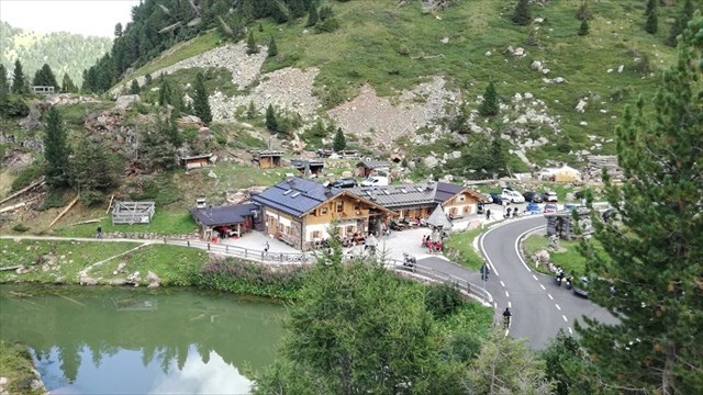
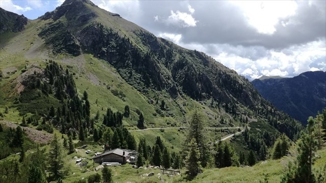
IL passo Manghen (2.047 m) è un valico alpino del Trentino nella catena del Lagorai. Il suo versante meridionale, tramite la val di Calamento, porta a Borgo Valsugana, mentre quello settentrionale porta a Molina di Fiemme tramite la val Cadino.
E' uno dei più celebri passi dolomitici percorsi nel Giro d'Italia, particolarmente duro per la sua lunghezza.
La salita da Borgo Valsugana è lunga ben 23,4 chilometri e presenta una pendenza media del 7%, anche se gli ultimi 7 chilometri sono quelli più impegnativi con una pendenza media del 9,5%, ma con punte del 15%.
Il versante di Molina di Fiemme è più breve, 16,4 chilometri al 7,5% medio, ma ancora il tratto finale è il più duro, con ancora il 9,5% medio per gli ultimi 8 chilometri.
Il versante meridionale del passo Manghen, così come tutta la zona della Val Calamento, appartiene al comune di Telve. Mentre quello settentrionale al comune di Castello-Molina di Fiemme.
Il Passo Manghen è stato scalato più volte al Giro d'Italia, la prima volta fu nel 1976. Nel 2019 è stato designato come Cima Coppi dopo l'annullamento del passaggio al Passo Gavia, impraticabile per maltempo.

[Informazioni tratte da Wikipedia]
La cache e il ciclista amatoriale
Ovviamente questa cache è a disposizione di tutti i Geocacher che vorranno cercarla, qualunque sia il mezzo di locomozione utilizzato per raggiungere GZ. Il passo è transitabile in macchina e la cache è praticamente una "park and grab", se però ai 2040 m della fine della salita ci arrivate in bicicletta allora questa definizione potrebbe sembrarvi un po' riduttiva!
La salita del Manghen rappresenta una pietra miliare per i ciclisti amatoriali della zona: con i suoi 23 Km di salita (per chi proviene dalla Valsugana) e quasi 1800 m di dislivello costituisce una autentica sfida con la quale ogni ciclista vuole prima o poi misurarsi.
Per questo motivo verrà stilata una speciale classifica nella classifica dedicata ai primi tre Geocacher che riescono a trovare la cache arrivandoci in bici. Come prova basterà allegare una propria foto sul passo (esistono anche due divertenti cartelli, uno per versante, che permettono di farsi un selfie assieme al profilo altimetrico della salita appena conclusa!)
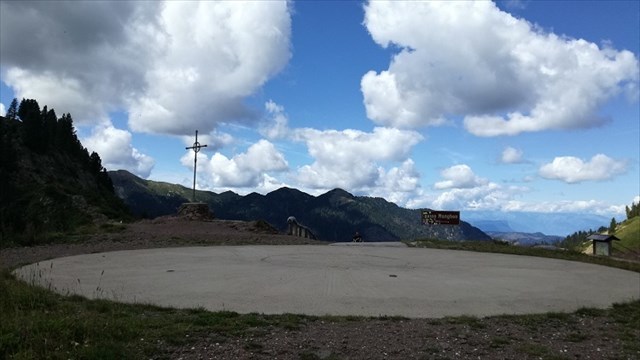
Il contenitore è nascosto proprio sulla sommità del passo con vista panoramica sulla salita che arriva dalla Valsugana.
Buona caccia e .... buona pedalata!
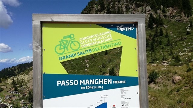

This cache is hidden on the summit of the Manghen pass at a height of 2047 m and is dedicated to all those cyclists who try their hand at climbing the pass starting from Valsugana or from Val di Fiemme.
The pass
The Manghen pass (2,047 m) is an alpine pass of the Trentino in the Lagorai chain. Its southern slope, through the Calamento valley, leads to Borgo Valsugana, while the northern one leads to Molina di Fiemme via the Cadino valley.
It is one of the most famous Dolomite passes in the Giro d'Italia, particularly hard for its length.
The climb from Borgo Valsugana is 23.4 kilometers long and has an average gradient of 7%, even if the last 7 kilometers are the most demanding ones with an average gradient of 9.5%, but with peaks of 15%.
The Molina di Fiemme side is shorter, 16.4 kilometers at 7.5% average, but still the final stretch is the hardest, with an average 9.5% for the last 8 kilometers.
The southern slope of the Manghen pass, as well as the entire Val Calamento area, belongs to the municipality of Telve. While the northern one to the municipality of Castello-Molina di Fiemme.
Passo Manghen has been climbed several times in the Giro d'Italia, the first time it was in 1976. In 2019 it was designated as Cima Coppi after the cancellation of the passage to Passo Gavia, impractical due to bad weather.
The cache and the amateur cyclist
Obviously this cache is available to all Geocachers who want to look for it, whatever the means of transport used to reach GZ. The pass is passable in the car and the cache is practically a "park and grab", but if you reach the 2040 m of the end of the climb by bicycle then this definition might seem a bit reductive to you!
The ascent of the Manghen represents a milestone for amateur cyclists in the area: with its 23 km of ascent (for those coming from the Valsugana) and almost 1800 m of altitude it is a real challenge with which every cyclist wants to measure himself sooner or later.
For this reason, a special classification will be drawn up dedicated to the first three Geocachers who can find the cache by bike. As a proof, it will be enough to attach your own photo on the pass (there are also two amusing signs, one on each side, which allows you to take a selfie together with the altimetric profile of the ascent just ended!)
The container is hidden right on the top of the pass with a panoramic view of the climb that comes from the Valsugana.
Good hunting and .... good ride!