
The Tuia Mātauranga GeoTour is about having fun discovering the history of Aotearoa New Zealand by finding sites of significance in local communities from early Pacific voyaging and migration, European settlement to present day. The interaction between people, and people and the land have provided a rich history that the GeoTour invites you to explore.
---

Visit the rock art at Takiroa, near Duntroon in North Otago.
A rock face at Takiroa, near Duntroon in Central Otago has a number of drawings which date to the 19th century and appear to depict European style sailing vessels, people riding horses as well as taniwha, birds and other animals.
Takiroa is a significant landmark in the traditions of Ngāi Tahu Whanui. The rock shelter lies on an ancient pathway following the Waitaki River from the mountains to the sea. The head waters of the Waitaki River are fed from ka roimata o Aoraki (the tears of Aoraki) - the ancient mountain of Ngāi Tahu Whanui. The limestone outcrops at Takiroa are said to be a legacy of Tamatea-Pokai-Whenua, a great explorer who lit fires as he walked the land. Te ahi tapu o Tamatea (the sacred fires of Tamatea) cooled to form mounds of pale white ash such as the outcrop at Takiroa.
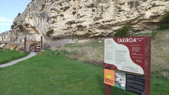
Access to the site was closed in May 2010 following a large rockfall. It has since been cleared and the site is fully open for viewing.
Takiroa Rock Art https://nzhistory.govt.nz/media/photo/takiroa-rock-art-shelter
The cache is a 400ml container and it is placed at ground level. Bring your own pen.
To be able to complete this Geotour and receive your special geocoin, remember to take a note of the codeword on the log book of the cache. This will need to be recorded in your passport which can be downloaded from here. If the passport is unavailable for any reason just keep a note of the codeword and try again later.