Sandstein
Sandstein ist ein klastisches Sedimentgestein mit einem Anteil von mindestens 50% Sandkörnern, d. h. von Körnern, die nach der allgemeinen Definition der Korngröße Sand zwischen 0,063 und 2 mm groß sind. Die Sandkörner bestehen aus verschiedenen Mineralen, meistens jedoch aus Quarz.
Bodenbildung auf Sandstein
Auf Grund des Vorherrschens von Quarz entstehen in Mitteleuropa aus Sandstein im Allgemeinen nährstoffarme Böden, die außerdem zur Versauerung neigen. Je nach Wasserangebot und Entwicklungstiefe des Bodens findet man Ranker, Braunerden oder Podsole. Meist werden diese Böden forstwirtschaftlich genutzt.
Luxemburger Sandstein
Der Luxemburger Sandstein ist ein kalkig gebundener Sandstein aus der Zeit des Unteren Schwarzen Jura. Er bildet den oberflächennahen geologischen Untergrund weiter Teile Luxemburgs, des sogenannten Ferschweiler-Plateaus, einer Hochebene im Westen des Eifelkreises Bitburg-Prüm in Rheinland-Pfalz sowie des Bollendorfer und Wißmanndorfer Plateaus.
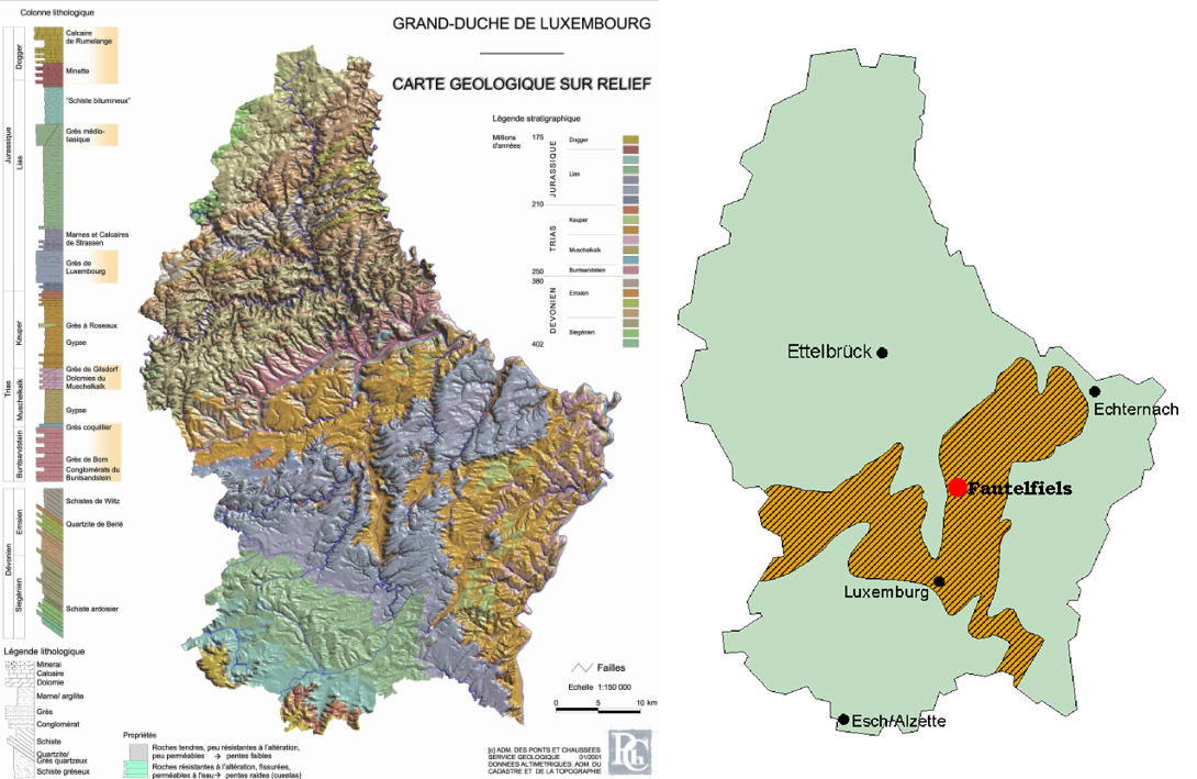
Der Luxemburger Sandstein entstand in der Nähe eines Flussdeltas. Der Fluss schüttete von Norden nach Süden sandiges Sediment aus dem Bereich der Rheinischen Masse in ein flaches Becken des Jura-Meeres. Die Ablagerungen verfestigten sich dort nachfolgend mit ebenfalls eingebrachtem Kalk. Ist er im Bereich des Ferschweiler-Plateaus noch etwa 30 m mächtig, verliert er in Richtung Luxemburg an Mächtigkeit.
In den Luxemburger Sandstein lassen sich relativ einfach Keller graben. So befinden sich im Bereich des Luxemburger Sandsteines zahlreiche Weinkeller. Auch die Kasemtten, der unterirdische Teil der Befestigungsanlagen der Stadt Luxemburg, befinden sich im Luxemburger Sandstein.
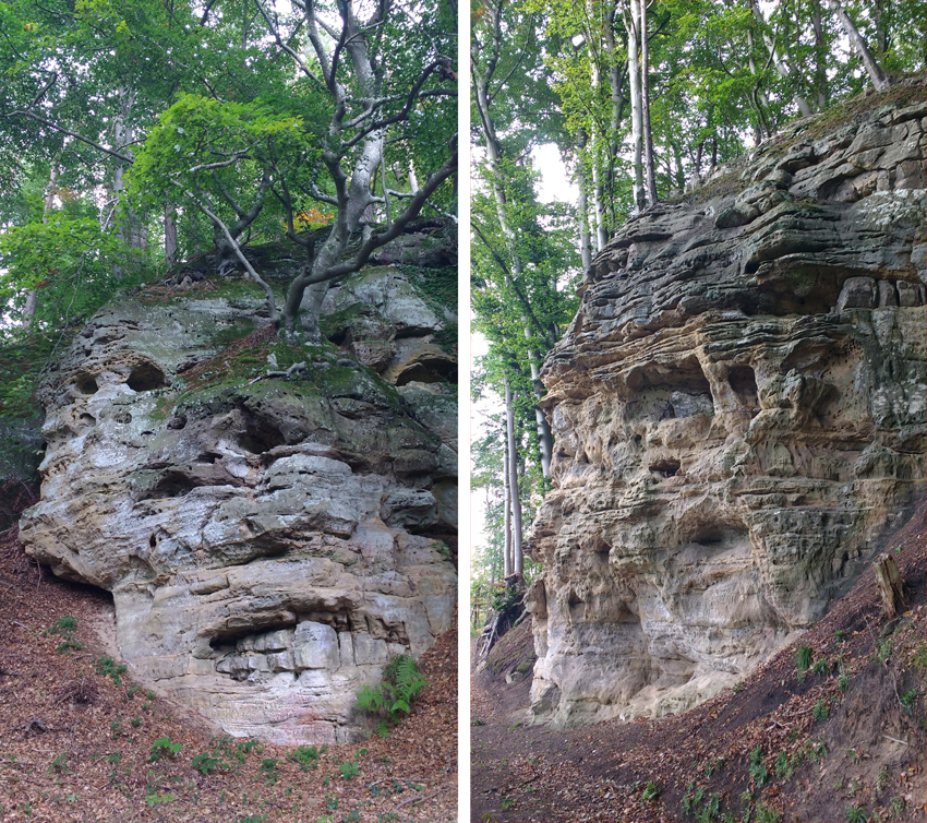
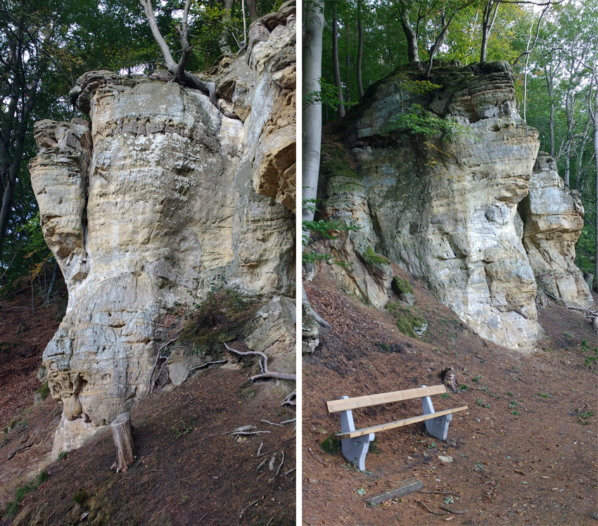
Fautelfiels
Menschen auf Wanderschaft mögen diese Höhle als Unterschlupf bewohnt haben. Sicher schient, dass Köhler, die ihre Meiler gebaut und überwacht haben, hier lebten. Daher auch die Namen „op Kuelent“ und „Kuelebierg“.
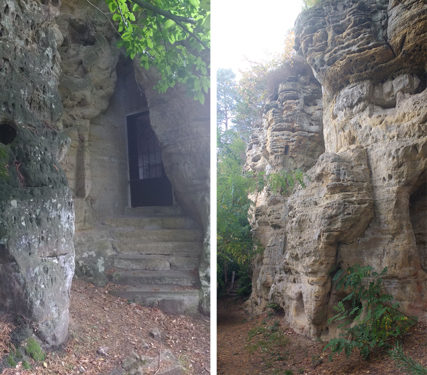
1805-1806 soll ein Priester, der den Eid auf die französische Revolution verweigert hatte, hierher geflüchtet sein. Damit begann die Zeit, in welcher der Ort eine religiöse Bedeutung bekam: Altar, Statuen, Prozessionen, Messen, u.s.w.
Der Name „Fautelfiels“ kann mit ziemlicher Sicherheit vom altfranzösischen Wort „faulde“ (Köhlerei) hergeleitet werden, brannten doch Köhler aus Nordfrankreich und Wallonien über längere Zeit ihre Meiler „op Kuelent“ in der Nähe des „Fautelfiels“
Sandstone
Sandstone is a clastic sedimentary rock containing at least 50 % grains of sand, i.e. grains which, according to the general definition of sand grain size, are between 0,063 and 2 mm in size. The sand grains consist of various minerals, but mostly quartz.
Soil formation on sandstone
Due to the predominance of quartz, sandstone in Central Europe is generally used to form nutrient-poor soils, which also tend to acidify. Depending on the water supply and the development depth of the soil, one can find ranker, brown earth or podsole. These soils are mostly used for forestry purposes.
Luxembourg sandstone
The Luxembourg sandstone is a limestone bound sandstone from the time of the Lower Black Jurassic. It forms the near-surface geological subsoil of large parts of Luxembourg, the so-called Ferschweiler Plateau, a plateau in the west of the Eifelkreis Bitburg-Prüm in Rhineland-Palatinate as well as the Bollendorfer and Wißmannsdorfer Plateaus.
The Luxembourg sandstone was formed near a river delta. From north to south, the river poured sandy sediment from the Rheinische Masse area into a shallow basin of the Jura Sea. The sediments then solidified there with limestone. If it is still about 30 m thick in the area of the Ferschweiler plateau, it loses thickness in the direction of Luxembourg.
It is relatively easy to dig cellars into the Luxembourg sandstone. There are numerous wine cellars in the area of the Luxembourg sandstone. The casemates, the underground part of the fortifications of the city of Luxembourg, are also located in the Luxembourg sandstone.
Fautelfiels
People on their travels may have occupied this cave as a shelter. It seems certain that charcoal burners who built and supervised their piles lived here. Hence the names "op Kuelent" and "Kuelebierg".
Between 1805 and 1806, a priest who refused to swear an oath of allegiance to the French Revolution is said to have fled here. This marked the beginning of the period in which the place acquired a religious significance: Altar, statues, processions, masses, etc.
The name "Fautelfiels" can almost certainly be derived from the old French word "faulde" (charcoal burning), as charcoal burners from northern France and Wallonia burned their piles "op Kuelent" near the "Fautelfiels" for a long time.
Logbedingungen:
An den angegebenen Koordinaten findest du eine Infotafel mit allen Informationen, die ihr zur Beantwortung dieser einfachen Fragen benötigt.
- Wann entstand die Bodenformation „Luxemburger Sandstein“?
- Was wurde durch Erosion und Verwerfungen im Laufe der Zeit ausgeschwemmt?
- Welche sind die Abmessungen (L und B) des Fautelfiles heute? Wie hoch ist der Fels?
- Wir werden uns über ein Foto von dir bei der Kapelle Fautelfiels sehr freuen.
To log this cache:
At the given coordinates you will find an Info Board with all the information you need to answer these easy questions.
- When was the soil formation „Luxemburger Sandstein“originated?
- What has been washed out by erosion and faults over time?
- Which are the dimensions (L and B) of the Fautelfiles today? How high is the rock?
- We will be very happy about a photo of you by the Fautelfiels chapel.