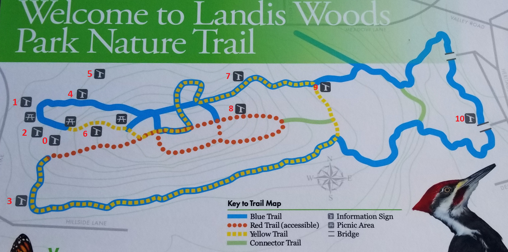
As I usually do every weekend, I took Clifford for a walk in a different place. A park, a rail trail, ... Usually unfound caches help me decide where to go. Today we went to Landis Woods, not to find a new cache, but to maintain one. After the maintenance stop, we explored the park. As we walked, we noticed the informational signs placed along the trails. It turns out there are 11 signs. In the image below, I have labeled the signs 0 through 10. Sign 0 is the trail map near parking, and not used for the calculation of the final coordinates. The sign numbers correspond with the stage numbers/names. You will need to visit all of the signs to collect the information to calculate the final coordinates. Each value is calculated using the info found on the sign and the sign number the info was found on.
Please pay careful attention to the calculations below.
Final Coords : N40 AB.CDE W76 VW.XYZ
A = Sign number MINUS #.
The Eastern Hemlock was designated Pennsylvania's official state tree in 19#1.
B = Sign number MINUS #.
The # of canoes required to fit 20 paddlers.
C = Sign number MINUS #.
The # of rivers mentioned in the write-up
D = Sign number MINUS #.
The # of common aquatic microinvertibrates pictured in the small circles on the sign.
E = # MINUS Sign number.
Today, Landis Woods is a #0-acre habitat for a variety of species of plants and animals.
V = # MINUS Sign number.
# of (very common) owls listed.
W = # PLUS Sign number.
# of Monarch Butterfly larva pictured.
X = Sign number MINUS #
Approximately 13# species have been seen here at Landis Woods.
Y = Sign number MINUS #
Multiflora Rose is a scrambling shrub climbing over other plants to a height of #-12 feet
Z = # MINUS Sign number.
Up to #0% of the forest biomass may be deadwood.