Weir in Cape Coral
How did the weirs help make Cape Coral a City
Cape Coral, Florida is a relatively new city. It was founded in 1957. Before that time the area had a lot of non-inhabitable land mass. The land was mostly wet lands that prohibited the development of the city. Some of the area, while not a wet land, was difficult to reach because of the amount of standing water. There were people living in Cape Coral but the area was rural and wilderness. For those that did settle in the Cape in the early 1900’s they were primarily cattle farmers that farmed in the northern portions of what would become Cape Coral. Others used the land for hunting and lived in other parts of the state. In 1958, development of the city as a master-planned, pre-planned community began. Cape Coral is a planned community divided into four quadrants. It is the largest city between Tampa, Florida and Miami, Florida with approximately 120 square miles (310km squared).
When the Rosen Brothers started developing the land in the late 1950’s they had to build canals to control the storm waters. Canals were dredged in the areas not accessible by automobiles. The canals needed to be dredged to provide excavated dirt to build the lots up higher. Failure to raise the building site would put the buildings in danger of flooding. The canal system that is now in place is over 400 miles long. Cape Coral has more miles of navigable canals than any other city in the world. There are both saltwater and fresh water canals.
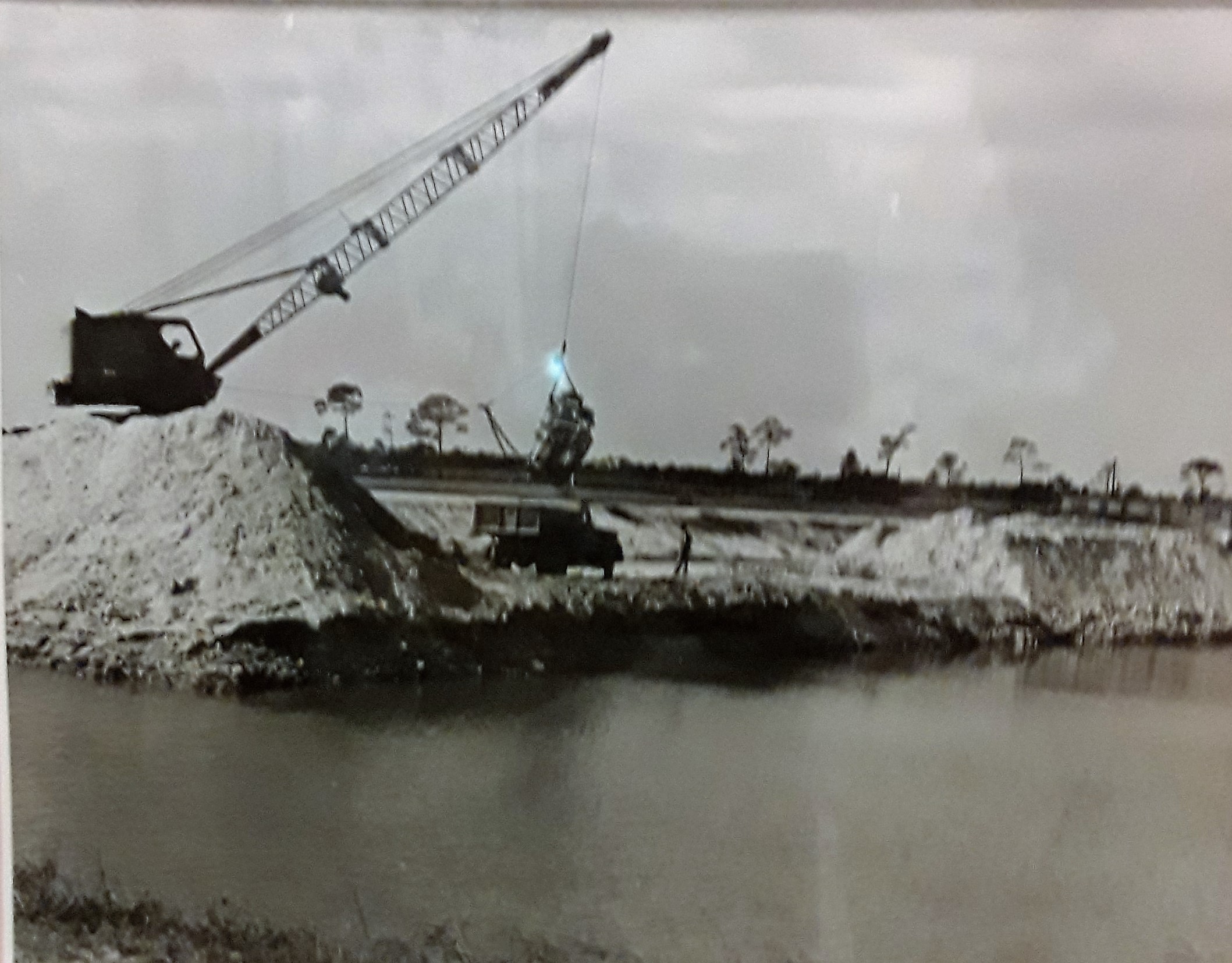
The water in the canals served more purposes than draining the land into navigable boat canals and providing dredged dirt. The water was used for municipal irrigation, environmental recovery, and more recently for fire suppression. The water in the canals had to be controlled so that there would not be saltwater intrusion. The control of the canals was accomplished with weirs. The weirs that are in place were primarily built in the late 60’s and early 70’s as fixed weirs. Some of the weirs were replaced in about 2000, with moveable weirs.
A weir is a structure that does not stop the flow of water completely. It allows the water to flow over the top into the continuation of the waterway. The water is not redirected to a spillway such as a dam would. The upstream side of the waterway will typically be higher because of the weir. The water depth will fluctuate during extreme drought and during a tropical storm.
There are several different types of weirs in the City of Cape Coral. The most common of the 33 weir currently in place, are the fixed weir. There are several moveable weirs placed around the city. The two types of moveable weirs are baffle (inflatable) and removable weir plates. The moveable weirs allow for the water level in the fresh water canals to be drained off at a higher rate by lowering the gate (or removing the plates). Drainage is especially important in the rainy season (June – November) as well during an occurrence of a hurricane. These moveable weirs prevent storm water from backing up and flooding the residential areas. The moveable inflatable weirs can be controlled by wind and solar power. Having power during a storm is vital to the structures as well as the land around the weir.
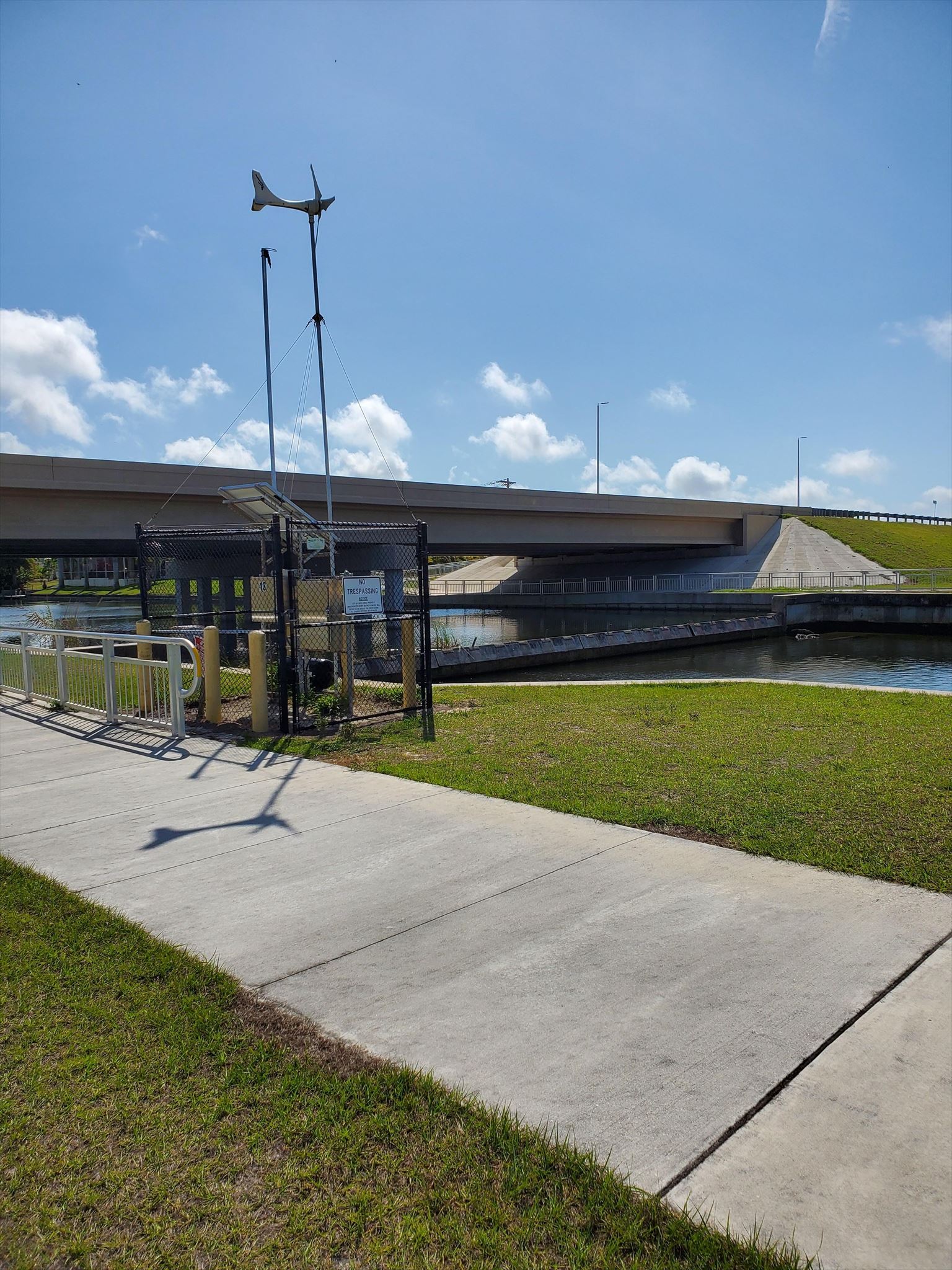
Powering a moveable weir near Burnt Store and Diplomat
All of the weirs help to maintain water in the canals during the dry season, December through May. The fresh water can be harvested to offset the lack of rainwater and avoid damage from the drought conditions. When a hurricane or storm is predicted the moveable weir can be lowered or the plates removed. This allows the evacuating freshwater, that is pushing out of the canal, to limit the saltwater intrusion. Environmentally, the freshwater canals are protected from red tide, algae blooms and blue green algae because of the placement of the weirs.
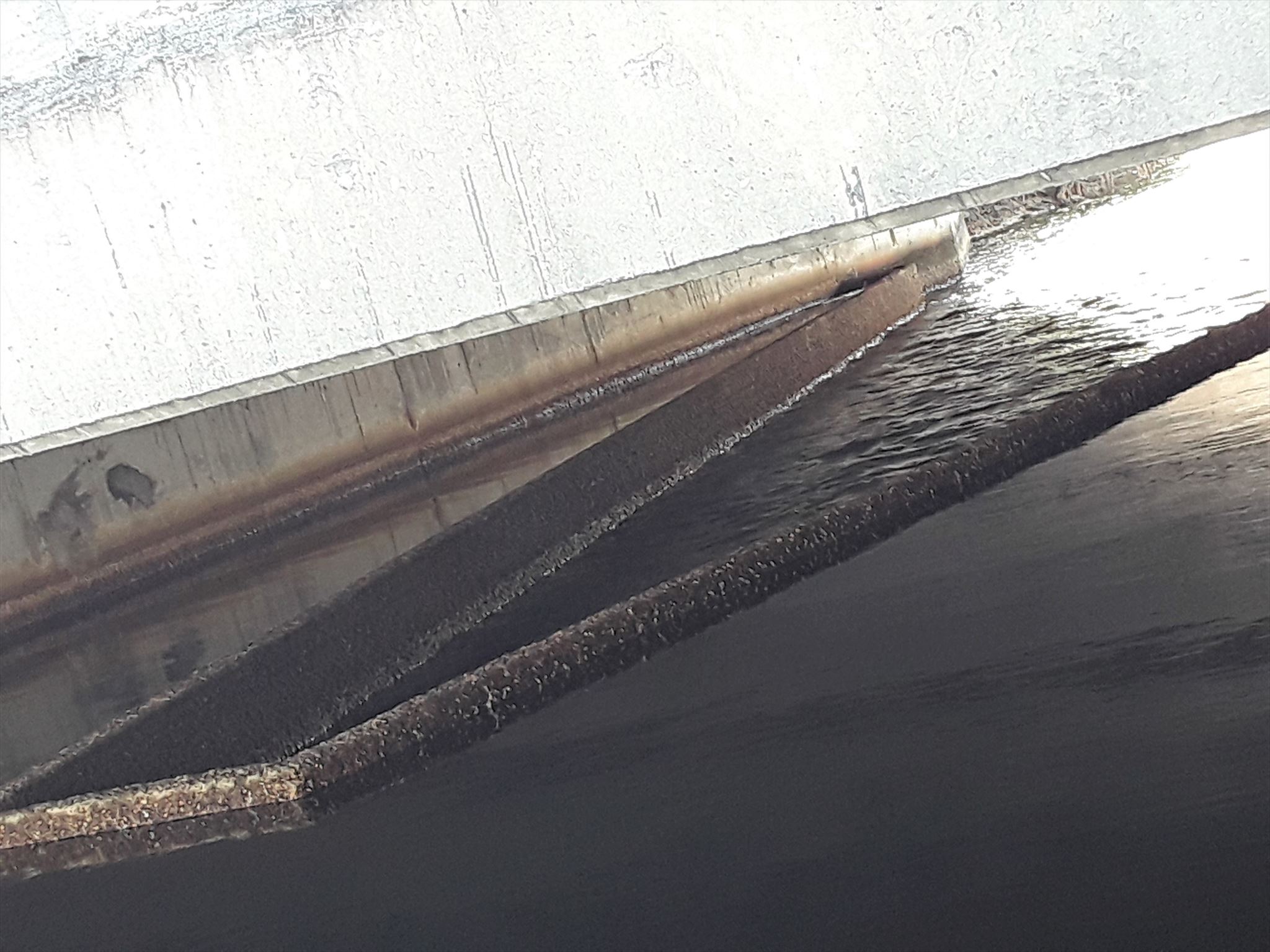
Fixed weir separating the salt and freshwater at the Eastover Canal
At the first set of coordinates, N 26 43.809 and W 082 03.305 is a type of fixed weir. This “V” shaped weir is holding back the water in the Eastover Canal. This weir maintains a navigable canal of freshwater. The saltwater is tidal influenced and varies in depth with the tide. Looking to the east is fresh water. Looking to the west is saltwater. The saltwater canal is navigable out to the North Spreader Waterway Canal which leads out to the gulf.
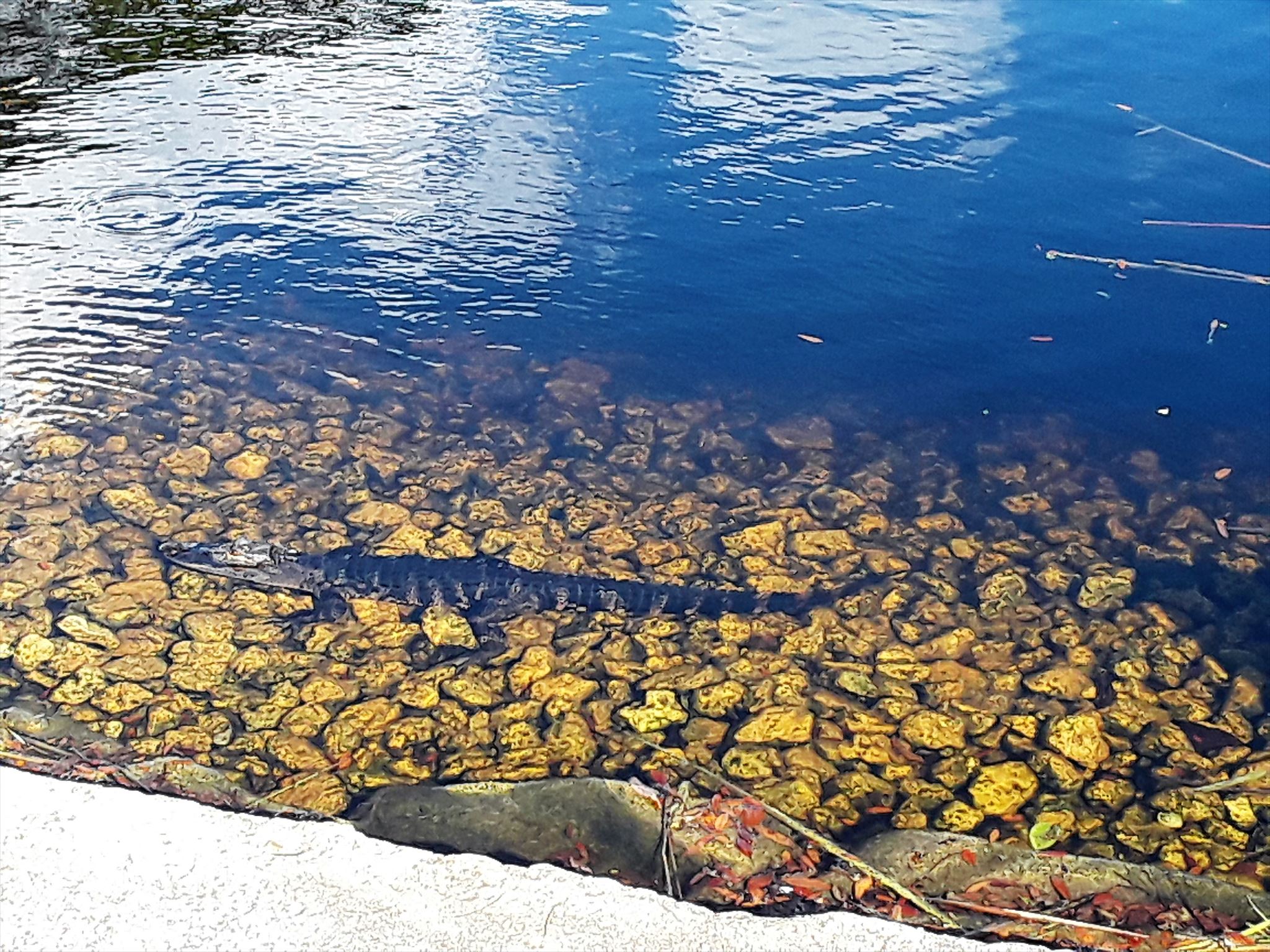
Alligator resting at the Dewberry weir
The weir that is located at the second set of coordinates, N26 44.608 and W 082 03.286 is a different style of fixed weir. This waterway is part of the Dewberry Canal. This fixed weir allows water to pass through it via four circular culverts once the water reaches a height of 1.97 feet. This weir overflowed on June 26, 2012 during Tropical Storm Debbie. Due to this being a fixed weir the saltwater intrusion cannot be controlled during a storm. This freshwater canal flows into the Charlotte State Preserves, Annie’s Creek, which is a portion of the Great Calusa Blueway Paddling Trail and is saltwater. (For more information on the Paddling Trail go to www.CalusaBlueway.com)
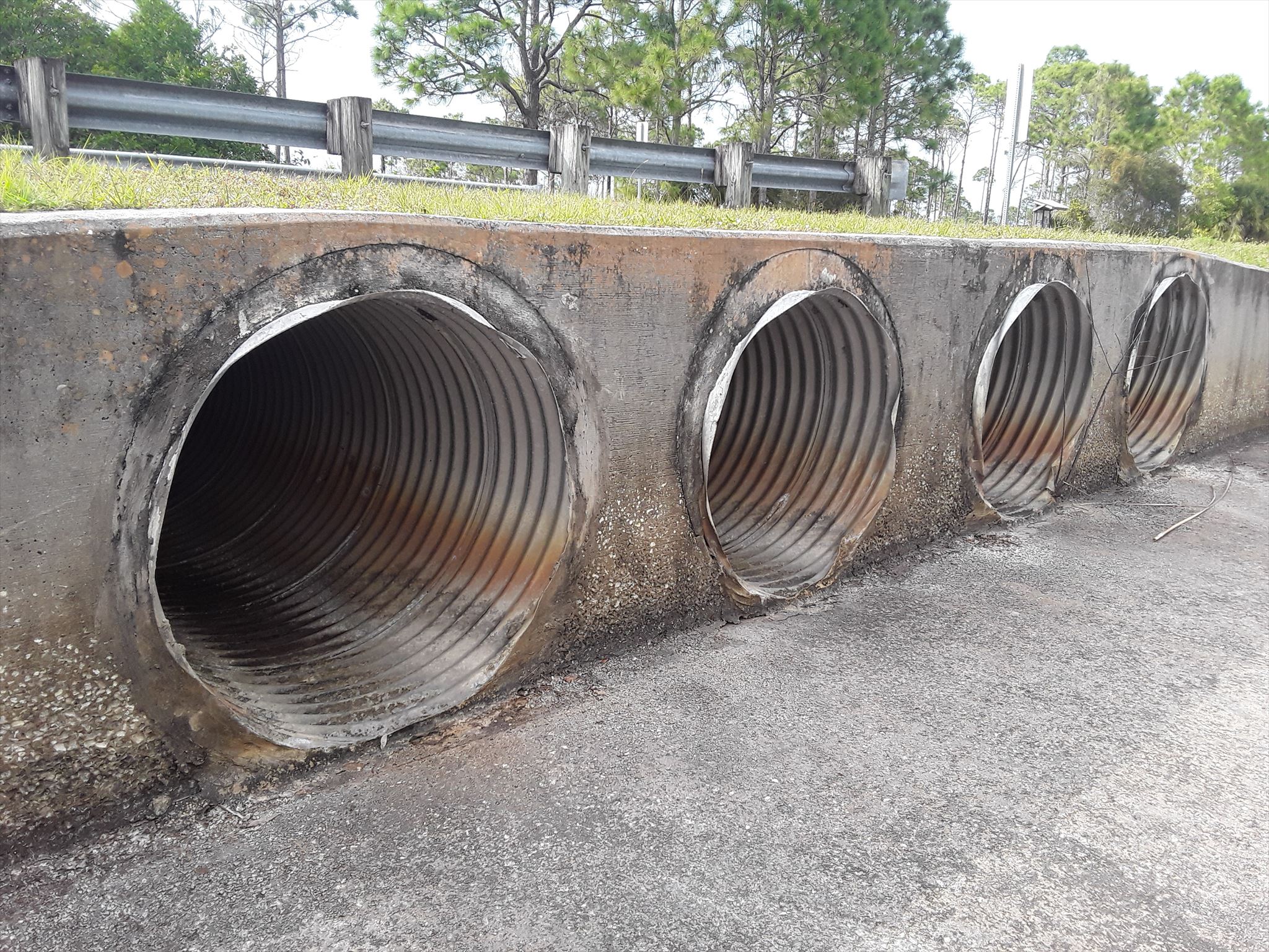
Dewberry Canal weir
The requirements to log this two stop cache must be completed as follows. Please do not post your answers to your log. E-mail me with your answers to get credit for this Earthcache and earn your smiley:
1. How many total weirs are in Cape Coral as of the posting of this Earthcache (read above)?
2. What is one of the listed reasons for the weirs (read above)?
3. At the first set of coordinates, can you hear or see the water flowing over the weir? Walk down the embankment and look under the bridge. You can walk down the bank from either the salt or freshwater sides. Be careful you don’t fall in. Notice the different water levels between the salt and freshwater. As well as see the actual “V” shaped weir. Approximately, how many inches is the saltwater lower than the freshwater? Or the saltwater higher than the freshwater? Be specific which is higher and lower. Also tell me the date and approximate time of your actual visit.
4. At the second set of posted coordinates. Is there water in the cement basin of the weir? If yes approximately how deep is the water inside the cement weir basin?
5. Take a picture of you, your team, or your signature item at one of the two weir locations and post it with your log. During the winter months you will get a nice sunset at the first set of coordinates.
Some of the information for this Earthcache was obtained from capecoral.net, “Images of America Cape Coral” by Chris Wadsworth, Anne Cull and the Cape Coral Historical Society. Invaluable research interviews were conducted with City Employees Janel Trull and Jeffrey Walter allowing all of us to gain from their knowledge. Photo credits are the historical society, Jeffrey Walter and this cache owner Mermaidsh.
Congratulations to Pilot Searcher and Scout1950 on being the FTF