

Baltic Sea
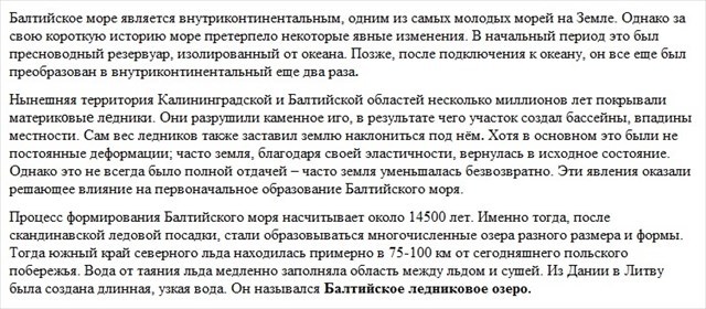
The Baltic Sea is an intracontinental, one of the youngest seas on Earth. However, during its short history, the sea has undergone some clear changes. In the initial period, it was a freshwater reservoir, isolated from the ocean. Later, after connecting to the ocean, it was still twice converted to an intracontinental.
The current area of the Kaliningrad and Baltic region has covered ice sheets several times over millions of years. They destroyed the rock base, which caused the site to create basins, hollows of the terrain. The very weight of the glaciers also caused the earth to bend beneath it. Although mostly these were not permanent deformations; often land, thanks to its elasticity, returned to its original state. However, it was not always a complete return - often the land decreased irrevocably. These phenomena have had a decisive impact on the original formation of the Baltic Sea.
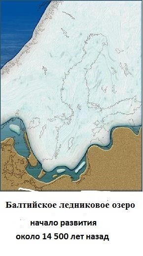
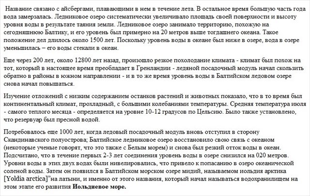
The process of formation of the Baltic Sea dates back about 14500 years. It was then, after the Scandinavian ice landing, that numerous lakes began to form - of different sizes and shape. The southern edge of the north-rearing ice was then about 75-100 km from today's Polish coast. Water from melting ice slowly filled the area between ice and land. Long, narrow water strech was created from Denmark to Lithuania. It was called the Baltic Ice Lake (there is also the name of the Ice Lake).
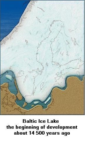
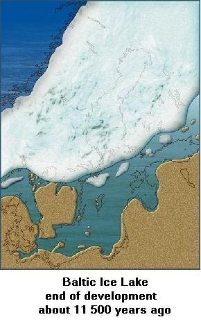
The name is due to the icebergs floating in it during the summer. For the rest, the majority of the year the water was frozen. Ice Lake systematically increased its surface area and height of water levels in the wake of the melting land. Ice Lake occupied an area similar to today's Baltic proper, and its level was about 20 meters higher than the then ocean. This state of affairs lasted about 1500 years. Then Baltic ice Lake merged the ocean . As the water level in the ocean was lower in the Lake, the water in Lake decreased - its waters flowed into the ocean.
After another 200 years, about 12,800 years ago, there was a sharp cooling of the climate - the climate was similar to that that currently prevailing in Greenland - the ice lander has started to slide back into areas in the south - there was no connection between the ocean and lake and at the same time the water level in the Baltic Ice Lake has started to rise again. The study of sediments with a low content of plant and animal remains showed that there was a continental climate at the time, cool, with large temperature fluctuations. The average temperature of July - the warmest month - is determined at 10-12 degrees Celsius. It was also found that the tank was freshwater.
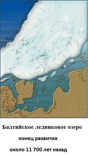
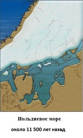
It took another 1,000 years when the ice lander once again retreated towards the Scandinavian Peninsula; Baltic Ice Lake has regained its connection to the ocean (some scientists say it also with the White Sea) and again there was a sharp outflow of water into the ocean. It is estimated that within the first 2-3 years of the connection, the water level in the Lake decreased twenty-several meters. The water levels of the two waters were levelled, which caused oceanic salt water to flow into the Lake. In the Baltic Sea Lake apeared mussels, called yoldia arctica in Latin, and it was from this name that began to be called the reservoir in this phase of its development of the Yoldi Sea.
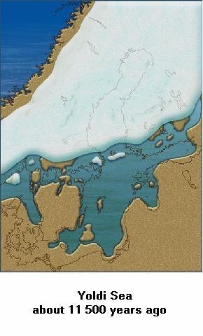
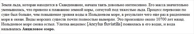
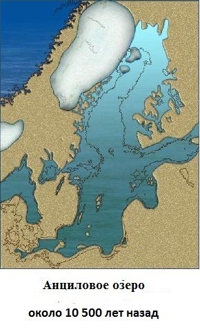
The iceberg in Scandinavia started to melt quite intensively. Its mass decreased significantly, which caused the Earth's crust, bent under the weight of ice, to start rising. The process of rising land was greater than the rise in water levels in the Yoldi Sea, resulting in the separation of the Sea from the ocean once again. Saltwater creatures are almost completely extinct. It happened about 10700 years ago. The Yoldi Sea has been sweetened again. The Ancylus fluviatilis snail appeared in its waters and the area was called Ancylus Lake.

The climate has clearly changed during this time and has become more mild, moist and warm. The average temperature, quoted in early July, has increased by almost 3 degrees. However, the organic life in the water was still very poor. The rise of the Scandinavian Peninsula as a result of melting ice sheet caused a constant inflow of water into Ancylus Lake. However, this did not result in water overflowing into the ocean (in the northern part the land was rising). However, in the southern part, where the height of the Earth's crust remained unchanged, the water began to find its numerous, small outlets to the ocean.
It happened 10200 years back. After another 400 years, as a result of the erosion of the places where the water flowed into the ocean, its supply to the ocean increased strongly. The level of Lake Ancylus began to fall again.
Around 9600-9800 years ago there was a global increase in ocean levels. The Baltic Sea and the ocean, the North Sea, were finally connected. Saltwater began to flow again, but this time it was already a large influx, the salinity of the Baltic Sea was rapidly increasing. The more so as the Danish Straits (through which the main influx of oceanic waters took place), quickly deepened and expanded. This process of transforming freshwater into brackish water took about 1200 years
At that time the Baltic Sea was called the Mastogloia Sea. Again, the name was given by the characteristic creatures inhabiting the waters; it was a saltwater diatom of the genus Mastogloia. The name of the basin was constantly changing.
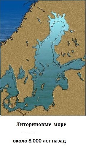
About 8500 years ago the sea snail Littorina litorea appeared in Baltic waters and at this stage of development the Baltic was called the Litorine Sea.
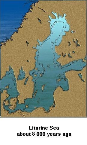
Its waters were warmer (by 2-3 degrees than today) and more salty (by 5-6 per mille) compared to today's Baltic Sea. Life in its waters has been greatly enriched. In the period 3000-4000 years ago the Earth's crust in the area of the Danish Straits slightly floated. As a result of this process, the water exchange with the North Sea has decreased and, consequently, the salinity of the waters has decreased to a level close to the present one. This stage of development of the reservoir is called the Politorinian Sea.
As can be seen, the greatest role in the various phases of the formation and development of today's Baltic was played by:
- vertical movements of the Earth's crust, especially in Scandinavia
- the global increase in the level of the ocean water, resulting in the opening and closing (to a greater or lesser extent) of the connections between the Baltic and the ocean waters.
Currently, the Baltic Sea has an area of over 415,000 square kilometres and a volume of over 21,000 cubic kilometres.
There are 9 countries by it. The coastline is 8100 km.
Its greatest depth is 459 metres.
Average salinity is 7 per milligrams; minimum salinity is 2, maximum 20 per milligrams.
250 rivers flow into the Baltic Sea.
TASKS:
1. At what stage of the Baltic Sea development was the warmest water in it?
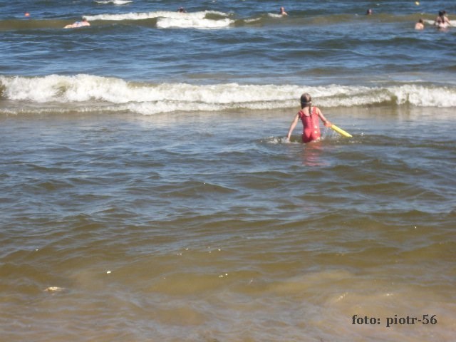
2. Sea currents and water having cause the sea to "take away" land or increase it (of course, there are also neutral cases). This is the case with the Baltic Sea. It is estimated that the Baltic Sea's activities generally cause land loss of 50 hectares per year. Task for you: look around; take a look at the beach, dunes, vegetation and adjacent terrain. Write whether, in your opinion, where you are, the land arrives or whether it is taken by the sea. Briefly justify your judgment.
3. The Baltic Sea is salty because it contains a certain amount of sodium chloride or table salt. Do an experiment: Take some seawater in a bottle. At home, pour 250 ml of water (almost full glass) into a glass and add the table salt to it with a teaspoon of stirring well. Compare the taste of water in a glass and water from the Baltic Sea. How much did you have to pour into a glass of salt to get the same "salt" of water? Select one of the answers: - just had a little salt on the tip of a teaspoon - about half a teaspoon - full spoon - two teaspoons You can also experiment over water, taking with you clean drinking water, salt and a teaspoon. Remember - if you abhor drinking water from the sea or ingesting salt water can cause damage to your health - stop the experiment. You do the experiment at your own risk. [optional task]
4. When logging in, attach your photo with the stone breakwater in the background.
Photo by the author