Welcome to Little Pine Island
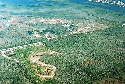
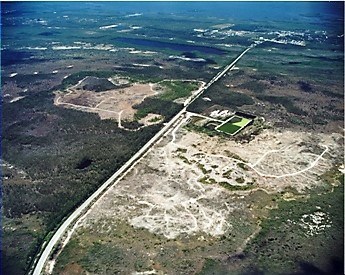
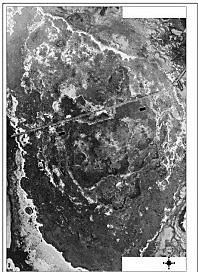 Little Pine Island 1944
So you want to learn some geology about Florida. The state of Florida has geology, though sometimes you have to search for it. This Earthcache will teach you about two different science lessons. The first part though more ecology leads directly into the geology lesson.
You are standing almost in the middle of geology at the coordinates. You are standing on top of a freshwater lens. Little Pine Island was the unfortunate recipient of some destruction back in the 1950s. Because people did not know better, they tried to remedy what they viewed as problem areas, with damaging effects of the land. In an attempt to eliminate the mosquito issue in the area, mosquito canals we're dug on Little Pine Island. Additionally, Invasive plants were placed on the island in an attempt to help dry up the standing water. It wasn't until many years later that they realized the damage that was caused to the island.
Little Pine Island is a small island about 4700 acres, just east of Pine Island and west of Matlacha. The island is owned by the State of Florida. There are no residents living on the island. Animals and native vegetation are now making a comeback to the area that is now primarily wetlands.
The perimeter of little Pine Island is covered in mangroves. The interior of the island is a wet land and what is known as a freshwater lens. This geological feature was put in dire straits of being eliminated due to the mosquito canals and the invasive plants. The mosquito canals were allowing saltwater intrusion into the freshwater lens which is part of the aquifer which provides drinking water.
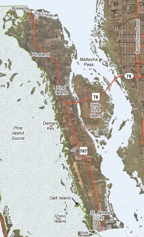 Overview of area
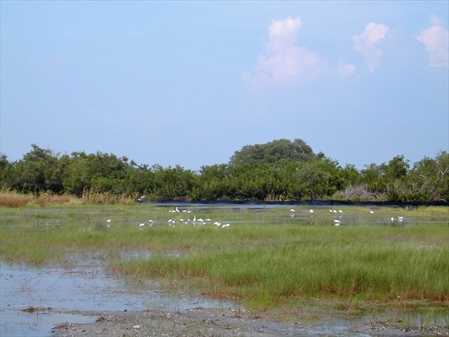
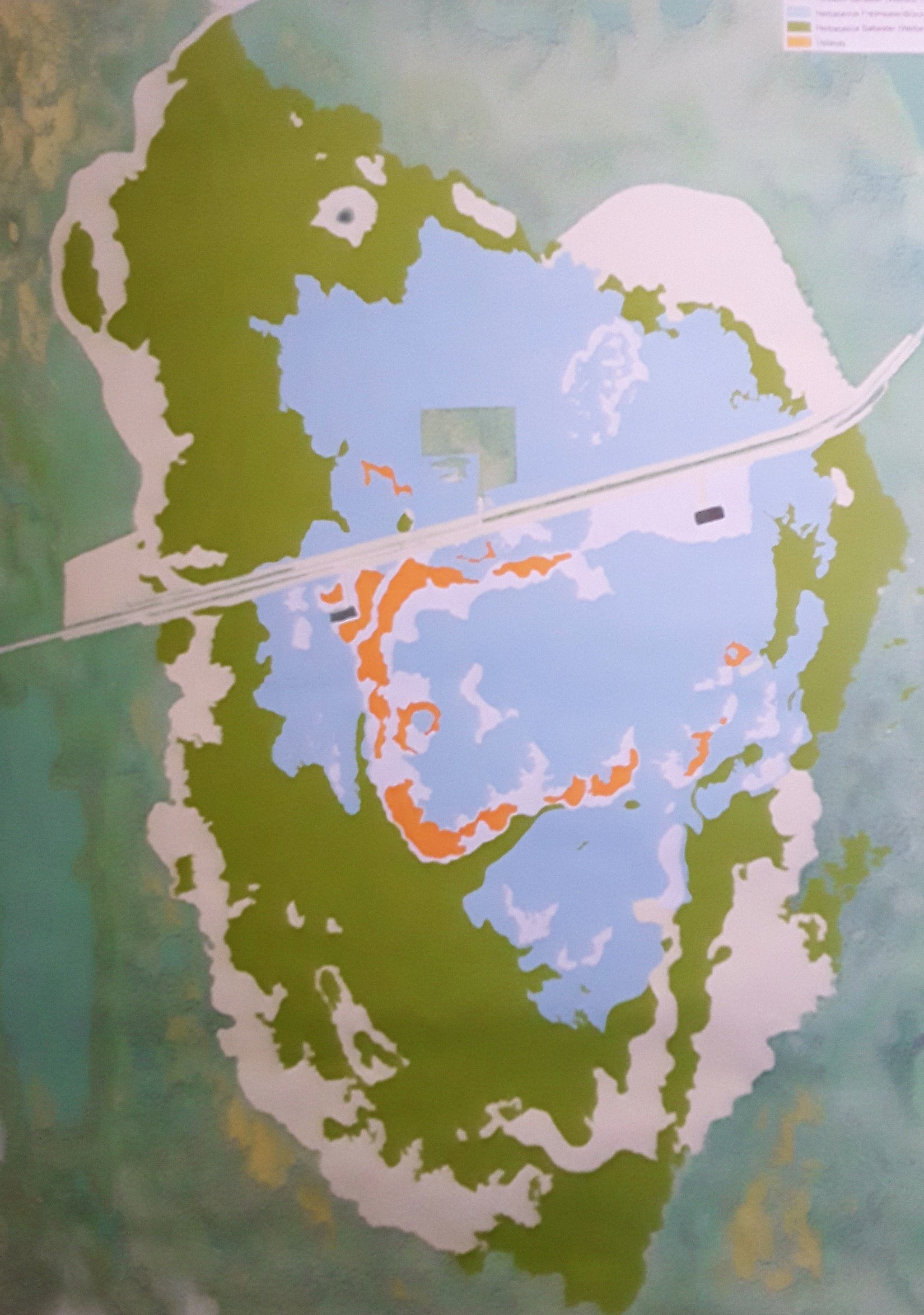 Location of Freshwater Lens
STOP, STOP, STOP…let's take a step back. What is a mosquito canal? What is a freshwater lens? And how did Mitigation banking resolve the problems?
A mosquito canal is not a geological feature. It is a manmade feature. They are canals or ditches that are dug to help drain standing water. Over the course of human history malaria has been one of the deadliest tropical diseases that man has encountered. So eliminating the mosquitos through these canals seemed to be the correct course of action for the health of the nearby residential communities. On Little Pine Island the canals were dug to drain into Charlotte Harbor and Pine Island Sound. These are tied into the Gulf of Mexico. They were successful in building the mosquito canals and reducing the mosquito population. What they did not anticipate was that the canals would allow salt water to flow up the canal during high tide. Ultimately what they were doing was replacing fresh water in the aquifer drinking water, with salt water.
What is a freshwater lens? And can you see it? A freshwater lens is a convex shaped layer of fresh ground water, that floats above denser saltwater. This freshwater lens would have initially been created by storm waters. As in the diagram the lens is replenished during the rainy season. This area over the freshwater lens will have water visible when the lens is replenishing.
After the mosquito canals were filled back in, the freshwater lens was able to start replenishing the freshwater from the damage of the canals. The freshwater lens has now been restored to over 700 acres. This also includes the establishment of natural tidal patterns on the island. The studies show saltwater is more dense than freshwater. Increasing the mass by adding salt increases the density. Seawater is more dense than freshwater so it sinks beneath freshwater. The densities of fresh and saline groundwater and the thickness of the freshwater lens are related to the elevation of the groundwater table. The project on Little Pine Island has concluded with both baseline testing and post-restoration monitoring. The project was deemed successful.
If it was successful can you see it? You may not be able to see the difference in the freshwater and saltwater but you will see the difference in what the area has for vegetation and the seasonal water that accumulates.

(By Global Climate Change Impacts in the United States (2009) - https://nca2009.globalchange.gov/freshwater-lens/index.html, Public Domain, https://commons.wikimedia.org/w/index.php?curid=74171272)
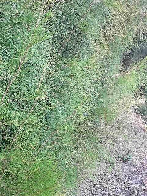
 Melaleuca Tree (invasive)
Little Pine Island was one of the first locations in Florida that was authorized for Mitigation Banking. The State of Florida recognized the need to save Little Pine Island and specifically the freshwater lens from development and the associated impacts to adjacent water bodies. In 1995 Florida entered into an agreement to correct the damage that had been done on Little Pine Island.
 (Australian Pine- invasive)
There are four primary possible conservation functions in Mitigation Banking (PERC) preservation, enhancement, restoration or creation. The purpose of the project on Little Pine Island was to restore the island’s wetland ecosystem through removal of exotic species and re-establishment of native vegetation, and hydrologic restoration.
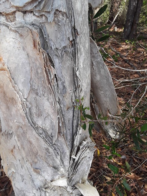
 Prior to the Invasive tree removal
What is Mitigation Banking? Mitigation banking is the preservation, enhancement, restoration or creation (PERC) of a wetland, stream, or habitat conservation area which offsets, or compensates for, expected adverse impacts to similar nearby ecosystems. Basically, what this means is that the mitigation corrects the damage that was done to the wetland. In the Little Pine Island example the land and therefore the freshwater lens were damaged by the canals and the invasive plants. The mitigation banking repaired the area and returned it into a wetland.
 After removal
The requirements to log this cache must be completed as follows. Please do not post your answers to your log. E-mail me with your answers to get credit for this Earthcache and earn your smiley:
To meet the requirements of this Earthcache you must go to the listed coordinates (there is a gate that you as a pedestrian are allowed to walk around. The opening should be obvious.) and make the following observations as well as analysis. You will need a salinity test strip.
- Is there water visible in the area beyond the fence at the approximate coordinates? If there is no water, look at the wooden fence post at your feet. Can you see signs of previous ground water?
- Explain based on the time of year and your observation if the freshwater lens is currently being replenished.(Read above)
- What does PERC stand for in Mitigation Banking? (Read above)
- Using a salinity test dip stick, is the water salt or fresh on your visit? These can be purchased at a pool supply store-just make sure it tests for salinity. I am not looking for an exact percentage but if there is presence of saltwater. You can do a taste test if you are so inclinded at your own risk. If absolutely no water is present, based on the information above would this be salt water or freshwater?
- Is a freshwater lens flat, concave or convex? (Read above)
- Why is the freshwater lens important to the community? (Read above)
(Updated February 18, 2024)
 CONGRATULATIONS chablewi on being the FTF
This Earthcache could not have been possible without the help and support of Buffer Boss.
Information for this Earthcache came from the State of Florida, Wikipedia, Environment.com, and In the classical Badon Ghijben-Herzberg principle
The Gate Keepers Series (GKS) The Charlotte Harbor Preserve State Park is the third largest state park in the state. There are 57 entry points or public gates. While it is permissible to enter through any of the gates most people tend to enter through a handful of the most used gates. This series will bring you to many of the lesser known gates and therefore probably will not be park and grabs (specifics will be included for each individual cache). This series will most likely require some bushwhacking and during the summer some may not be accessible, without boots or at minimum getting your feet wet. All will be off the ground (or in a dry area) for those that are brave enough to venture through water to reach them in the wet season. Some will be easier some will be more difficult but I would recommend byop and tott for all the hides. I want this to be a fun series so the containers will be all over the board but no nanos. Please check for parking waypoints for most of these locations.
It is unfortunate but some people don’t understand how to carry out their own trash. Please help keep the park clean. Remember to carry that grocery bag with you and by participating in, “Cache in Trash Out” at all sites.
This cache was placed with permission of the Florida Park Service. For information about placing caches in THIS state park, please contact the park office at 941-575-5816. For further information about the Charlotte Harbor Preserve State Park: www.floridastateparks.org/charlotteharbor