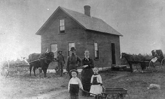
Look around you. What do you see? Trees, lots of lovely big trees. Who wouldn't want to build a home in the woods today! We take for granted all the lovely big trees we see around. But if you had arrived here, buying new farmland from Knapp, Stout and Company Co. you would have seen a totally different landscape. No trees, just stumps and brush as far as the eye could see. After the back breaking work of removing the stumps your farm house would have stood alone in a barren landscape. Trees around the buildings didn't come for many years.
Part of the Boyceville-Wheeler “Old Roads” series.
Old maps can be fascinating! Our family has a battered 1915 plat book for Dunn County that has probably been in the family since it was new. You might think that our current roads more or less follow along the routes laid out by the pioneers – until you really look at an old map! In the map montage shown here, you won’t find State Highway 170 at all – the idea of a state highway did not even exist until 1917 when Wisconsin enacted the first numbered highway system in the world. Highway 170 was not extended west of Wheeler until 1947! Maybe there were too many marshes to cross? Instead, there were two routes, only one of which survives today.
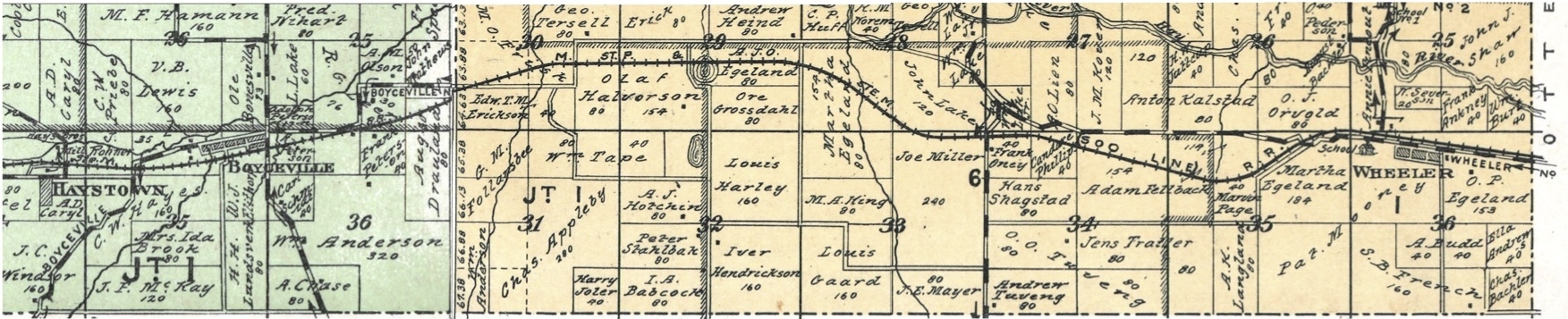
As you work your way along this series of mostly easy park and grabs, take a moment to look around and compare today’s view to the 1915 map. Some roads from 1915 vanished seemingly without a trace, unless you are an archeologist.