The Hoodoos at Hoodoo Creek:
Hoodoo Creek offers a lovely hike on a well defined trail. From the parking area located on the north side of Highway 11, pick up the trail heading up the east side of the Hoodoo Creek drainage. Expect a one-way hike of 1.5 km with an elevation gain of close to 200 m. There is one slightly steep section of the trail, but otherwise it is an easy hike.
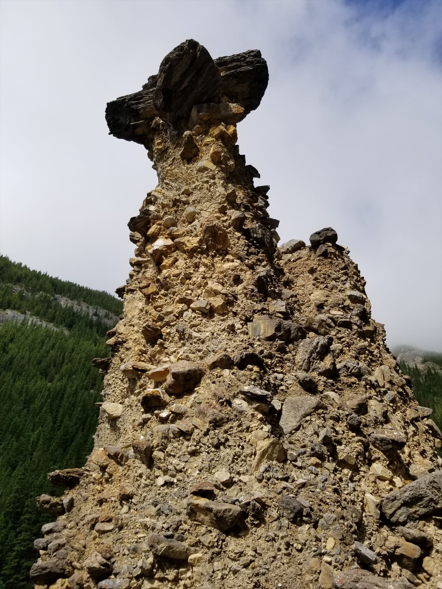
Hoodoos typically form in areas where a thick layer of a relatively soft rock , is covered by a layer of hard rock. In previously glaciated mountainous valleys, the soft lower layer may be glacial till (ground up rock produced by glaciers) with the protective capstones being large boulders in the till. Over time, cracks in the resistant layer allow the much softer rock beneath to be eroded and washed away. Hoodoos form where a small cap of the resistant layer remains, and protects a cone of the underlying softer layer from erosion. The heavy cap pressing downward gives the pedestal of the hoodoo its strength to resist erosion. With time, erosion of the soft layer causes the cap to be undercut, eventually falling off, and the remaining cone is then quickly eroded and the hoodoo disappears.
Typically, hoodoos form from multiple weathering processes that continuously work together. Frost wedging is one major weathering process that occurs in colder climates such as Canada. In the winter, melting snow, in the form of water, seeps into the cracks and then freezes at night. When water freezes, it expands by almost 10%, prying open the cracks bit by bit, making them even wider, similar to the way a pothole forms in a paved road.
In addition to frost wedging, rain is another weathering process causing erosion. In most places today, rainwater is slightly acidic, which lets the weak carbonic acid slowly dissolve limestone grain by grain. It is this process that rounds the edges of hoodoos and gives them their lumpy and bulging profiles. Where internal mudstone and siltstone layers interrupt the limestone, one may expect the rock to be more resistant to the chemical weathering because of the comparative lack of limestone.
To Log this Earthcache, Answer the Following Questions (email answers to cache owner):
1) What is the full GC code for this Earthcache?
2) Estimate the height of the two major hoodoos at GZ.
3) Do the hoodoos appear to be made of the same type and size of rock?
4) Look up at the banks behind the hoodoos. Does the rock of the hoodoos more closely resemble the stone slightly north of the hoodoos or slightly south? Explain why you might think that is the case.
5) In metres, estimate the dimensions (length, width, height) of the capstone of one of the hoodoos.
6) Given the density of limestone is roughly 2,000 kg/m3, calculate the weight of the capstone using your answer from question 5.