Grand Lake Slate
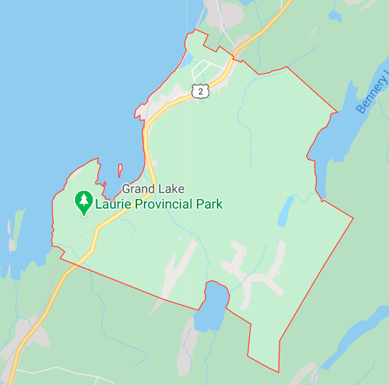
Grand Lake is a small community in the Halifax Regional Municipality, Nova Scotia and sits on the shores of the Shubenacadie Grand lake. Shubenacadie Grand Lake is a large Canadian lake straddling the Halifax Regional Municipality and Hants county on mainland Nova Scotia. It drains into the Shubenacadie River at its northeastern outlet. The lake is the seventh and largest lake in the Shubenacadie Canal system and is located between Lock 5 and 6. Shubenacadie Grand Lake hosts two provincial parks, Laurie Provincial Park and Oakfield Provincial Park, both on its eastern shore.
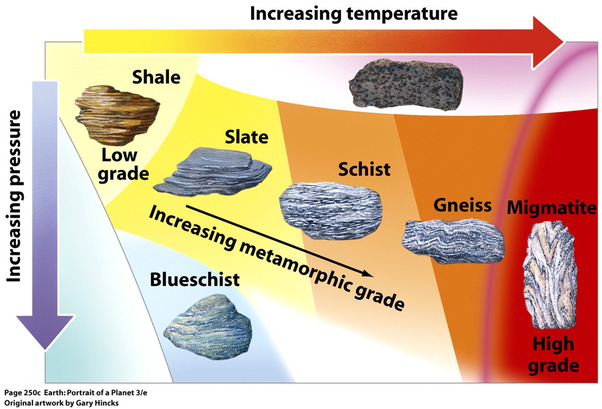
Slate is a fine-grained, foliated metamorphic rock that is created by the alteration of shale or mudstone by low-grade regional metamorphism. It is popular for a wide variety of uses such as roofing, flooring, and flagging because of its durability and attractive appearance. Slate is composed mainly of clay minerals or micas, depending upon the degree of metamorphism to which it has been subjected. The original clay minerals in shale alter to micas with increasing levels of heat and pressure.
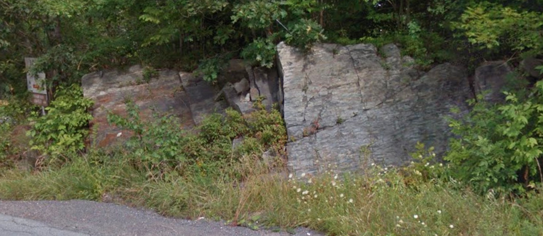
The tectonic environment for producing slate is usually a former sedimentary basin that becomes involved in a convergent plate boundary. Shales and mudstones in that basin are compressed by horizontal forces with minor heating. These forces and heat modify the clay minerals in the shale and mudstone. Foliation develops at right angles to the compressive forces of the convergent plate boundary to yield a vertical foliation that usually crosses the bedding planes that existed in the shale.
Angular unconformities
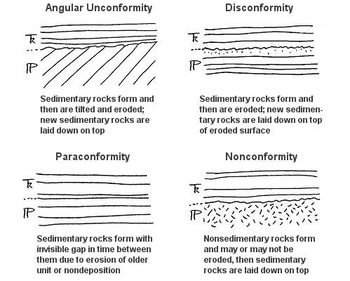
An angular unconformity is the contact that separates a younger, gently dipping rock unit from older underlying rocks that are tilted or deformed layered rock. The contact is more obvious than a disconformity because the rock units are not parallel and at first appear cross‐cutting. Angular unconformities generally represent a longer time hiatus than do disconformities because the underlying rock had usually been metamorphosed, uplifted, and eroded before the upper rock unit was deposited.
Dip is the angle from horizontal that the feature sits in cross section. Strike is the direction of the feature as it interacts with the horizontal plane.
To log this Earthcache visit the viewing location. Please answer the following questions and send in a timely manner to my geocaching profile or email. Answers not received will result in deleted logs.
Questions:
1. How long and high is the outcrop?
2. Describe the texture and colour of the outcrop?
3. Are there signs of erosions, if so what are they?
4. What is the Dip and Strike of the outcrop?
5. Post a picture in your log with a personal item or hand in picture to prove you were there.
[REQUIRED] In accordance with the updated guidelines from Geocaching Headquarters published in June 2019, photos are now an acceptable logging requirement and WILL BE REQUIRED TO LOG THIS CACHE. Please provide a photo of yourself or a personal item in the picture to prove you visited the site.