A River’s Sandbars
The Shubenacadie River stretches 72 kilometres (45 miles) from Grand Lake to Maitland, where it enters the Minas Basin of the Bay of Fundy. Twice a day, the Bay of Fundy’s famously high tides create a powerful tidal bore in the northern portion of the river. As the tide swells, water enters and surges up the river, sometimes reaching 12 km/h (7 mph) and up to 3.4 m (11 ft) in height. Sandbars are numerous in the area, and the movement of the tides often makes the water turbulent and hard to predict.
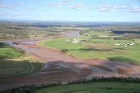
A Sandbar in a river is an elevated region of sediment (such as sand or gravel) that has been deposited by the flow. Types of bars include mid-channel bars (also called braid bars, and common in braided rivers), point bars (common in meandering rivers), and mouth bars (common in river deltas). The locations of bars are determined by the geometry of the river and the flow through it. Bars reflect sediment supply conditions, and can show where sediment supply rate is greater than the transport capacity.
A point bar is an area of deposition typically found in meandering rivers. Point bars form on the inside of meander bends in meandering rivers. As the flow moves around the inside of the bend in the river, the water slows down because of the shallow flow and low shear stresses there reduce the amount of material that can be carried there. Point bars are usually crescent shaped and located on the inside curve of the river bend. The excess material falls out of transport and, over time, forms a point bar. Point bars are typically found in the slowest moving, shallowest parts of rivers and streams, and are often parallel to the shore and occupy the area farthest from the thalweg (lowest point), on the outside curve of the river bend in a meandering river.
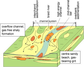
Here, at the deepest and fastest part of the stream is the cut bank, the area of a meandering river channel that continuously undergoes erosion. The faster the water in a river channel, the better it is able to pick up greater amounts of sediment, and larger pieces of sediment, which increases the river's bed load. Over a long enough period of time, the combination of deposition along point bars, and erosion along cut banks can lead to the formation of an oxbow lake.
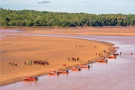
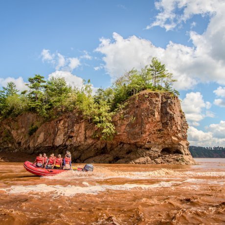
In the Shubenacadie river the sand bars near the mouth of the river are formed around high rock formations. The combination of the sandbars and speed of the Tidal Bore make these spots perfect for a white water rafting experience.
Watch the Tidal bore cover the sandbar in minutes.
To log this Earthcache visit the viewing location. Please answer the following questions and send in a timely manner to my geocaching profile or email. Answers not received will result in deleted logs.
Year round Parking at Fundy Tidal Interpretive Center N 45 14.982 w 063 27.594.
Important Notes:
Do Not Stand or Park on the Bridge.
Use the parking coordinates and follow the path on the North side of the road that takes you under the bridge to ground zero.
This location needs to be viewed at LOW TIDE.
Check Tide Times for South Maitland.
Questions:
1. From ground zero, look south, what is the angle of the river around the bend?
2. Give the dimensions (length x width) of the sandbar(s) to the south?
3. What causes the sandbars to form in this specific spot on this turn?
4. Post a picture in your log with a personal item or hand in picture to prove you were there.
[REQUIRED] In accordance with the updated guidelines from Geocaching Headquarters published in June 2019, photos are now an acceptable logging requirement and WILL BE REQUIRED TO LOG THIS CACHE. Please provide a photo of yourself or a personal item in the picture to prove you visited the site.