Merigomish Drumlin Field
Merigomish is a community in the Northern part of Nova Scotia, located in Pictou County. It is located on the north coast of eastern mainland Nova Scotia, on the Northumberland Strait, and is connected to the town of Antigonish to the southeast and to New Glasgow to the west by Route 245, the "Sunrise Trail".
Drumlin Fields
An oval-shaped hill, largely composed of glacial drift, formed beneath a glacier or ice sheet and aligned in the direction of ice flow. There are no strict definitions relating to their size but they tend to be up to a few kilometres long and up to 50 m in relief. They are widespread in formerly glaciated areas and are especially numerous in Canada, Ireland, Sweden and Finland.

Whilst there are many variations in shape, the `classic´ drumlin is a smooth, streamlined hill that resembles an egg half buried along its long-axis. They tend to exist as fields or swarms of landforms rather than as isolated individuals.
Some researchers deem drumlin formation as occurring close to ice margins and believe fields are built up incrementally as the margin retreats, whereas others believe that extensive patterns of drumlins may have formed approximately synchronously under wide swathes of an ice sheet.

The internal composition of drumlins reveals a perplexing array of different sediment types and structures. Some have rock cores surrounded by a concentric sheath of till, but they are mostly filled with unconsolidated sediments that are poorly sorted, and may contain silts, sands, gravel and boulders.
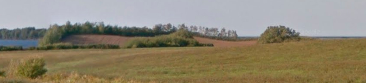
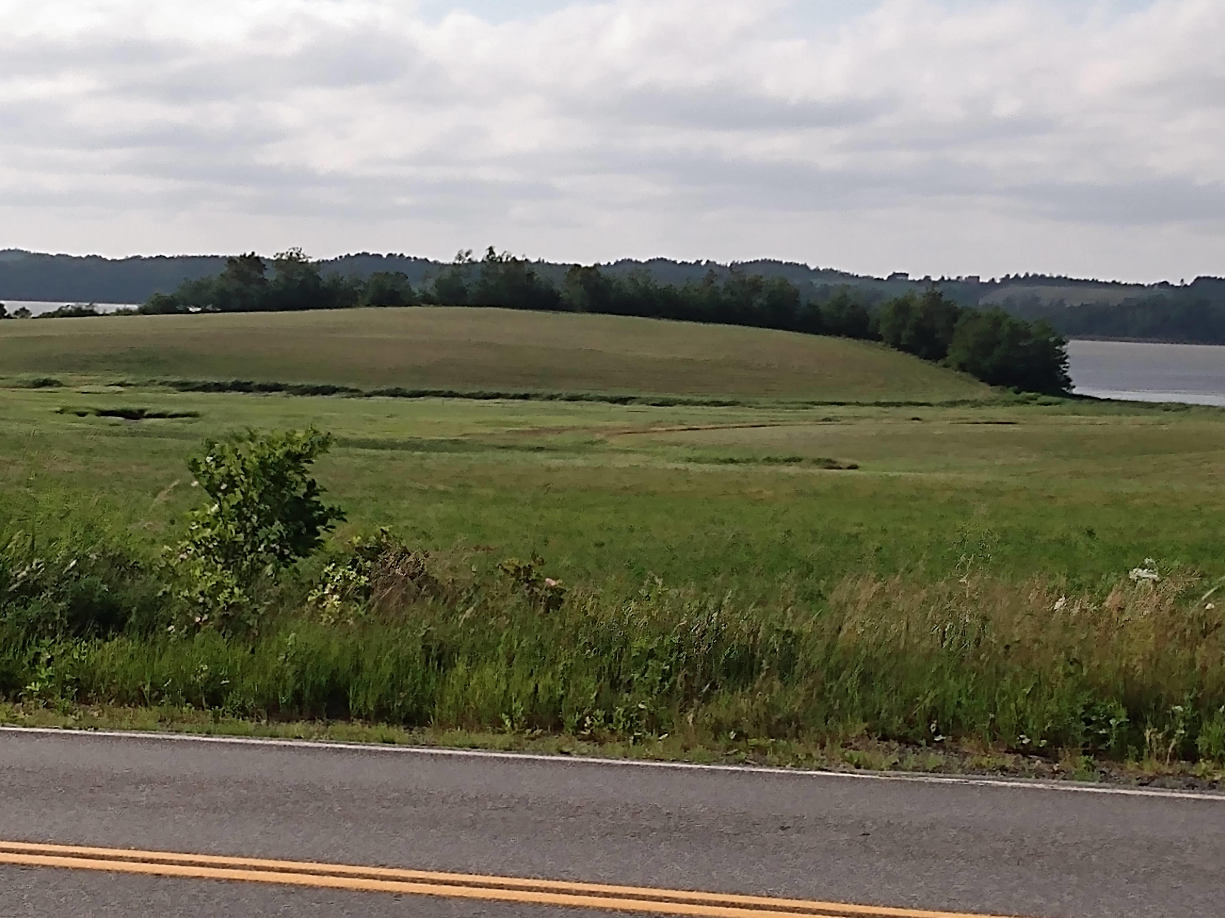
As you drive from Merigomish, North on hwy 245 you pass through a Drumlin field to ground zero. What is interesting about this field is some of it is coastal with part of the drumlins eroded.
To log this Earthcache visit the viewing location. Please answer the following questions and send in a timely manner to my geocaching profile or email. Answers not received will result in deleted logs.
Questions:
1. What is unique about the Drumlin to the West?
2. How many Drumlins do you see from Ground Zero?
3. You are not to the top of this Drumlin but what is the elevation at ground zero?
4. State 2 different things the Drumlins are being used for?
5. Post a picture in your log with a personal item or hand in picture to prove you were there.
[REQUIRED] In accordance with the updated guidelines from Geocaching Headquarters published in June 2019, photos are now an acceptable logging requirement and WILL BE REQUIRED TO LOG THIS CACHE. Please provide a photo of yourself or a personal item in the picture to prove you visited the site.