This small tube container is located on the 3,374m summit of Mount Cline. Cline is a beautiful mountain situated just east of Banff National Park on Crown land. Expect a significantly challenging mountaineering adventure covering a round trip distance of 25 kilometers with 2,000 meters of elevation gain. The easiest route follows up the SW Ridge, which is an alpine climb with technical difficulties up to YDS 5.4. This geocache is an extreme challenge which requires mandatory glacier travel, technical rock climbing, scrambling, mountaineering experience and all associated equipment.
Mount Cline:
About the Mountain
Reaching the Summit of Mount Cline:
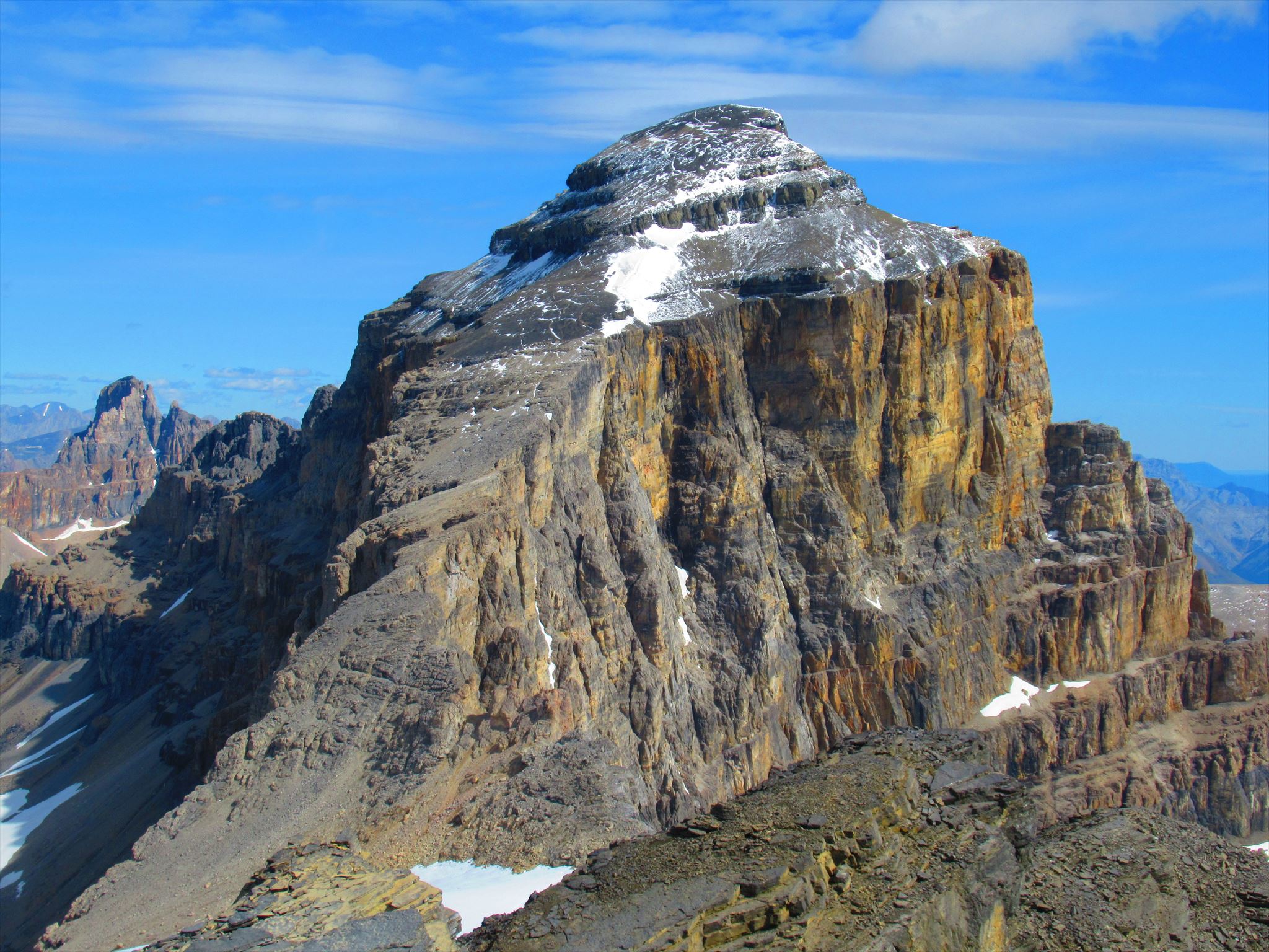
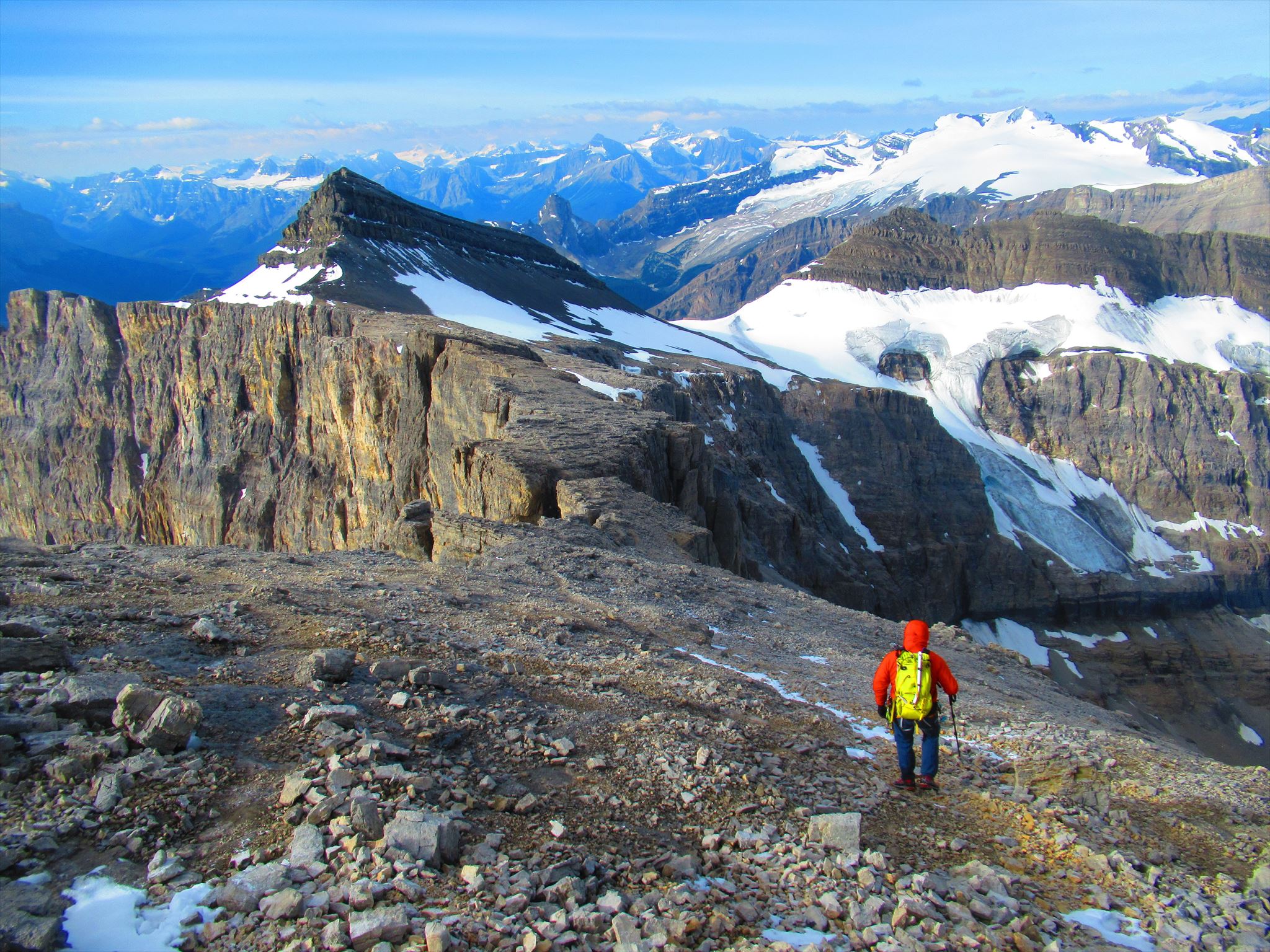
Mount Cline is one of a handful of Canadian 11,000 foot peaks well east of the Continental Divide in the front ranges. Located in the angle between the North Saskatchewan and Cline Rivers, it is just outside Banff National Park. For a modest effort, mountaineers will discover a stark but ruggedly beautiful landscape, highlighted by a lovely campsite beside two small lakes (Cline Lakes). Higher up are unique views of Cline’s lower but quite aesthetic neighbours, Mounts Wilson and Murchison, as well as the seldom visited White Goat Wilderness Area to the north.
Cline is worth at least a two day trip, though it can be climbed in a long day from the car. Because it’s on the edge of the dryer front ranges, Cline can often be tackled by early July, when many other big peaks are still entombed in snow.
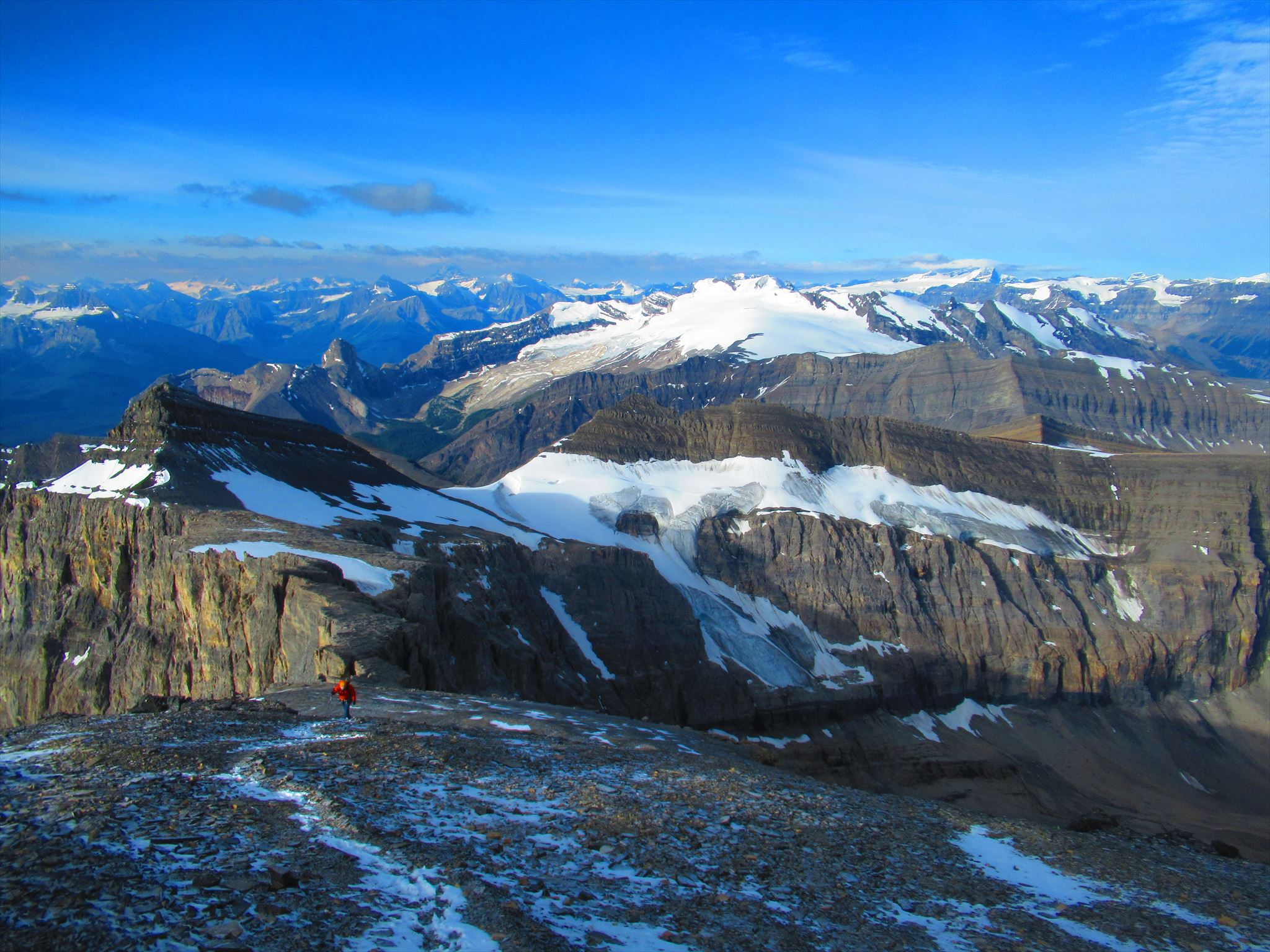
The standard Southwest Ridge route is mostly a relaxed scramble, with a couple of notches thrown in for excitement. Rarely climbed, the North Ridge offers a recommended alpine mix of rock and ice, with superb positions. Cline’s impressive East Face has yet to be climbed.
Naming: Norman Collie named the peak for area fur trader, trapper and one-time Jasper postmaster Michel Cline, who in the early 19th century commuted through the mountains from Jasper House to Kootenay Plains via “Old Cline’s Trail.”
Season: July-September
Trip Time: 2 days, 6-8 hours return bivy-to-bivy
First Ascent: July 1927: J.H. Barnes, Alfred Castle, Alfred Castle, Jr., Jimmy Simpson, Rudolph Aemmer
The Approach & Route
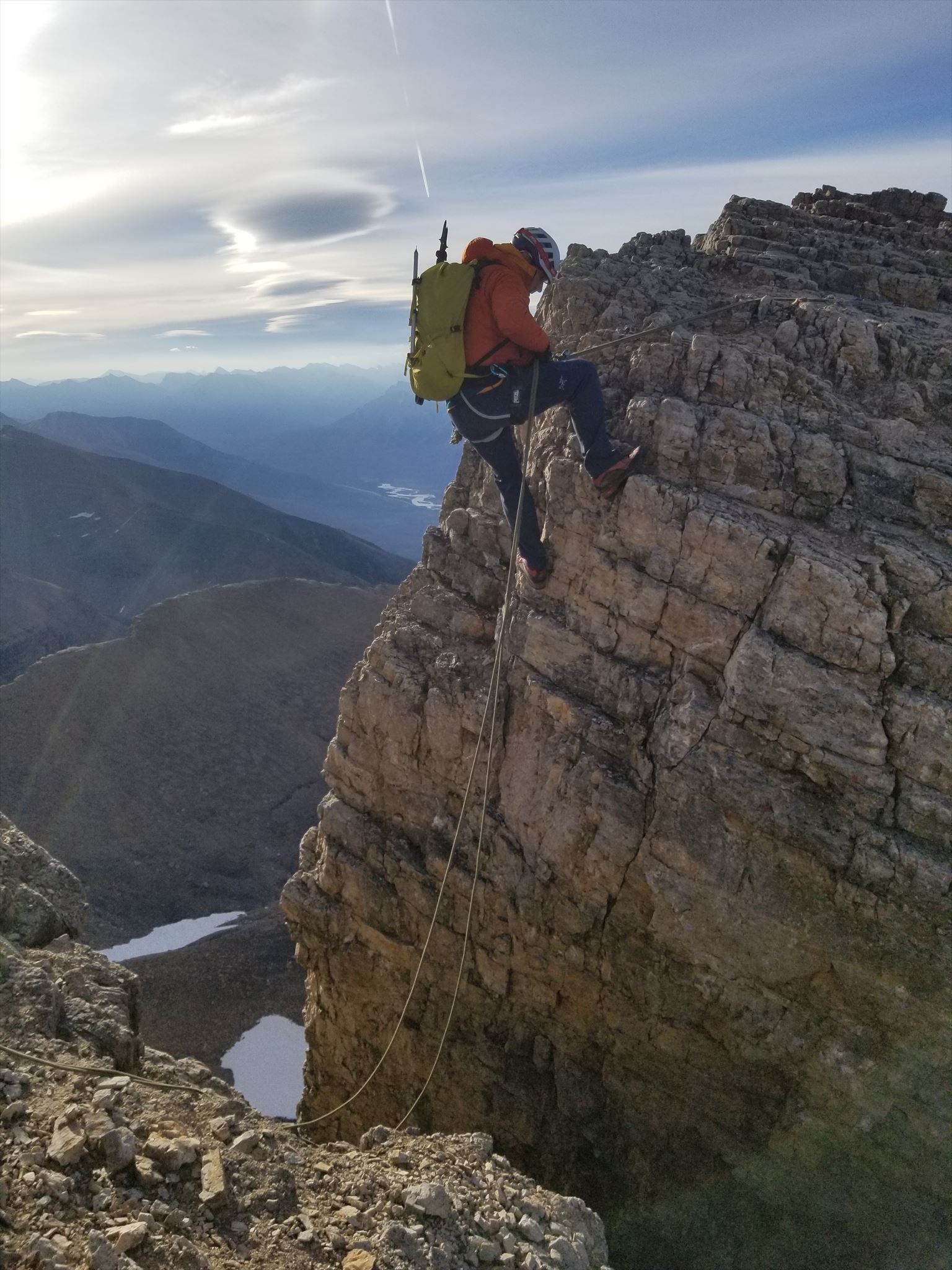
CalHobz Rappelling the Crux Step:
Approach: From just west of Lake Louise, drive 75 km north on Highway 93 (Icefields Parkway) to Saskatchewan River Crossing and then 9 km east on Highway 11 to the signed Thompson Creek campground. Park beside the creek at an obvious trail on the east side of Thompson Creek (waypoint provided).
From the parking area, take a good trail up the east side of Thompson Creek, turning left after about one kilometer as the trail crosses two small bridges (waypoint provided). Follow the trail up beside the creek. Watch for an important left turn (flagged, waypoint provided) shortly before a waterfall, and head steeply uphill on a good trail up a moraine into a rubbly bowl. Follow up and cross over the gully to reach a better trail heading right on a treed bench. When this trail peters out, continue contouring around into the upper valley. Go northwest along the upper stream to reach two small lakes (Cline Lakes), with good campsites at their north end (about 3.5-5 hours from the car).
The Southwest Ridge: From the northwest end of the lakes, take a left-rising ramp that provides easy access into an upper basin and then traverse north on slabs to a col, from where Cline is visible to the northeast. Cross a small glacier to reach the Southwest Ridge at a low, U-shaped break in the rock. A short distance along the ridge, two notches are reached. Crossing the first involves loose but straightforward down climbing onto a chockstone and then back up the other side. The nearby second notch, while only a couple of metres across, is deeper and steeper, requiring about five metres of down climbing on solid holds and then stepping across a gap. There are bolted anchors on both sides of both notches. Beyond the notches, it’s easy going up the final slope on scree to the summit. Descend the same way.
Safety Blurb
The terrain to reach Mount Cline is very technically challenging, requiring a significant approach, glacier travel, technical rock climbing up to 5.4, travel through rough terrain, likely an overnight stay, etc - all at high elevations deep in the backcountry. Do not underestimate the challenge of this summit. You must be trained in and have experience with glacier travel, crevasse rescue, multi-pitch rock climbing and backcountry travel. You must also come prepared with all the required mountaineering equipment and at least one similarly skilled and equipped partner. I highly recommend a rope for the crux notches. If you attempt to climb the notches unroped and you fall, you will die. You must know how to belay, rappel and lead climb as the notches require you to use these skills. If you are not 100% confident in your skills or abilities, hire a mountain guide.
Note: Without the hint and spoiler photos, this geocache may be extremely difficult to find in adverse conditions. Bring copies or have access to the spoiler photos to aid in your search.
Mount Cline is a fantastic objective for more novice mountaineers who have all the necessary skills and equipment to travel on glaciated terrain and through technical rock. I can promise that it will be an adventure you won't soon forget. Have fun & stay safe!