MASSICCIO DEL POLLINO
Il massiccio del Pollino è un massiccio montuoso dell'Appennino meridionale, posto lungo il confine di Basilicata (provincia di Potenza) e Calabria (provincia di Cosenza), segnavia del confine tra l'Appennino lucano a nord e quello calabro a sud.
Annoverabile tra i grandi massicci della catena appenninica, comprende tutte le maggiori cime di quella meridionale: Serra Dolcedorme (2.267 m), Monte Pollino (2.248 m), Serra del Prete (2.181 m), Serra delle Ciavole (2.130 m), Serra di Crispo (2.054 m), il Cozzo del Pellegrino (1.987m),la Manfriana (1.981 m), Coppola di Paola (1.919 m), Monte Grattaculo (1.891 m), Monte Caramolo (1.827 m), Timpone della Capanna (1.823 m), lo Sparviere (1.713 m).
Il confine Calabro-Lucano riveste un particolare interesse nella geologia dell'Italia meridionale, rappresentando la complessa fascia di raccordo tra i domini strutturali dell'Appennino Calcareo auct. e le coltri cristallino-metamorfico-sedimentarie dell'Arco Calabro-Peloritano.
Circa 100 milioni di anni fa l'avvicinamento delle due placche continentali, europea ed africana, provocò un corrugamento del territorio e la lentissima formazione dei rilievi. Più tardi, 5 milioni di anni fa, movimenti contrapposti di distensione determinarono le fratture delle rocce emerse, chiamate faglie, un esempio è la parete meridionale di Timpa Falconara.
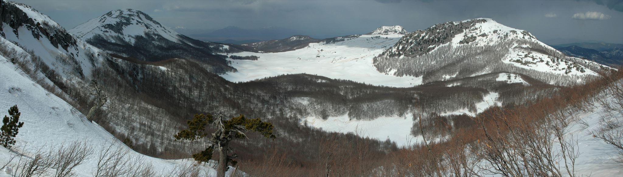
L'azione erosiva delle acque ha inciso a fondo le rocce, provocando gole e canyon che caratterizzano le aree più suggestive del parco: le Gole del Lao, della Garavina, del Barile, del Raganello, le cui pareti così alte e così ravvicinate rendono difficile la penetrazione della stessa luce.
L'avvento dei ghiacciai poi, nel corso dell'ultima glaciazione, ha eroso le valli e i pianori di alta quota, definendo l'aspetto delle vette, mentre l'accumulo di enormi masse di ghiaccio ha dato luogo ai circhi glaciali osservabili nel versante settentrionale del Monte Pollino, di Serra del Prete o di Serra Dolcedorme, nella conca della Fossa del Lupo e nel versante meridionale della Mula, dove si possono riconoscere i depositi morenici, cioè il trasporto di pietre e detriti che la lenta fase di ritiro dei ghiacciai ha comportato.
In alcuni casi si sono concentrati ingenti accumuli di materiale, che hanno formato le collinette moreniche, in altri casi il ritiro dei ghiacciai ha abbandonato grandi massi isolati, cosiddetti massi erratici, di cui splendidi esempi possono essere osservati nell'area del Piano di Acquafredda e dei Piani di Pollino.
CONFINE CALABRO-LUCANO
ll confine Calabro-Lucano è un’area di grande interesse per la geologia dell’Italia meridionale. Essa rappresenta la fascia di raccordo tra diversi domini strutturali: i domini calcarei dell’Appennino meridionale e le coltri cristallino-metamorfiche-sedimentarie dell’Arco Calabro-Peloritano. L’area è stata interessata dallo sviluppo di un sistema di faglie, con orient-zione media N120°, e iniziale cinematica di trascorrenza sinistra che hanno prodotto l’accostamento di terreni appartenenti a diversi domini paleogeografici. Ciò è avvenuto in seguito alla migrazione verso SE dell’Arco Calabro, come risposta all’arretramento flessurale della litosfera Ionica in subduzione. I terreni più profondi esposti nell’area affiorano al Monte Alpi. È una successione carbonatica (Piattaforma apula), sollevata nelle fasi tettoniche tardive della costruzione dell’orogene, in seguito all’attività di un sistema di faglie transpressive sinistre orientate N120°. L’elemento geometricamente più elevato è rappresentato dal Complesso Liguride.
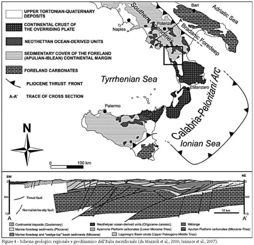
I termini liguridi giacciono in sovrapposizione tettonica sulle unità carbonatiche che derivano dalla deformazione della Piattaforma Appenninica.
Le formazioni che compongono le unità di piattaforma sono rappresentate da un complesso calcareo-dolomitico (Triassico sup.- Cretaceo sup.). In continuità passano alla Formazione di Trentinara (Selli, 1957), costituita da una sequenza ben stratificata di biocalcareniti, calcilutiti e calcareniti e marne del Paleocene-Eocene. Segue in concordanza la Formazione di Cerchiara (Selli, 1957), costituita da calcareniti del Miocene inferiore. La Formazione del Bifurto (Selli, 1957), data da un’alternanza di argilliti, calcari marnosi, calcareniti, brecciole a macroforaminiferi e quarzareniti del Miocene medio, chiude in concordanza la successione.
Sul margine sud-orientale del Massiccio del Pollino le formazioni di Cerchiara e del Bifurto sormontano direttamente i calcari del Cretaceo.
MONTE SELLARO
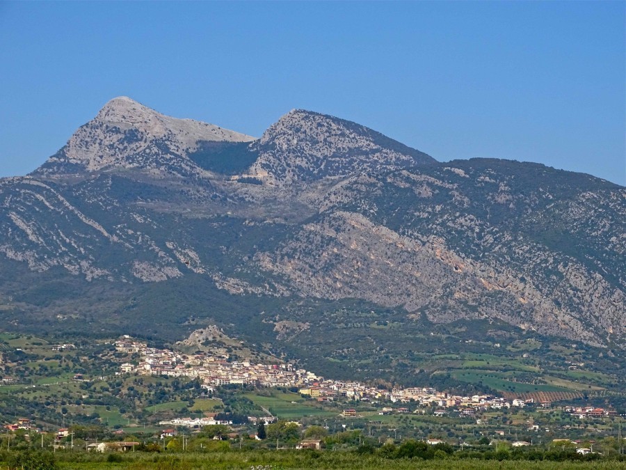
Il Monte Sellaro insieme al Monte Sparviere rappresentano le cime più orientali del Massiccio del Pollino.
Il Sellaro data la sua particolare forma piramidale si erge maestoso sul versante sud-est del borgo di Cerchiara di Calabria, mostrando una “imponenza” maggiore di quanta ne abbia in realtà, difatti è alto solo 1439 metri, ma la sua caratteristica forma lo rendono visibile e inconfondibile anche dalle maggiori vette del Pollino, come il Serra delle Ciavole.
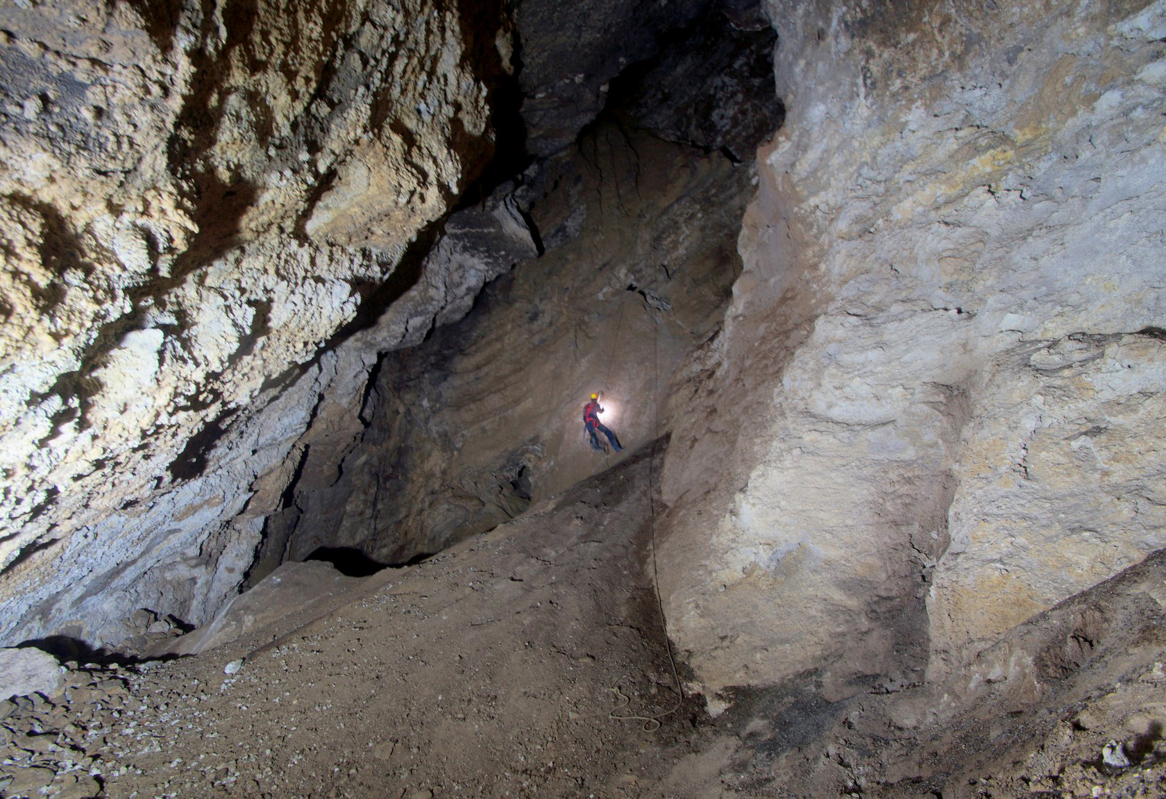
Il suo territorio di natura carsica è ricco di grotte e anfratti naturali, su tutte spicca l’Abisso del Bifurto, un inghiottitoio perpendicolare che si inabissa nelle viscere della terra per 680 metri, rendendola di fatto la quarantesima grotta più profonda della Terra. La Grotta della Serra del Gufo, che diversamente dalla precedente ha un andamento in orizzontale e si spinge nelle profondità terrestri per circa due chilometri.
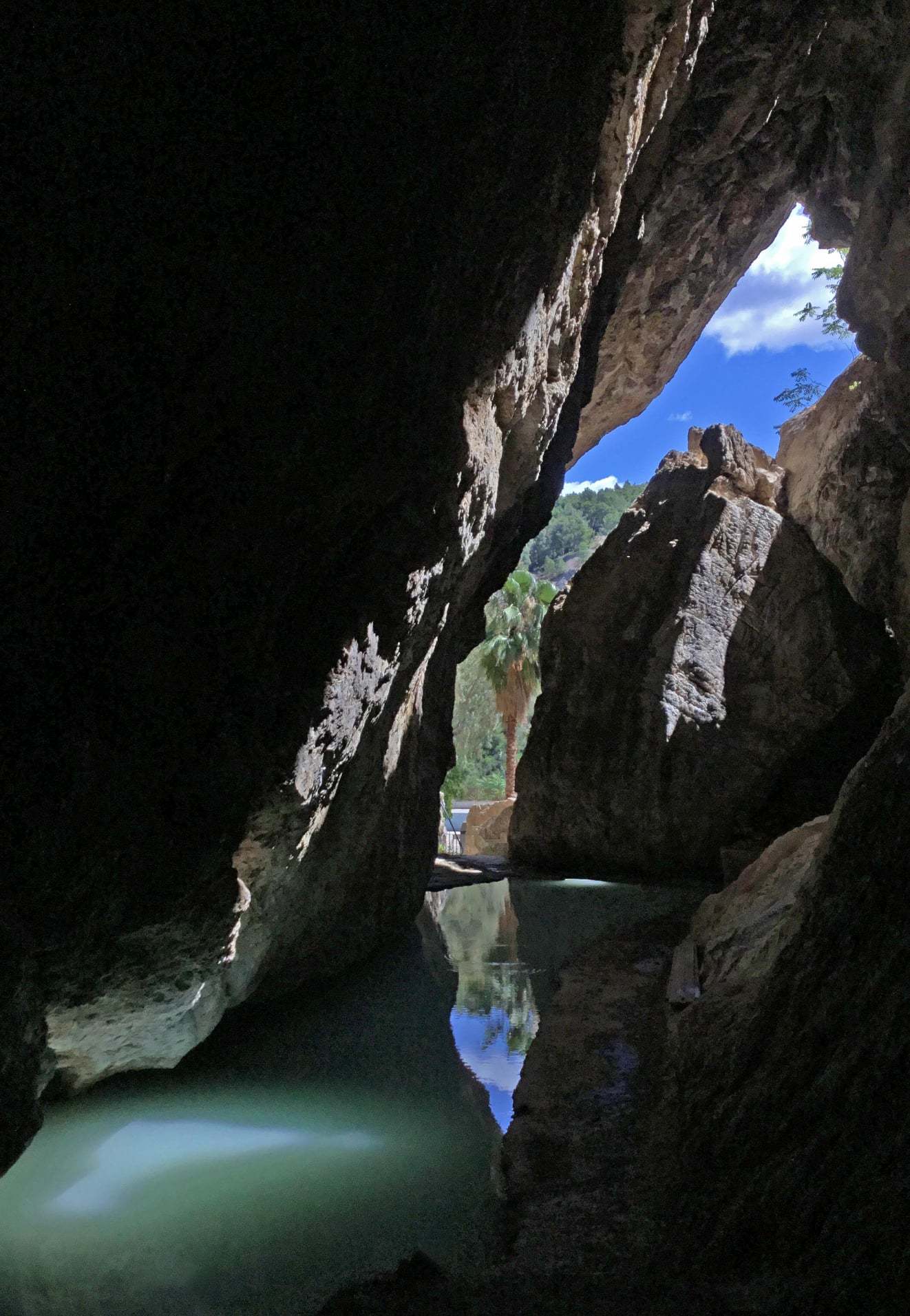
GROTTA DELLE NINFE
A Cerchiara di Calabria è ubicato il sistema carsico della cosiddetta “Caldana", formato da quattro distinte cavità sotterranee attraversate al loro interno da acque sulfuree calde.
Queste cavità sono, procedendo dalla più alta in quota alla più bassa: 1) la Voragine delle Balze di Cristo (o Voragine San Marco); 2) la Grotta delle Ninfe (originariamente nota come Grotta del Mulino o Grotta dei Bagni); 3) la Grotta Scura - (detta anche ‘dei Pipistrelli’ o ‘del Bandito’) e, infine, la Risorgente sul Torrente Caldanello.
Di tali cavità solo la Voragine delle Balze di Cristo possiede un andamento verticale, mentre le restanti tre sono sub-orizzontali.
La più nota è certamente la Grotta delle Ninfe. Secondo la leggenda, la Grotta delle Ninfe Lusiadi era un antro segreto che nascondeva agli occhi dei mortali l'alcova della ninfa Calipso. Altre leggende raccontano invece che la stessa caverna fosse la dimora delle ninfe Lusiadi, che custodivano gelosamente il loro segreto di bellezza eterna, legato all'utilizzo delle acque sulfuree che nascono da questa sorgente termale.
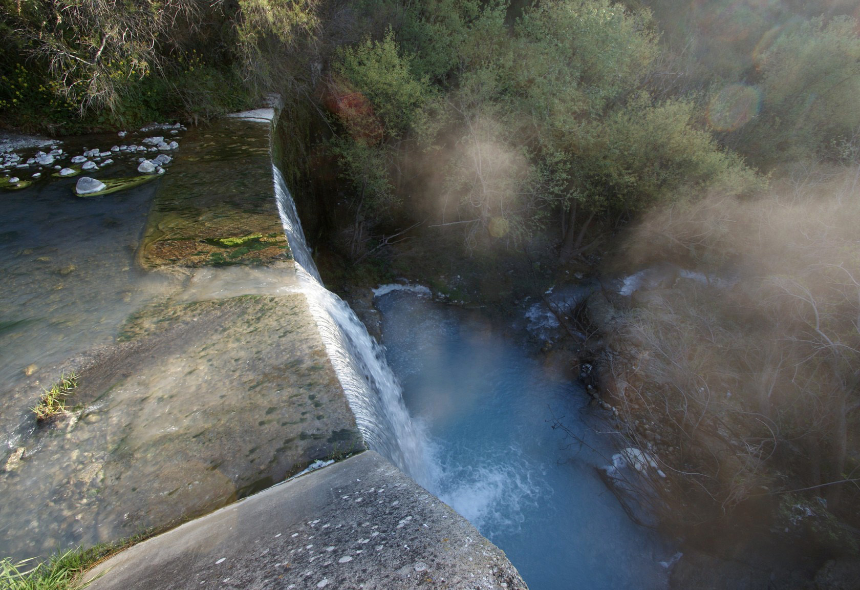
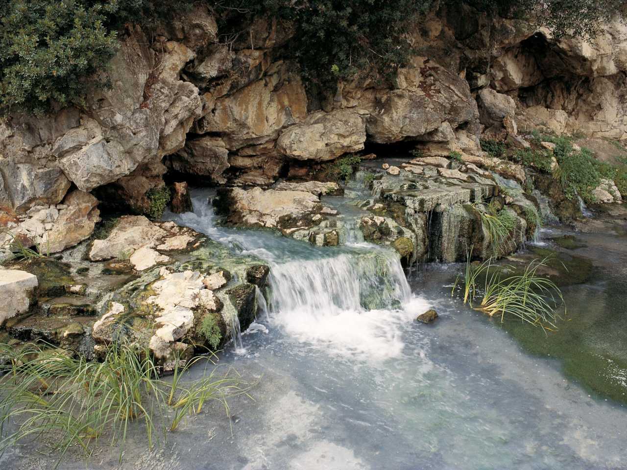
La sorgente restituisce a giorno le acque che scorrono all’interno della cavità più in quota (la Voragine delle Balze di Cristo). Apertasi lungo un’evidente frattura nella roccia, è costituita da un unico vano ipogeo diffusamente illuminato dalla luce diurna che vi penetra attraverso l’imbocco e da alcuni varchi sulla volta.
All'interno della suggestiva grotta calcarea si è creata una piscina di acqua termale che si mantiene costantemente sui 30° C e da cui fuoriesce un ruscello che corre verso il mare, portandosi dietro il suo caratteristico odore. Le acque erano già note agli antichi Sibariti per la cura delle malattie della pelle e di quelle reumatiche.
Queste acque si originano per interazione prolungata con rocce carbonatiche e rocce evaporitiche (contenenti non solo gesso e/o anidrite ma anche alite).
Provengono da un circuito profondo, che è ospitato principalmente negli scogli dell'Unità di Pollino.
Le acque meteoriche, infiltrandosi nel Massiccio del Pollino ad altitudini medie di 1800 mslm, ricaricano la falda termale profonda. Durante la loro circolazione prolungata nell'acquifero termale profondo, acquisiscono calore dalle rocce attraverso trasferimento conduttivo, raggiungendo l'equilibrio termochimico a ~40°C. La termalaquiferazione profonda si comporta come una sorta di serbatoio ben miscelato, i cui fluidi sono completamente miscelati con quelli in entrata. L'acqua che lascia il serbatoio termico profondo subisce un flusso verso l'alto relativamente veloce e un raffreddamento limitato che si muove lungo i sistemi di faglia, scaricando infine in superficie a 30° C nella finestra tettonica di Cerchiara.
Parte delle acque restituite dalla cavità si perdono quindi in altre due grotte situate più in basso (Grotta Scura e Risorgente sul Torrente Caldanello) per riemergere poi definitivamente in superficie.
Le temperature interne, soprattutto al fondo della Voragine delle Balze di Cristo, ma anche nella Grotta Scura e nella Risorgente sul Torrente Caldanello, sono molo elevate a causa del calore delle acque correnti. Anche l’umidità interna è alta e raggiunge, in specifici settori ipogei, picchi che toccano il 95%. Oltre che a livello idrogeologico, le grotte appartenenti al sistema carsico della Caldana possiedono un eccezionale interesse storico-documentario: la non comune circostanza dell’emersione in superficie di acque calde, ritenute benefiche già nell’antichità, ha sempre attratto l’attenzione dell’uomo, sicché il rapporto tra quest'ultimo e il fenomeno naturale affonda le radici in un passato remoto.
Fonti
Luigi Bloise, Egidio Calabrese, 2015. Parco Nazionale del Pollino: geositi, patrimonio naturale e culturale.
Luigi Bloise, Egidio Calabrese, 2019. Tutela, valorizzazione e gestione della biodiversità.
Van Dijk et alii, 2000. Tectonic model and three-dimensional fracture network analysis of Monte Alpi (southern Apennines). Tectonophysics , 324, 203-237.
Giovanni Vespasiano (a), Carmine Apollaro (a), Francesco Muto (b), Rosanna De Rosa (a),. Preliminary geochemical characterization of the thermal waters of the Grotta delle Ninfe near Cerchiara di Calabria (South Italy). 39/2016 Pages: 130-133
EARTHCACHE
Per poter registrare come "found" questa eartcache devi rispondere alle seguenti domande.
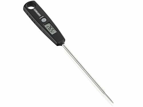
Per poter rispondere è necessario portare con sè un termometro per misurare la temperatura dell'acqua (quindi ad immersione - quello per cucina va benissimo).
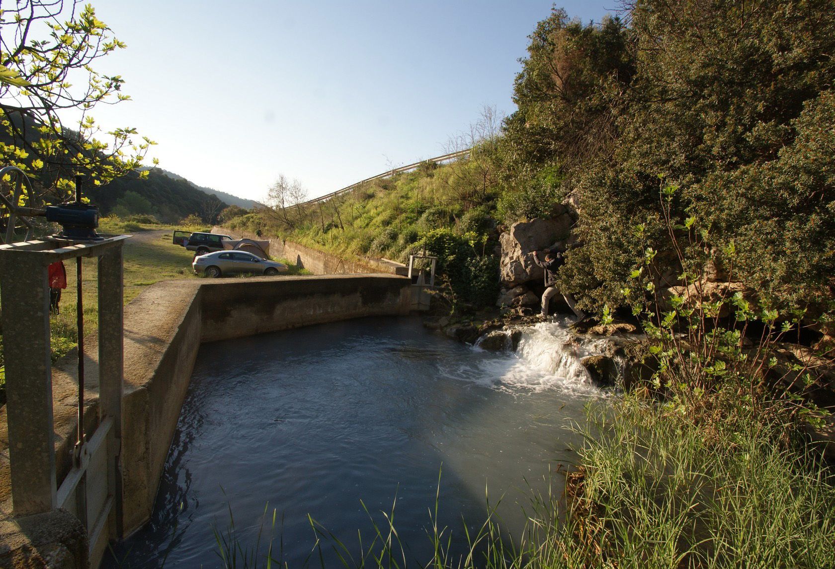
1. Risorgente sul Torrente Caldanello
Una volta a destinazione sarai di fronte ad una grossa vasca di raccolta.
:
Qual e' la temperatura dell'acqua (misurate almeno 3-4 cm sotto la superficie)?
Che odore senti provenire dall'acqua?
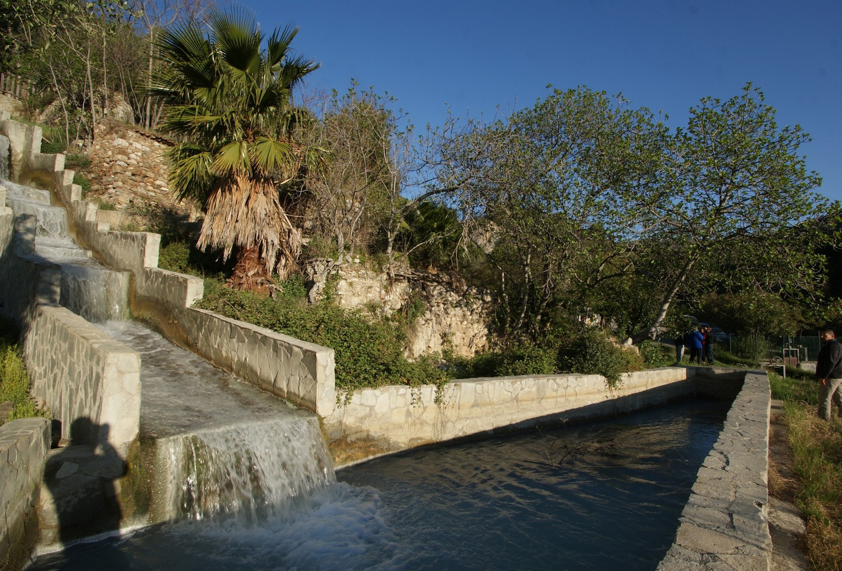
2. Sotto la Grotta
Spostati dall'altro lato del parcheggio. Qui troverai un'altra vasca di raccolta e, poco più in là, lo scarico delle acque provenienti dalla Grotta delle Ninfe.
Qual e' la temperatura dell'acqua (misurate almeno 3-4 cm sotto la superficie)?
3. Sistema carsico
Alla luce di quanto letto nel listing,a che sistema carsico stiamo facendo riferimento?
3. OBBLIGATORIO
Fatti una foto o falla al tuo GPS/smartphone/nickname (a scelta) sul posto.
Si prega di non scrivere le risposte nel log, ma di inviarle attraverso il mio profilo su geocaching.com.
Puoi fare il log DOPO AVER INVIATO LE RISPOSTE, senza aspettare la mia conferma.
Se le tue risposte sono sbagliate ti contatterò.
La mancanza della foto comporterà la cancellazione del log; lo stesso la mancanza di risposte.