Back in Brussels in 2020, M. Burns, a famous photographer using drones to take aerial pictures and videos, wanted to make a video of the somewhat less crowded city during the first lock down.
He chose the same launch field as his previous trip and started to fly his drone from Montgomery all the way to the center of the Jubilee Park (Parc du Cinquantenaire in French, Jubelpark in Dutch). Unfortunately on the way his drone hit a bird (or was it the other way around?) and a part of it fell and he couldn't recover it.
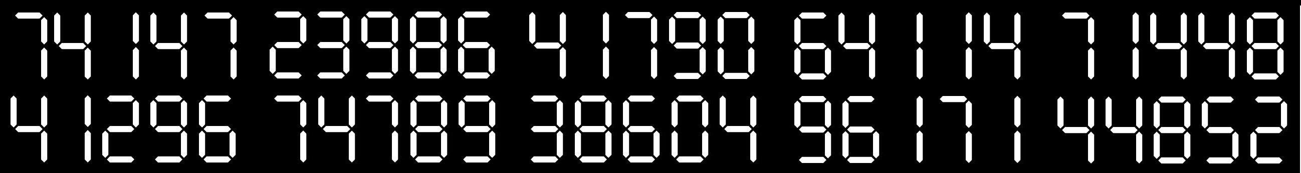
The error message on the drone was showing the below message. It is supposed to contain the coordinates of the impact, but he couldn't make sense out of it. Maybe you can...
This mystery was inspired by another one I found.
Thx pfisser for the bêta-test.